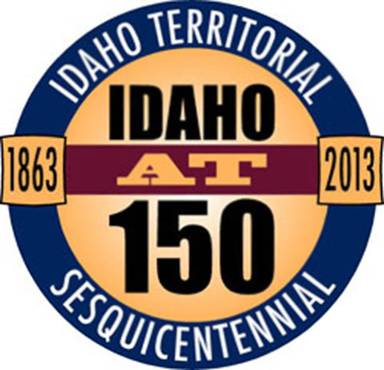
Idaho Territorial Sesquicentennial
“Idaho Territory”
Organized March 4, 1863
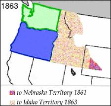
The Territory of Idaho
was officially organized on March 4, 1863 by Act of Congress, and signed into
law by President Abraham Lincoln.
The original organized
territory covered most of the present-day states of Idaho,
Montana and Wyoming. The later was wholly spanned
east-to-west by the bustling Oregon Trail and its hitchhiker emigrant trails,
the California Trail and Mormon Trail which since hitting stride in 1847, had
been conveying settler wagon trains to the west, and incidentally, across the
Continental Divide into the Snake River Basin, a key gateway into the Idaho and
Oregon Country interiors.
The discovery of gold,
silver and other valuable natural resources throughout Idaho beginning in the 1860s, as well as the
completion of the Transcontinental Railroad in 1869, brought many new people to
the territory. As Idaho
approached statehood, mining and other extractive industries became
increasingly important to its economy. By the 1890s, for example, Idaho exported more lead
than any other state.
The first territorial
capital was at Lewiston.
The town was founded in 1861 in the wake of a gold rush which began the
previous year near Pierce, northeast of Lewiston.
In 1863 Lewiston became the capital of the
newly-created Idaho
Territory.
Lewiston's stint as a seat of the new
territory's government was short-lived. As the gold rush quieted in northern Idaho, it heated up in a new mineral rush in southwestern
Idaho, centered in Idaho City,
which would become the largest city in the Northwest in the mid-1860s. A
resolution, to have the capital moved from Lewiston
to Boise, was
passed by the Idaho Territorial Legislature on December 7, 1864, six weeks
before the territorial legislature's session legally began, and after
litigation, on a split decision decided by one vote on the territorial Supreme
Court on geographic lines. Boise
became the capital in 1866. The move was very unpopular in northern Idaho and in violation
of a court order. So, the territorial governor, Caleb Lyon and the territorial
secretary secretly took the territorial seal, archives and treasury and fled
from Lewiston,
their territorial capital. Lyon went down river to Portland, Oregon,
a trip marked by the alleged theft of the treasury from his steamship cabin.
The territorial secretary departed southward for Boise to avoid the public outrage that was
sure to erupt. Boise
was the territorial capital from 1865.
In the late 1860s Idaho Territory
became a destination for displaced Southern Democrats who fought for the
Confederate States of America
during the Civil War. These people were well-represented in the early
territorial legislatures, which often clashed with the appointed Republican territorial
governors. The political infighting became particularly vicious in 1867, when
Governor David W. Ballard asked for protection from federal troops stationed at
Fort Boise against the territorial
legislature. By 1870, however, the political infighting died down considerably.
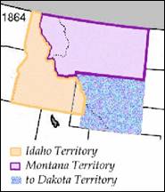
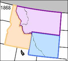
In 1868, the areas east
of the 111th meridian west were made part of the newly created Wyoming Territory. Idaho Territory
assumed the boundaries of the modern state at that time.
In 1887 Idaho Territory
was nearly legislated out of existence, but as a favor to Governor Edward A.
Stevenson, President Grover Cleveland refused to sign a bill that would have
split Idaho Territory
between Washington Territory in the north and Nevada in the south. The territory was
admitted to the Union on July 3, 1890.
Construction began on the
Idaho Territorial Prison in 1870 and was completed by 1872. The prison was in
use by the territory, then the state until 1973. The Old Idaho State
Penitentiary was placed on the National Register of Historic Places in 1974 for
its significance as a Territorial Prison. The site currently contains museums
and an arboretum.
Almost immediately after Idaho Territory
was created, a public school system was created and stage coach lines were
established. Regular newspapers were active in Lewiston,
Boise and Silver City
by 1865. The first telegraph line reached Franklin
in 1866, with Lewiston being the first town
linked in northern Idaho
in 1874. The first telephone call in the Pacific Northwest was made on May 10,
1878, in Lewiston.
Although forming a
sizeable minority, Mormons in Idaho were held
in suspicion by others in Idaho.
By 1882 notable and powerful Idahoans successfully disenfranchised Mormon
voters in Idaho Territory, citing their illegal practice
of polygamy. Idaho was able to achieve
statehood some six years before Utah,
a territory which had a larger population and had been settled longer, but was
majority LDS with voting polygamists.
There were four thousand
Chinese living in the Idaho
Territory from 1869 to
1875. Like many Chinese immigrants, they came to “Gold Mountain”
to work as miners, or found work as laundrymen and cooks. The 1870 census
reported there were 1,751 Chinese in Idaho
City who were nearly half
of city residents. Annie Lee was one legendary Idaho city woman who like Polly Bemis,
escaped enslavement from the “world’s oldest profession”. She escaped from a
member of the Yeong Wo Company in the 1870s to Boise to marry her lover, another Chinese
man. Charged by her owner with grand larceny, she told a judge “me want to stay
in Boise City” who granted her freedom. The story
of Polly Bemis who helped settle the Idaho
territory became the basis for the novel and fictionalized 1991 film A Thousand
Pieces of Gold which was set in California.
In 1889, the University of Idaho
was awarded to the northern town of Moscow
instead of its original planned location at Eagle Rock (now Idaho Falls) in the south. This served to
alleviate some of the hard feelings felt by North Idaho
residents over losing the capital.
The territory was
admitted to the Union as the State of Idaho
on July 3, 1890.
Idaho Territorial Prison
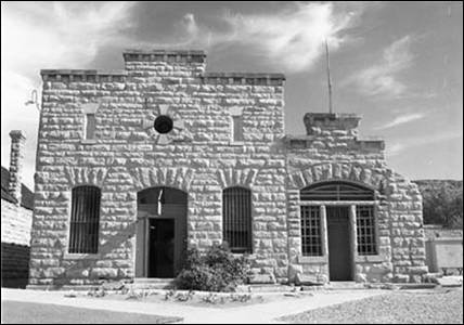
A façade of the Old Idaho
State Penitentiary
The Old Idaho Penitentiary
State Historic Site, also known as the Idaho Territorial Prison, was
constructed in the Territory
of Idaho in 1870 and
lasted until 1973. The territory was less than ten years old when the prison
was built east of Boise, Idaho
in the western United States.
From its beginnings as a single cell house, the penitentiary grew to a complex
of several distinctive buildings surrounded by a high sandstone wall. The stone
was quarried from the nearby ridges by the resident convicts, who also
completed all the later construction.
Over its one-hundred and
one years of operation, the penitentiary received more than 13,000 convicts,
with a maximum population of a little over six-hundred. Two-hundred and fifteen
of the inmates were women. Two famous inmates were Harry Orchard and Lyda Southard. Harry Orchard assassinated Governor Frank Steunenberg at the turn of the century and Lyda Southard was known as Idaho’s Lady Bluebeard for killing several
of her husbands to collect upon their life insurance. Two serious riots
occurred in 1971 and 1973 over living conditions in the prison. The 416
resident inmates were moved to a modern penitentiary south of Boise and the Old Idaho Penitentiary was
closed on December 3, 1973.
In 1992, the Idaho State
Historical Society recorded oral history interviews with fifteen former prison
guards. These tapes and transcripts cover prison operations and remembrances
from the 1950s to the closing of the prison. The collection is open for
research at the society.
The prison has been
featured on the television series Ghost Adventures.
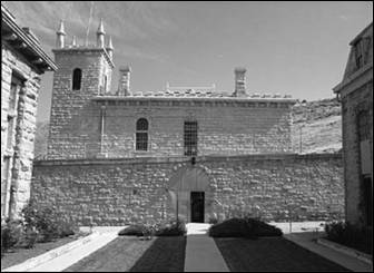
The Territorial Prison
was completed in 1872 and received its first 11 inmates from the Boise County
Jail. This building was converted into a Chapel in the 1930s and was destroyed
by fire in the 1973 riot.
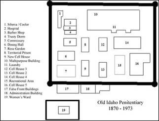
The New Cell House
(1889-1890) consisted of three tiers of forty-two steel cells. The third tier
closest to the Rose Garden served as “Death Row.”
The area now known as the
Rose Garden (as this it what it is now) was once used to execute prisoners by
hanging. Of the 10 executions in the Old State Penitentiary, 6 occurred here.
The Administration Building
(1893-1894) housed the Warden’s office, armory, visitation room, control room
and the turn key area.
The False Front Buildings
(1894-1895) held the Commissary, Trusty Dorm, Barber Shop (1902-1960s) and
Hospital (originally the blacksmith shop, but was remodeled in 1912 and
remained the prison hospital until the 1960s).
The Dining Hall (1898)
was designed by George Hamilton (an inmate at the time) and ultimately burned
down in the 1973 riot.
Cell House 2 (1899), also
known as the “North Wing” contained two-man cells. A “honey bucket” was placed
in each cell to serve as a toilet. Inmates burned the building in the 1973
riot.
Cell House 3 (1899) was
built the same as Cell House 2. It was eventually condemned for habitation, but
in 1921 was converted into a shoe factory. In 1928 this building was remodeled
for inmate occupancy and became the first cell house with indoor plumbing.
The Women’s Ward
(1905-1906) was built out of necessity. Prior to its completion women did not
have separate quarters. Male inmates built a wall around the old Wardens home
to serve as a separate facility for women. This building had seven two-person
cells, a central day room, kitchen, and bathroom facilities. This building held
the infamous Lyda Southard (Lady Bluebeard).
Built by inmates, the Multipurpose Building (1923) served as a shirt
factory, shoe shop, bakery, license plate shop, laundry, hobby room, loafing
room and housed the communal showers.
Solitary confinement
consisted of two sections. The first, built in the early 1920’s, was the
Cooler. Although built for solitary confinement, each cell contained 4-6 men.
The second section, known as Siberia, was
built in 1926 and housed 12 3’x8’ cells with one inmate per cell.
Cell House 4 (1952) was
the largest and most modern cell house at the penitentiary. Some inmates
painted their cells and left drawings on the walls that can be seen today.
Cell House 5 (1954) was
Maximum Security where the most unruly and violent offenders stayed. This
building also served as a permanent place of solitary confinement. It includes
a built in gallows and “Death Row.”
Although not a building,
there is also an outdoor Recreational Area where inmates played baseball,
boxing, basketball, handball, tennis, horseshoes and football. The baseball,
and later softball, team was named “The Outlaws” and frequently played teams
from across Treasure
Valley.
Today, visitors can
experience over 100 years of Idaho’s
unique prison history with a visit to Solitary Confinement, cell blocks, and
the Gallows.
The Old Idaho
Penitentiary features thirty historic buildings and special exhibitions
including the J. Curtis Earl Memorial Exhibit of Arms and Armaments. Events and programs provide families, school
groups, and visitors an opportunity to relive the Old Pen’s exciting past of
daring escapes, scandals, and executions.
The Old Idaho
Penitentiary is located in the Old Penitentiary Historic District and is open
year round.
The Old Idaho
Penitentiary receives support and resources from the Friends of the Historical Museum and Old Idaho Penitentiary.
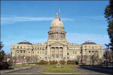
Idaho State Capitol
|
|
|
|
First Territorial Capitol
in Lewiston
|
Idaho Capitol completed in 1920
|
In 1863, Lewiston,
Idaho was the original Idaho State Capitol
site until Boise was made the capitol in 1890 which
is also when President Benjamin Harrison signed Idaho into statehood. The story behind Boise becoming the capitol is government workers sneaked
in and stole the state seal from Lewiston and
fled to Boise
in the middle of the night. A few years after Idaho gained statehood the construction on
the original capitol building began in the summer of 1906. The architects who
developed the building were John E. Tourtellotte and
Charles Hummel. Tourtellotte was a Connecticut
native whose career began in Massachusetts and
skyrocketed further when he moved to Boise.
Hummel was a German immigrant who partnered up with Tourtellotte
in 1903 and after they finished the capital they relocated to Portland, Oregon.
The final cost of the building was approximately $2,098,455.05 and it was
completed in 1920. The architects used several different materials to construct
the building and their architecture was inspired by various sources and
cultures.
Tourtellotte
and Hummel used four different types of marble from various locations: red
marble from Georgia, gray
marble from Alaska, green marble from Vermont, and black marble from Italy. The architectural
inspirations for the capitol’s design were Roman based, and a few examples are
St. Peter’s in Rome, St. Paul’s in London, and the U.S. Capitol in Washington,
D.C. The most distinguishable feature to the capitol building is the dome. On
top of this dome is a bronze eagle, 5 feet 7 inches high. The capitol building
is 208 feet high and takes up a total of 201,720 square feet, and there is over
50,000 square feet of artistically carved marble. There are 219 pillars on the
original building which were either Doric, Corinthian, or
Ionic columns, and each pillar is made up of marble dust, plaster and scagliola. Scagliola is a mixture
of granite, marble dust, gypsum and glue, and then dyed to look like marble.
This mixture was created by a family of artisans from Italy.
On the first floor of the
capitol building, when looking upward to the dome, thirteen large stars and
forty-three smaller stars can be seen. The thirteen large stars represent the
thirteen original colonies and the forty three smaller stars indicate that Idaho was the forty
third state to enter the union. When looking down at the floor, a compass rose
can be seen. In its center is a sundial that has minerals that are found in Idaho. Also on the first
floor is a statue called “The Patriot.” It was made by Kenneth Lonn for those who worked in the mining industry.
On the second floor there
are three separate entrances; from the east, the south and the west. The
lieutenant governor’s office is located in the west wing, just opposite the
governor’s office. On the north side of the second floor rotunda is the statue
of George Washington astride a horse. And to the rear of the George Washington
statue is the attorney general’s suite of offices. The offices were used by the
Idaho Supreme Court until the new Supreme Court building was constructed in
1970. In the east wing is the office of the secretary of state and in the reception
area is the official copy of the Great Seal of the State of Idaho.
On the third floor is
where the legislative chambers are located as well as the Senate in the west
wing and the House of Representatives in the east wing. The two chambers on the
third floor were remodeled in 1968. Also on this floor is the Idaho Supreme
Court room which is used for hearings and committee meetings of the Joint
Finance and Appropriations Committee.
And lastly on the fourth
floor are balcony entrances to the senate and house chambers. The balcony
entrances are there so that the public can watch the legislature while it is in
session. On this floor there are many historic paintings that the public can
see as well as three murals by Dana Boussard. They
hang in the northeast, northwest and southwest corners of this floor and the
mural symbolizes the state’s diversity and unity.
Seal of the Territory
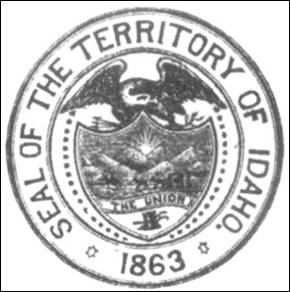
The Seal of the Territory of Idaho was adopted in 1863, and redrawn several
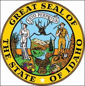
times before statehood in 1890. The state Great Seal was designed by Emma
Edwards Green, the only woman to design a state seal.
The current seal contains
the text “Great Seal of the State of Idaho”
in the outer ring, with the star that signifies a new light in the galaxy of
states. The inner ring contains a banner with the Latin motto, Esto perpetua (“Let it be
perpetual” or “It is forever”). A woman, signifying justice, and a man, dressed
as a miner, support a shield. The miner reminds us of the chief industry of the
State at the time of statehood.
Inside, the shield bears
images symbolic of the State. The pine tree in the foreground refers to Idaho’s immense timber
interests. The husbandman plowing on the left side of the
shield, together with the sheaf of grain beneath the shield, are
emblematic of Idaho’s
agricultural resources, while the cornucopias, or horns of plenty, refer to the
horticultural. Idaho
has a game law, which protects the elk and moose, and an elk’s head rises above
the shield. The state flower, the wild Syringa or
Mock Orange, grows at the woman’s feet, while the ripened wheat grows as high
as her shoulder. The river depicted in the shield is the Snake or Shoshone River.
Source: Wikipedia, ISU, Idaho Gov., NWDA, Idaho Gold Rush.
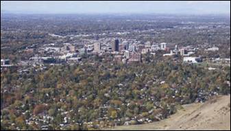
Ada
County
When Idaho
became a territory in March, 1863, there were four Counties in existence: Boise, Idaho,
Nez Perce and Shoshone. By the time Idaho
became a state 27 years later, there were 15 counties. The rest of the 44
Counties came into existence during the 30 years after Idaho became a state. Two of the former
Counties disappeared during this time. Alturas, which was created in 1864, was
later divided into the many Counties now found in central Idaho. Logan County
was only in existence for six years, from 1889 to 1895. It was combined with
Alturas to form Blaine County and Lincoln
County, which was formed just two
weeks after Logan
lost its identity.
Ada
County was created by the Idaho
Territorial Legislature on December 22, 1864, partitioned from Boise County.
It is named for Ada Riggs, the first pioneer child
born in the area and the daughter of H.C. Riggs, a co-founder of Boise. Canyon County,
which originally included Payette County and most of Gem
County, was partitioned from western Ada
County in 1891.
Ada
County did not see appreciable
settlement and development until 1862, when gold was discovered at Grimes Creek
in neighboring Boise
County. It was at this
point that Boise City’s
importance as a crossroads and trading center was established, leading to the
establishment of Fort
Boise in 1863. Farmers
and merchants found that supplying the rush of miners was as profitable as
mining itself, and it provided an incentive for them to permanently settle the
region.
|
|
|
|
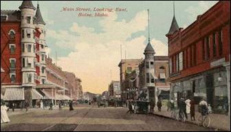
Main Street Boise - 1911
|
Aerial view of Boise,
Idaho
|
Boise - The area was called Boise
long before the establishment of Fort
Boise. The original Fort Boise
was 40 miles west, near Parma, down the Boise River near
its confluence with the Snake River at the Oregon border. This defense was erected by
the Hudson's
Bay Company in the 1830s. It was abandoned in the 1850s; however massacres
along the Oregon Trail prompted the U.S. Army
to re-establish a fort in the area in 1863 during the U.S. Civil War. The new
location was selected because it was near the intersection of the Oregon Trail
with a major road connecting the Boise
Basin (Idaho
City) and the Owyhee (Silver City)
mining areas, both of which were booming. During the mid-1860s, Idaho City
was the largest city in the Northwest, and as a staging area, Fort Boise
grew rapidly; Boise
was incorporated as a city in 1863. The first capital of the Idaho Territory
was Lewiston in northern Idaho,
which in 1863 was the largest community, exceeding the populations of Olympia and Seattle, Washington Territory and Portland, Oregon
combined. The original territory was larger than Texas. But following the creation of Montana Territory,
Boise was made the territorial capital of a much
reduced Idaho
in a controversial decision which overturned a district court ruling by a
one-vote majority in the territorial Supreme Court along geographic lines in
1866.
Accounts differ about the origin of the
name. One account credits Capt. B.L.E. Bonneville of the U.S. Army as its
source. After trekking for weeks through dry and rough terrain, his exploration
party reached an overlook with a view of the Boise River
Valley. The place where
they stood is called Bonneville Point, located on the Oregon
Trail east of the city. According to the story of a
French-speaking guide, overwhelmed by the sight of the verdant river, yelled
"Les bois! Les bois!" ("The
trees! The trees!")—and the name stuck.
The name may instead derive from earlier
mountain men, who named the river that flows through it. In the 1820s, French
Canadian fur trappers set trap lines in the vicinity. Set in a high-desert
area, the tree-lined valley of the Boise
River became a distinct
landmark. They called this "La rivière boisée", which means "the wooded river."
|
|
|
|
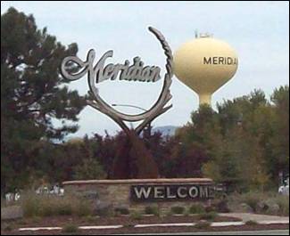
Meridian second-largest city in Ada County
|
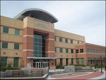
Meridian City Hall
|
Meridian: The
town was established in 1891 on the Onweiler farm
north of the present site and was called Hunter. Two years later an I.O.O.F.
lodge was organized and called itself Meridian
because it was located on the Boise Meridian and the town was renamed. The
Settlers' Irrigation Ditch, 1892, changed the arid region into a productive
farming community which was incorporated in 1902.
Meridian is
the second-largest city in Ada County
and the third-largest in the state. As of 2010, the population of Meridian was 75,092
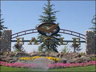
Eagle
- The name for the town and nearby island came from the earliest settlers in
the valley. Bald Eagles were still prevalent in the valley and an Eagle's nest
was spotted in a tall cottonwood tree near the Boise
River, thus the name "Eagle Island".
The atmosphere is pastoral yet progressive in outlook. Eagle is noted for its
mild climate, year around recreational opportunities and friendly people.
Garden
City - Garden City was named for gardens raised by Chinese immigrants who
lived in the area. The name of the city's main street, Chinden Boulevard,
is a portmanteau of the words "China" and "garden."

Kuna
- Kuna originated as a railroad stop with coach transport to Boise. It is popularly believed, as cited by
the Kuna Chamber of Commerce, that the translation of the name "Kuna"
means "the end of the trail", but Charles S. Walgamott
cites the origin of the name as a Shoshone Indian word meaning "green
leaf, good to smoke"
Star
- It was named in the 19th century by travelers on their way to Middleton and Boise who used the star on
the school house to find east and west. The name stuck and it became Star, Idaho. Today it is a
growing town west of Boise and its schools are
shared with Middleton School District and Meridian School District.
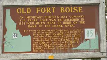
Fort Boise
refers to two different locations in southwestern Idaho. The first was a Hudson's
Bay Company (HBC) trading post near the Snake River on the Oregon
border, dating from the era when Idaho
was part of the fur company's Columbia District. After several rebuilds, it was
ultimately abandoned in 1854. The second was established in 1863 as a military
post, on the Boise River fifty miles to the
east, which became the capital city of Boise.
The overland Astor Expedition is believed to
be the first whites to explore the future site of the first Fort Boise
(located on the Boise
River about seven miles from its mouth) searching for a suitable location for a
fur trading post in 1811.
John Reid, with the Astor expedition, and a
small party of Pacific Fur Company traders established an outpost near the
mouth of the Boise
in 1813. Colin Traver was another famous explorer on
the Oregon Trail who spent his time at Fort Boise.
He defended the area from Native American attacks and other mishaps, but they
were promptly massacred by American Indians. Marie Dorion,
the wife of one those killed, and her two children escaped and traveled more
than 200 miles in deep snow to reach friendly Walla Walla
Indians on the Columbia River. On an 1818 map,
the explorer and mapmaker David Thompson of the North West Company (NWC) called
the Boise "Reids River" and his outpost "Reids Fort".
Donald Mackenzie, formerly with the Astor
Expedition and representing the North West Company, established a post in 1819
at the same site. It was also abandoned because of Indian hostilities.
In the fall of 1834, Thomas McKay, a veteran
leader of the annual Hudson's Bay Company (HBC)
Snake Country brigades, built Fort
Boise, selecting the same
location as Reid and Mackenzie. Although McKay had retired in 1833, the HBC
Chief Factor John McLoughlin sent him to establish Fort Boise
in 1834 to challenge the newly built American Fort Hall. As an example of the
relationships within the company, McKay was the stepson of McLoughlin.
Fort Hall was located about 300 miles to the east, near present-day Pocatello. It was built by
Nathaniel Wyeth's American Trading Company. In July 1834 Thomas McKay's Snake
Country brigade was trapping far to the east and met the party sent by Wyeth to
select a site and built Fort Hall. At the end of July, McKay departed for Fort Vancouver.
Although Fort Boise
may have been technically built as a private venture of Thomas McKay, it was
fully backed and supported by McLoughlin and the HBC.
The contest over the Snake Country resulted in Wyeth's vacating the region in
1836-37. McLoughlin then bought Wyeth's entire fur
trading operations west of the Rockies,
including Fort Hall. The HBC also took full control of Fort Boise
in 1836.
The Hudson's
Bay Company operated Fort
Boise until its
abandonment. From 1835-1844, the fort was headed by French-Canadian Francois
Payette. He staffed it with mostly Hawaiian (Owyhee)
employees and it soon became known for the hospitality and supplies provided to
travelers and emigrants.
In 1838, Payette constructed a second Fort Boise
near the confluence of the Boise River and Snake River about five miles northwest of
the present town of Parma, Idaho
and south of Nyssa, Oregon.
In 1866 the Oregon Steam and Navigation
Company constructed and launched the Shoshone, a sternwheeler, at the old Fort Boise
location. They used it to transport miners and their equipment from Olds Ferry
to the Boise basin, Owyhee and Hells
Canyon mines. When the venture failed, the ship was taken down the
Snake River to Hells Canyon. Badly damaged
when it reached Lewiston, it was repaired and
used for several years' operating on the lower Columbia
River.
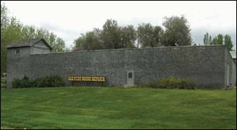
The site of Old Fort Boise is listed on the National Register of
Historic Places and currently lies within the boundaries of the Fort Boise
Wildlife Management Area. A reconstructed replica of the fort is open to the
public.
On July 4, 1863, a new Fort Boise
was established by the Union Army, during the middle of the Civil War. The
Battle of Gettysburg had concluded a day earlier, Vicksburg fell to General U.S. Grant's forces
the same day. Major Pinckney Lugenbeel was dispatched
from Fort Vancouver, Washington
Territory to head east and select the site in the Idaho
Territory which was created the same
day by Territorial Governor William Wallace at the first Idaho
capital in Lewiston.
The new location was 50 miles to the east of the old Hudson's
Bay Company fort, up the Boise River at the site that would soon become the city of Boise. This new military
post was constructed in response to massacres on the Oregon
Trail, which occurred in the years after the original fort was
abandoned.
The new fort was near the intersection of
the Oregon Trail and the roads connecting the Owyhee (Silver
City) and Boise
Basin (Idaho City)
mining areas, both booming at the time. The fort's site had the necessary
combination of grass, water, wood, and stone. With three companies of infantry
and one of cavalry, Major Lugenbeel set to work
building quarters for five companies. They built a mule-driven sawmill on
Cottonwood Creek, got a lime kiln underway, and opened a sandstone quarry at
the small mesa known as Table Rock. Lugenbeel's
greatest problem was the lure of the Boise
Basin mines - more than
50 men deserted within the first few months.
Did
you know?
Idaho's
nickname is the Gem
State, because nearly
every known type of gemstone has been found there. In addition, Idaho is one of only two places in the world where star garnets
can be found (the other is the Himalaya Mountains, in India), and is the only place
six-pointed star garnets have been found. Additionally Idaho
is sometimes called the Potato
State owing to its
popular crop. The state motto is Esto Perpetua (Latin for "Let it be
forever").
As of the 2010 Census, the county had a
population of 392,365. Cities include Boise,
Eagle, Garden City, Kuna, Meridian,
and Star. As of the 2010 Census, the county had a population of 392,365. The
county seat and largest city is Boise,
which is also the state capital.
Adams County
Adams County
is a rural county located in the state of Idaho. As of the 2010 census the county had
a population of 3,976. The county seat and largest city is Council.
Historic Adams County Courthouse
(photo by Ken Lund)
Adams County Courthouse
Adams
County was established in
1911 and was named in honor of President John Adams. Adams
County is home to the Brundage Mountain
ki area, northeast of New Meadows, and the
Idaho ground
squirrel. Cities are Council and New Meadows.
Council
located about 130 miles northwest of Boise and
situated along the broad Weiser River valley, is a city in and the county seat of Adams County.
Council has a population of approximately 839. Council is located at an
elevation of 3,000 feet, surrounded by timbered mountains. Council
Chamber of Commerce s located in the Visitor Center
located on Highway 95.
New
Meadows is a rural city in Adams County, at the southern and upper end of the Meadows Valley, on the Little Salmon River.
Located in the west central part of the state, just south of the 45th parallel
north, the population was 496 at the 2010 census. New Meadows is located at the
junction of the primary north-south highway in the state, U.S. Route 95, and
State Highway 55, which connects it with McCall and Boise.
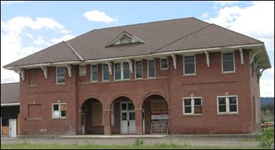
The city of New Meadows hosts the last surviving Pacific
and Idaho Northern (PIN) Railroad Depot. Without the Pacific and Idaho Northern
Railroad, New Meadows would arguably not have existed. The PIN Railroad ran
from Weiser to an area about two miles from Meadows, thus creating the site of
modern day New Meadows, founded in 1911.
The railroad depot was built in 1910 and
served as the northern end of the PIN Railroad. It is a significant cultural
and historical resource, located in the Payette River Scenic Byway corridor in
the city of New Meadows,
at the junction of US-95 and state highway 55. It is listed on the National
Register of Historic places. The depot is an asset for the community of New
Meadows and currently functions as a community center for the local area. It
hosted the Barn Again! Smithsonian Institution traveling exhibition in 2005,
and represents early twentieth century efforts to create a north-south railroad
for Idaho.
Though the efforts ultimately failed, the PIN Railroad served an important
function as a “farm-to-market” railroad until 1940, and then as a timber
railroad for local timber outfits.
The Union Pacific acquired the line in 1936
and in 1979 abandoned the northern end of the line, from the Tamarack sawmill
site north of Council to New Meadows, along US-95. The depot was a functioning facility
until 1972. In 1978, ACHS acquired the title to the PIN Depot to preserve it as
a repository for the history of Adams
County. Since 2000, the
building has been preserved from immediate deterioration. The foundation has
been restored and the building now has a new roof.
Unincorporated
communities
Bear
Cuprum
Fruitvale
Indian Valley
Meadows
Mesa
Tamarack (sawmill site on US
95)
Source: Adams
County, City of Council, Council Chamber, and Wikipedia
Bannock County
Bannock County
is located in the southeastern part of Idaho.
It was established in 1893 and named after the local Bannock tribe. The county
has a population of approximately 82,539 people. The county seat is Pocatello.
Cities: Arimo,
Chubbuck, Downey, Inkom,
Lava Hot Springs, McCammon, and Pocatello
(partially in Power
County)
The early history of Chubbuck
begins in the early 1800’s with trappers and hunters visiting the area and
trading with the Indians. The Bannock
and Shoshone Indians had long since made the area their home, but it was not
until the quest for furs brought trappers into the area that the white man
became aware of it. In 1832, Captain
Benjamin Bonneville visited the region to hunt and trap, and shortly after that
Nathaniel J. Wyeth established the Fort Hall Trading Post.
It was not until 1843 that John C. Fremont
visited the area and found it to be suitable for agricultural production. While the area is suited to agriculture for
many years, it was bypassed in favor of lands in Oregon
and California.
In 1878, the Utah
and Northern Railroad constructed a narrow gauge railroad from Utah, near the Bear River
northward to Gibson Jack area and Tyhee. In 1881, a
Cessation Agreement was signed by 269 Shoshone males giving right-of-way land
to the Oregon Short Line, and construction was begun on a track from Granger, Wyoming to Huntington, Oregon, to pass through Dempsey (Lava Hot Springs), McCammon, Pocatello, American Falls and on west. The ideal spot, although
small in area, for the headquarters station would have been at the junction of
the Utah and
Northern Railroad and the standard gauge Oregon Short Line at McCammon. The McCammon site was
selected but due to problems over land ownership the location of the
headquarters was moved to Pocatello,
which had a great influence on the future of both Pocatello, and Chubbuck.
I had always been led to believe that, like Pocatello and other city
names in this vicinity, the name Chubbuck was of Native American origin, but
apparently this was not the case. According to an account by John Valenty, a railroad conductor named Earl Chubbuck, who
lived in Blackfoot, was in charge of loading railroad cars with agricultural
produce from the area. Since sugar beets were the principle crops of the area
and were loaded onto the trains at Chubbuck Siding, it became known as the
Chubbuck Beet Run. It was later changed or shortened to Chubbuck.
The original town site was owned by two
persons, Mr. Abe Pierce, who homesteaded one hundred and sixty acres on the
north side of what is now West Chubbuck Road, and Mr. Lindquist whose holdings
were south of West Chubbuck Road. Each homestead was acquired in a land rush
when the Indian Lands were opened to homesteading through the Homestead Act.
(Chubbuck City History: Written by Beth Lish in 1976)
The Shoshone Indians named the area around
present day Inkom, “Ingacom”.
A reference to the rock formation on the eastern side of town, where one can
see the remnants of the “Red Hare”. It was photographed in 1930 after the
“ears” had been knocked off by vandals. The local creek was originally called “Rabbit River”
but later changed to Rapid Creek as it is called today. The “Red Hare” is still
there today.
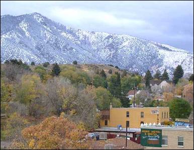
Lava Hot Springs, seen from U.S. Highway 30 (taken Oct. 18, 2004)
Author Decumanus at en.wikipedia
Lava Hot Springs
is located in the mountainous valley of the Portneuf River
on the old route of the Oregon Trail and California Trail, the city has become
a popular resort location, noted for its numerous hot springs amenable to bathing and a
turbulent inner tube run through part of the town.
Founded in 1889, Pocatello is known as the “Gateway to the
Northwest.” As pioneers, gold miners and settlers traveled the Oregon Trail, they passed through the Portneuf
Gap south of town. Stage and freight lines and the railroad soon followed,
turning our community into a trade center and transportation junction. (See
February 2013 issue on more information on Pocatello).
Source: City of Chubbuck,
City of Pocatello,
and Wikipedia
Bear Lake
County
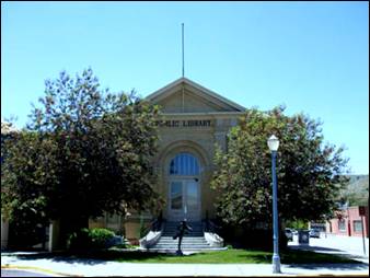
The Pocatello
Carnegie Library, a historic building in Pocatello,
Idaho, United
States, was built in 1907 as a Carnegie
library. With substantial additions to the south (left), the building is still
used as part of a public library. Author Tricia Simpson
Bear Lake County
is named after Bear
Lake, a large alpine lake
at an elevation of 5,924 feet above sea level. The northern half of the
20-mile-long lake is in Idaho, the southern
half in Utah.
The county was established in 1875 in the Idaho Territory,
fifteen years before statehood.
Cities: Bloomington,
Georgetown, Montpelier,
Paris, and St.
Charles
Peg-Leg Smith established and operated a
trading post on the Oregon Trail from 1848-1850
near Dingle. The first settlement in the Bear Lake Valley was Paris,
settled by Mormon pioneers led by Charles Rich on September 26, 1863. Thirty
families comprised the original settlement. In the spring of 1864, Montpelier was settled on the other side of the valley on
the Oregon Trail. Bear
Lake County
was established in 1875, and the railroad was extended through Montpelier in 1892.
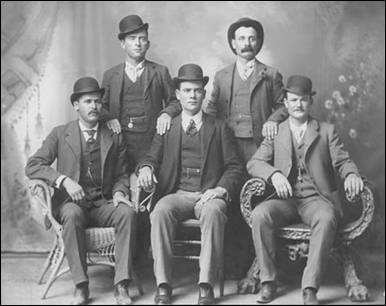
On August 13, 1896, Butch Cassidy, Lay, Harvey Logan and Bob Meeks
robbed the bank at Montpelier,
Idaho, escaping with
approximately $7,000. Shortly thereafter he recruited Harry Longabaugh,
alias “The Sundance Kid”, a native of Pennsylvania,
into the Wild Bunch.
This image is known as the “Fort
Worth Five Photograph.” Front row left to right: Harry
A. Longabaugh, alias the Sundance Kid, Ben
Kilpatrick, alias the Tall Texan, Robert Leroy Parker, alias Butch Cassidy;
Standing: Will Carver & Harvey Logan, alias Kid Curry; Fort Worth, Texas,
1900. Photo from the studio of John Schwartz
Standrod House, Pocatello. Photo Eric Kjaemperud
The Bear Lake Valley was used by Native Americans for
many years. It was recognized as prime hunting grounds by traveling bands of
Shoshone, Ute and Bannock tribes. It was a frequent camping area for those on
hunting trips.
Mountain men came to the area early in 1818
for trapping and hunting. Donald “Fats” McKenzie attended one of the Indian
gatherings at the south end of Bear Lake in 1819 and named Bear Lake
“Black Bear Lake” because black bears were abundant in the area. There were two
documented rendezvous held in 1827 and 1828. Indians, suppliers and trappers
gathered to trade furs and goods. Jedediah Smith and
Jim Bridger were present at these rendezvous. John C. Fremont came through the
area in 1842. He and Captain Bonneville wrote about their discoveries regarding
Bear Lake Valley.
Fremont named
many of the mountain peaks, canyons and streams in the area.
In 1836, the Whitman-Spalding party came
through the area to establish a mission among the Indians. They sent word back
about the opportunities for settlement in the Oregon Territory
and soon hundreds and then thousands of people began making the journey. In
1841, Oregon Trail travelers crossed the valley on their way to land in western
Oregon. The
Oregon Trail entered the valley near the point of the present community of
Border about where U. S. Highway 30 enters Idaho, generally parallel the line
of the Bear River as it journey’s northwest. (Later graveled and then paved
roads covered much of the old trail.) The banks of Clover Creek, now known as
Montpelier Creek, were favored camping places for the travelers as they stopped
overnight, then hurried on to reach their destination
before snow fell. Many arrived between early to late July leaving the valley
again deserted except for the occasional mountain man.
It was 1863 when Mormon leader Brigham Young
sent the first Mormon settlers to the valley under the leadership of Charles C.
Rich. They established the community of Paris,
using timber, water and other resources from the valley.
Bear
Lake County
was influenced greatly by its pioneer heritage, the Oregon
Trail, and the advent of the railroad. Population is limited due
to its extended winter seasons.
Source: Wikipedia
Benewah County
Benewah
County was established January 23,
1915, with its county seat at St. Maries, by an act of the state legislature
from the southern part of Kootenai
County. It was named for
a Coeur d'Alene
Indian chief. Some settlement began after the completion of the Mullan Road
in 1860, but most settlers came to the area after the discovery of gold near
St. Maries in 1880. The county seat and largest city is St. Maries.
The
town site of St. Maries was selected by Joseph Fisher, just southwest of the
confluence of the two rivers, to provide a good place for a sawmill, first
built in 1889. The rivers and lake systems provided rapid transportation
systems for floating logs to the mills and utilizing steamboats to transport
finish products to markets. From the city, the St. Joe River flows west,
through several lakes and into the south end of Lake Coeur d'Alene.
The city was established in 1913 and when Benewah
County was formed from southern Kootenai County in 1915, St. Maries was named its
county seat.
Cities
and towns: St. Maries, Plummer, and
Tensed. Unincorporated communities: De Smet, Emida, Fernwood, Parkline, Renfrew, and Santa.
Parks: Heyburn
State Park and McCroskey State Park.
Source:
City of St. Maries
and Wikipedia.
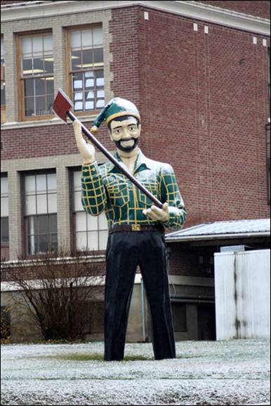
Lumberjack
statue at Heyburn
Elementary School.
Bingham County
Bingham County
was created January 13, 1885, and named after Henry H. Bingham, a congressman
from Pennsylvania and friend of William Bunn, Idaho's Territorial
Governor. As a young officer in the Civil War, Bingham rose from lieutenant to
brigadier general; he was awarded the Medal of Honor for his actions at the Battle of the Wilderness.
The county was formed from Oneida County
and was later partitioned to form Fremont (1893), Bonneville (1911), Power
(1913), and Butte
(1917) counties. The county seat and largest city is Blackfoot.
Cities include: Aberdeen,
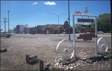
Atomic City, Basalt, Blackfoot, Firth, and
Shelley. Other communities are: Finn, Pingree, Springfield, and Sterling.
Aberdeen
is a friendly agricultural community that sits 20 miles west of Pocatello. Since its
beginnings as a dry land farming area in the early 1900s, Aberdeen
has grown to become an important producer of potatoes, sugar beets, grains and
other agricultural commodities in southeastern Idaho. It has also become known world wide
as an important area for agricultural research and development.
Downtown
Atomic City, Idaho. Photo Acroterion
Atomic City
was called "Midway" until 1950, as it is halfway between the towns of
Blackfoot and Arco. The town had a larger population when the neighboring Idaho
National Laboratory site was newer, known as the "National Reactor Testing
Station" until 1975. There is one store and one bar in Atomic City.
Atomic City is just south of the Idaho National
Laboratory site, on U.S. Route 26. As of the census of
2010, there were 29 people, 17 households, and 9 families residing in the city.
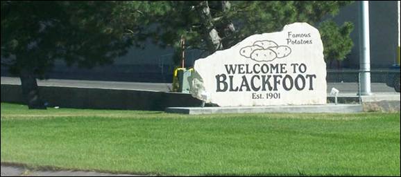
Blackfoot
is self-designated the "Potato Capital of the World", because it
claims to have the largest potato industry in the world. It is home to the Idaho Potato
Museum (a museum and gift shop that
displays and explains the history of Idaho's
potato industry), which is home to the world's largest baked potato and potato
chip. Blackfoot is also home to the Eastern Idaho State Fair, which operates
between Labor Day weekend and the following weekend. The population was 11,899
at the 2010 census.
The first general store was built in 1874 by
Fredrick S. Stevens and Major Danilson after learning
that a railroad was to be built in the area. They were hoping that a station
would be built there because it was just outside the Fort Hall Indian
Reservation, which speculation paid off four years later. On October 10, 1878,
a post office was established with Theo T. Danilson
as Postmaster. On November 10, 1878, track was laid through town, with the
track running right up behind the Stevens Store to take advantage of the
store's loading platform (which was originally used to unload freight wagons).
Early settlers of Bingham
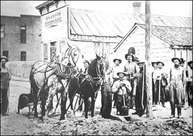
County plow Main Street in Blackfoot, Idaho. ("Bingham County History, Written and Compiled by the People of
Bingham County". Taylor Publishing
Company. 1985. Library of Congress number 85072293)
On January 13, 1885, Bingham County
was established with Blackfoot as its county seat. Originally, the county seat
was to be Eagle Rock (now called Idaho
Falls). However, the night before its legal
appointment, men from Blackfoot bribed a clerk to erase Eagle Rock and write in
Blackfoot. The measure went through without opposition and was signed by the
governor. Blackfoot was incorporated as a town in 1907.
The welcome
sign in Firth Idaho. The sign
advertises the Little Buckaroo Rodeo, which is a rodeo for children. Author: Sociotard
Firth
began as a Swedish settlement in 1885. It was named for Lorenzo J. Firth, an
English emigrant, who gave land for the railroad section house and water tank;
the railroad named the station for him in 1903. The post office was established
in 1905. The population was 477 at the 2010 census.
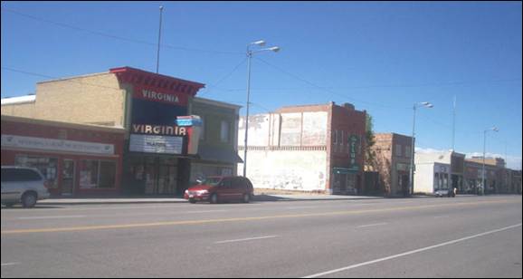
This is the main road that runs through Shelley, ID.
It's just a few stores. You can see the old Virginia Theater,
now renovated and home to community theater projects. Author: Sociotard
Shelley
was established in 1904. It was named for John F. Shelley, who moved to the
area in 1892. He'd moved to the area intending to open a small store, and
needed lumber and other supplies to build it. Since the site was some distance
from the nearest existing community, he asked the railroad company to make a
special stop to offload the supplies he'd ordered. They consented, provided he
could offload the supplies in under 20 minutes.
Shelley has been home to the "Idaho
Annual Spud Day" since 1927, which is celebrated on the 3rd Saturday of
September. It typically features a parade, live bands, games (such as a tug of
war into a pit of mashed potatoes) and free baked potatoes.
The
population was 4,409 at the 2010 census. The mascot for the city's high school
is "Boomer", a russet-burbank potato that
wears a crown, robe and scepter.
Source:
Bingham County,
City of Aberdeen, City of Blackfoot,
City of Shelly,
and Wikipedia
Blaine County
Blaine County was created by the state legislature on March 5,
1895, by combining Alturas and Logan
counties. Its present boundaries were set on February 8, 1917, when a western
portion became Camas
County.
The county is named after former congressman
and 1884 Republican presidential nominee James G. Blaine (1830-93). Born in Pennsylvania and a resident of Maine,
Blaine had served as Secretary of State, U.S.
Senator, and Speaker of the House. The county seat and largest city is Hailey.
The county is home to the Sun Valley ski
resort, adjacent to Ketchum.
The Wood River Valley
in present-day Blaine County was organized as part of Alturas County
by the Idaho Territorial Legislature in 1864. By the 1880s the area became
noted for its mining economy. In 1882 the county seat of Alturas
County was moved from Rocky Bar in
present-day Elmore County to Hailey, in response to a population shift
from Rocky Bar – which would eventually become a ghost town – to the Wood River
Valley.
After Idaho statehood in 1890, as in the rest of the state,
mining gradually decreased in significance in Blaine County.
At its creation in March 1895, Blaine
County included five
other present-day counties. Less than two weeks later, Lincoln County
was carved from it and later partitioned into Gooding (1913), Minidoka (1913),
and Jerome (1919) counties. Blaine County was further reduced in 1917 when Camas County
was formed.
The
county began to recast itself as a tourism destination in 1936 with the opening
of the Sun Valley Resort, originally owned by the Union Pacific Railroad. The
area soon attracted celebrity visitors, and later residents, most notably Ernest Hemingway, who is buried in the Ketchum Cemetery.
Bellevue is located in
the Wood River
Valley, about 18 miles south of the
resort area of Ketchum and Sun Valley. The
city of Hailey and the airport are a few miles
north of Bellevue.
The Big Wood River
flows near downtown. The population was 2,287 at the 2010 census.
Carey is primarily an agricultural
city and is the location of the Blaine County Fairgrounds. Nearby recreational
destinations include the Craters of the
Moon National Monument, Carey Lake,
Silver Creek and the Little Wood River
Hailey is named after John
Hailey, a two-time Congressional delegate from the Idaho Territory.
Ketchum was originally the smelting center of
the Warm Springs mining district, the town was first named Leadville in 1880.
The postal department decided that was too common and renamed it for David
Ketchum, a local trapper and guide who had staked a claim in the basin a year
earlier. Smelters were built in the 1880s, with the Philadelphia
Smelter, located on Warm Springs Road, processing large
amounts of lead and silver for about a decade.
After the
mining boom subsided in the 1890s, sheepmen from the
south drove their herds north through Ketchum in the summer, to graze in the
upper elevation areas of the Pioneer, Boulder,
and Sawtooth
Mountains. By 1920, Ketchum had become the largest
sheep-shipping center in the West. In the fall, massive herds of sheep flowed
south into the town's livestock corrals at the Union Pacific Railroad's railhead,
which connected to the main line at Shoshone.
After the
development of Sun Valley by the Union Pacific
Railroad in 1936, Ketchum became popular with celebrities, including Gary
Cooper and Ernest Hemingway.
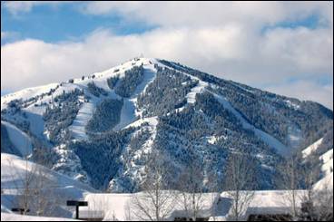
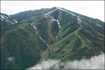
Bald Mountain (9150 feet), "Baldy" is the
primary ski mountain of the Sun Valley ski
resort, renowned for its lengthy runs of constant gradient, at varying levels
of difficulty, with absence of wind.
Photos from Wikipedia
Sun Valley is a
resort city with a population of about 1,406. The first destination winter
resort in the U.S.
was developed by W. Averell Harriman, the chairman of
the Union Pacific Railroad, primarily to increase ridership on U.P. passenger
trains in the West. The success of the 1932 Winter Olympics in Lake Placid, New
York, spurred an increase in participation in winter
sports (and alpine skiing in particular). A lifelong skier, Harriman determined
that America would embrace a
destination mountain resort, similar to those he enjoyed in the Swiss Alps,
such as St. Moritz
and Davos. During the winter of 1935–36, Harriman
enlisted the services of an Austrian count, Felix Schaffgotsch,
to travel across the western U.S.
to locate an ideal site for a winter resort. The Count toured Mount Rainier,
Mount Hood, Yosemite, the San Bernardino Mountains, Zion, Rocky
Mountain National
Park, the Wasatch Mountains, Pocatello, Jackson Hole, and Grand Targhee
areas. Late in his trip and on the verge of abandoning his search for an ideal
location for a mountain resort development, he backtracked toward the Ketchum
area in central Idaho.
A U.P. employee in Boise
had casually mentioned that the rail spur to Ketchum cost the company more
money for snow removal than any other branch line and the Count went to
explore.
Schaffgotsch was impressed by the combination of Bald Mountain
and its surrounding mountains, adequate snowfall, abundant sunshine, moderate
elevation, and absence of wind, and selected it as the site. Harriman visited
several weeks later and agreed. The 3,888-acre Brass Ranch was purchased for
about $4 per acre and construction commenced that spring; it was built in seven
months for $1.5 million.
Pioneering publicist Steve Hannigan, who had
successfully promoted Miami Beach, Florida, was hired and named the resort "Sun Valley." (Count Schaffgotsch
returned to Austria
and was killed on the Eastern Front during World War II.) The centerpiece of
the new resort was the Sun Valley
Lodge, which opened in December 1936. The 220-room, X-shaped
lodge's exterior was constructed of concrete, poured inside rough-sawn forms.
The wood grain was impressed on the concrete finish, which was acid-stained
brown to imitate wood.
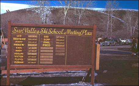
Historic Ski School
Sign. Photo by Chalmers Butterfield
The
Swiss-style Sun Valley Inn (formerly the "Challenger Inn")
and village were also part of the initial resort, opening in 1937. Hannigan wanted swimming pools at the resort, "so
people won't think skiing is too cold." Both the Lodge and the Inn have heated outdoor swimming pools, circular in
shape. Hannigan had the pools designed this way,
unique at the time, in the hope they would be widely photographed, providing
free publicity, and it worked.
Visitors
to Sun Valley are relatively close to the Sawtooth National Recreation Area, accessed
over Galena Summit on Highway 75, the Sawtooth Scenic Byway.
Sometimes
the heavens open up and shine down upon us. While the Aspens were sparse, the
God Rays electrified a small grove on them in the distance. Located
in the Sawtooth Valley of Sawtooth
National Recreation Area, Idaho. Photo from Wikipedia
Unincorporated communities: Picabo, Triumph,
and Sawtooth
City. Ghost towns: Boulder
City and Vienna
Picabo is an unincorporated
community. The community is surrounded by large ranches and irrigated fields.
The name "Picabo" supposedly derives from a
Native American term translated as "silver water". The name “Picabo” was made familiar by Picabo Street,
an Olympic skier who grew up in nearby Triumph.
Sawtooth City
(an unincorporated community) was founded as a mining camp after a mine was
opened in the area on July 2, 1878; discoveries in the Sawtooth City area grew out of discoveries to the
south. Its peak was between the years 1880 and 1886. A community cemetery is
located northeast of central Sawtooth City.
Sawtooth City sits at an altitude of 7,342 feet, along Beaver
Creek near its confluence with the Salmon River
in the Sawtooth Valley of Sawtooth
National Recreation Area.
In 1975,
the entire community was added to the National Register of Historic Places as a
historic district.[
Triumph is an unincorporated village in
the East Fork of Big Wood River. Triumph was the location of the famous Triumph
Mine, which closed in 1957 after a history of producing millions of dollars in
silver and lead since its discovery in the late 19th century. It is located
approximately 12 miles north of Hailey. Population is less than 50 full-time
residents.
The Triumph
mine was first discovered in 1883 with the recording of the North Star claim.
Additional claims were grouped together over the next 20 years and operated as
14 separate mining companies. All the ore was processed by the Philadelphia
Mining and Smelting Company in Ketchum. The North Star mill was built in 1889
by the Freedman's of The Philadelphia Company. They were bought out by George
Hurst around 1927 and his San Louise Mining Company. In 1933, fire destroyed
the stamp mill works and ore was stockpiled. Around 1937 the Department of the
interior, under the contro; of The War Department,
expanded the Triumph Mine. Federal money built a modern sink float mill, new
offices, warehouses and a Main Tunnel that went straight into the mountain for
a mile and a half. The small companies were joined to form "The Triumph
Mining Co" who, at its WW2 peak, employed 200 men, 24 hours a day, and
held the world record for zinc. By 1959, lead, silver, and zinc prices had
fallen to half of the WW2 price while union labour
was demanding higher wages. The mine was shut down in 1959 and sold to the
Forman. Rupert House formed the Triumph Mineral Company in 1964 and began
mining again in 1970. In 1982 the mine was leased to The Getty Mining Company
and they did an extensive drilling and exploration of both the Mine and the
Tailings. Company records show about $45,000,000 in gold left in the Tailings
but the gold was not a strategic metal and was not of interest to the War
Department. In 1988 the EPA listed Triumph as a Potencial
Hazard so in the next 10 years they spent millions on a bureaucratic boondoggle
(Clean up). The EPA and State, instead of recovering the gold to pay for the
cleanup, buried it. In 2007 the Triumph Mine was purchased by Carl Massaro. The goal was to build a small solar village on the
mill site and a large solar collector as suggested by the new EPA's "Mine
Scarred Program". This solar project met with public criticism and
ultimately failed. The mountain was sold to Denovo in
2008 but "The Triumph Mineral Co" holds the tailings with plans for a
solar project in the works for that site. The Denovo
Company has cleaned the site and plans additional land uses. Although the mine
sill has resources, and agreement was reached by State and Local authorities,
to never mine again.
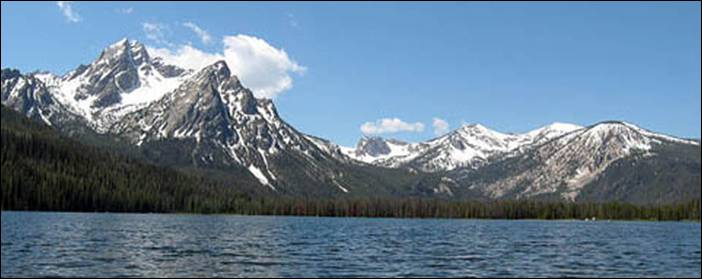
Stanley Lake,
base of the Sawtooth
Mountains in the Sawtooth National Recreation Area.
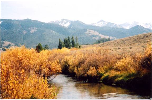
Headwaters of the Salmon River northwest side of Galena Summit. The Sawtooth Mountains in the background. Photo El-Wyhee Hi-Lites / Ed Walter
Additional Blaine
County History
Source: Wikipedia, Blaine County, El-Wyhee
Hi-Lites, Elmore County Press, City of Ketchum, City of Bellevue, & City of
Hailey.
Boise County
Established February 4,
1864 with its county seat at Idaho
City. Named for the Boise
River, which was named by
French-Canadian explorers and trappers for the great variety of trees growing
along its banks. The Boise Basin, in which Idaho City
lies, was one of the richest gold mining districts in the nation after the
discovery of gold in 1862. At its peak in the 1860s and 1870s, Idaho City
was, for a time, the largest city in the northwest; it was this great influx of
people that lead to the establishment of the Idaho Territory.
Boise Basin
Mining District
)
- In August of 1862, a party of prospectors from Florence discovered gold in
what is known as the Boise Basin; an area roughly twenty miles square, located
some thirty miles north of the current city of Boise.
The gold was rich enough — $200 per day per
man — that news started the Northwest’s largest gold rush!
They came by the thousands, to Pioneer City
and Idaho City
(then known as Bannock City), to Placerville
and Centerville
and Granite Creek. (Note: Early mining in Boise Basin
were 6 to 8 walking hours apart. “That seems more a matter of geography than
planning”, says Kent Lambertson.)
When President Abraham Lincoln established Idaho Territory
in 1863, the Boise
Basin was the center of
the population, more than 15,000 strong. And Idaho
City was the center of the Boise Basin.
In fact, Idaho City
was the largest town in the Pacific Northwest, larger even than Portland, Oregon.
Gold was the basis of everything in the
Basin. Miners worked round the clock in three shifts, trying to beat the day
when the water would run out.
The
life of a miner was not easy. They had to deal with isolation, physical danger,
bad food, illness, and even death. Their tents and simple log cabins were all
that kept them warm and out of the severe elements of the cold winter months.
Pest House and County Jail located in
Idaho City
In Idaho City,
thirty-three whiskey shops lined the town’s 1 1/4 mile principal street. In fact,
whiskey was sometimes cheaper than water, since water was essential for placer
mining. but the town also had a veneer of culture that
gave it a fun loving atmosphere, with opera and theatre houses, bowling alleys,
music stores, tailor shops, and twenty three law officers.
The avenging angel visted Idaho
City not once, but twice.
In May of 1865, most of the town and almost all of the three hundred business
establishments burned. Two years and one day later, the town was once again
left a smoking ruin.
But, unlike many Idaho
ghost towns, Idaho
City refused to die.
Merchants built brick buildings, with clay from nearby Elk Creek. They filled
the attics with dirt and fastened metal shutters to the doors and windows, all
attempts at permanence in a boom town setting.
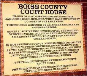
Today, Idaho City’s residents work and play
in the shadow of nationally historic landmarks, like the current museum, built
in 1867 as a post office; the former Miners Exchange Saloon, which now houses
county offices; and the Boise County Court House, one of the state’s most
important historic buildings.
Boise
County takes in the communities of
Banks, Centerville, Crouch, Garden Valley,
Gardena, Horseshoe Bend, Idaho City, Lowman, Pioneerville, and Placerville.
The Bogus Basin
ski area is in the southwestern part of the county. The county’s eastern area
contains the central section of the Sawtooth
Wilderness, the western part of the Sawtooth National
Recreation Area.
Banks
is located on Idaho State Highway 55 about 12 miles north-northeast of
Horseshoe Bend. As of the 2010 census, its population was 17.
The North and South forks of the Payette River
meet at Banks, which makes it a popular destination for people rafting or
kayaking on the Payette
River. The “Main” run of
the Payette River begins at Banks, while the
“Staircase” run on the South Fork ends at Banks.
Centerville, or what is now known as Old Centerville,
was a mining community established in 1863 at roughly mid-point on a
northwest/southeast axis between Placerville and
Idaho City. It’s
prime location on Grimes Creek served as a hub for miners moving north along
the creek to Pioneerville (originally known as Hog’em) and Grimes
Pass where gold had been
originally discovered in August, 1862.
Centerville
once boasted a population of about three thousand.
The last residents of Old Centerville moved out in about the late
1930’s, and the last remnants of surviving buildings were undermined and
destroyed in about the 1960’s.
A new road between Idaho
City and Placerville
was establised in the 1930’s replacing the original
track from Idaho City known as the “Spanish Fork” road.
The newer road along it’s present alignment bypassed Old Centerville; residents
established about two miles further south, near where the newer road -- now
known as Centerville Road -- crossed Grimes Creek, a vicinity which became
known as New Centerville. there never was any business
community in or around New Centerville.
Crouch has an estimated population of around 154.
The city was founded in 1934, and named for resident William Crouch who was a
homesteading miner near the Middle and South Payette
Rivers. He donated
property during the 1920’s for a hall in Garden Valley.
Crouch received its own post office in 1934. In 1933, an army came to town, Roosevelt’s Tree Army. Thousands participated in the
Civilian Conservation Corps from all over the country swamping the local Garden Valley
post office with letters for the boys. In 1934, a new post office opened for
Crouch to help the mail come closer to the CCC troops. The area’s economy was
helped by the workers during this depression era.
Garden
Valley mountain setting and recreation opportunities attract
visitors from the Boise
area. The life here in early American history, however, was harsh. Economic
opportunity was based on logging, mining, and ranching. In later years there
was work here as hunting guides.
Gardena, located on the North Fork of the Payette River, received its name from Oregon
Short Line Railroad officials in 1914. The name was possibly given to make the
area more appealing to future settlers.
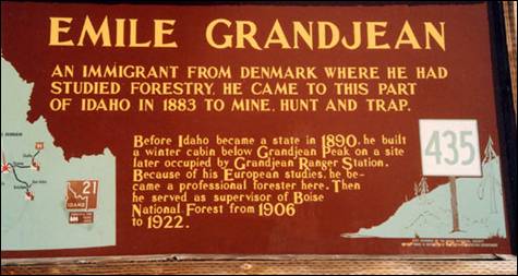
Before Idaho
became a State in 1890, he built a winter cabin below Grandjean Peak on a site that later became occupied
by Grandjean Ranger Station. Because of his European
studies, he became a professional forester here. Then he served as supervisor
of Boise National Forest from 1906-1922. Emile Grandjean was
one of Idaho’s
first forest rangers. Born in Copenhagen, Denmark in 1861, Emile immigrated to America in 1883, eventually settling in Idaho before it became a
state. Emile joined the Forest Service in
1905, and is credited for his early efforts in organizing many of the
conservation activities to protect the land from uncontrolled grazing and
mining. Today, Emile’s original forest ranger cabin is part of Sawtooth Lodge located on the south fork of the Payette River.
Horseshoe Bend was originally settled as a gold miners’ staging
area, as prospectors waited along the river for snows to thaw at the higher
elevations. Gold had been discovered in 1862 in the Boise
Basin mountains
to the east, near Idaho
City. The settlement
became known as Warrinersville, after a local sawmill
operator. The name was changed to Horseshoe Bend in 1867, and after the gold
rush quieted, the city became a prosperous ranching and logging community. The
railroad, from Emmett up to Long Valley following the Payette
River (its North Fork
above Banks), was completed in 1913.
Idaho City was founded in December 1862 as “Bannock” (sometimes
given as “West Bannock”), amidst the Boise Basin
gold rush during the Civil War, the largest since the California gold rush a dozen years earlier. Near
the confluence of Elk and Mores Creeks, its plentiful water supply allowed it
to outgrow the other nearby camps in the basin, such as Placerville,
Pioneerville, and Centerville. As its population swelled, the
new Idaho Territorial legislature changed the town’s name to “Idaho City,”
to avoid confusion with Bannack,
Montana, in present-day Beaverhead
County, the southwestern corner of Montana.
At its peak during the mid-1860s, there were
more than 200 businesses in town, including three dozen saloons and two dozen
law offices. Its 1864 population of 7,000 made it the largest city in the
Northwest, bigger than Portland.
Wood was the prime source of both shelter and heat, which caused Idaho City
to burn four times: 1865, 1867, 1868, and 1871.
In 1863, St. Joseph’s
Catholic Church was established; it was the first Catholic parish in the new Idaho Territory
and the church was completed the following year.
Idaho
City is an important
location in local Masonic history. The Grand Lodge of Idaho was founded in Idaho City
in 1867. Idaho Lodge No. 1 was originally located in Idaho
City, but is now in Boise.
During the boom, the greater Boise Basin
population numbered in the tens of thousands, but most departed the mountains
once mining declined. Idaho
City’s population fell
below 900 by 1870 and was down to 104 by 1920. The modern economy relies mainly
on hunting and fishing tourism, and visits to the many historic sites,
including the Boot
Hill Cemetery.
Outside of town, the mining tailings of the era are ubiquitous.
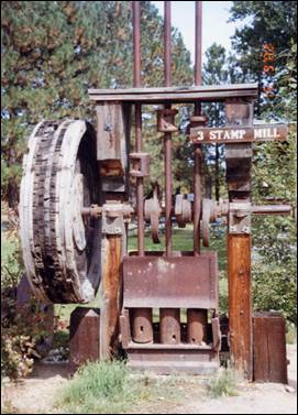
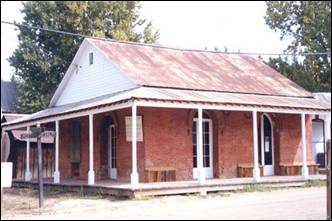
3-Stamp
Mill
A stamp mill is a type of mill machine that crushes material by pounding
rather than grinding, either for future processing or for extraction of
metallic ores. Breaking material down is a type of unit operation. A stamp mill
consists of a set of heavy steel (iron-shod wood in some cases) stamps, loosely
held vertically in a frame, in which the stamps can slide up and down. They are
lifted by cams on a horizontal rotating shaft. As the cam moves from under the
stamp, the stamp falls onto the ore below, crushing the rock, and the lifting
process is repeated at the next pass of the cam. Each one frame and stamp set
is sometimes called a “battery” or, confusingly, a “stamp” and mills are
sometimes categorized by how many stamps they have, i.e. a 10 stamp mill has 10
sets.
Senator Frank Church announced his candidacy
for the Democratic nomination for president from the porch of the county court
house in Idaho City in March 1976. His grandfather had
settled there in 1871 and his father was born there in 1889. Chase Clark,
Church’s father-in-law, had announced his candidacy for governor in Idaho City
in 1940.
Four thousand Chinese lived in the Idaho Territory
from 1869 to 1875. Like many Chinese immigrants, they came to “Gold Mountain”
to work as miners, or found work as laundrymen and cooks. The store of Pon Yam, a prominent Chinese businessman Pon Yam House from 1867 is one of the only remaining
buildings from Idaho
City’s Chinese. Although
today Chinese are rarely seen except as tourists, the 1870 census reported at
1,751 Chinese who were nearly half of city residents. Annie Lee was one
legendary Idaho
city woman who like Polly Bemis, escaped enslavement from the “world’s oldest
profession”. She escaped from a member of the Yeong Wo Company in the 1870s to Boise to marry her lover,
another Chinese man. Charged by her owner with grand larceny, she told a judge
that she wanted to stay in Boise
City. The judge subsequently
granted her freedom.

Lowman
is named for the homesteader Nathaniel Winfield Lowman from Polk County, Iowa.
It is nestled along the banks of the South Fork of the Payette
River at the junction of State Highway
21, eighty miles from Boise
and what will formerly be known as the “Banks-Lowman Highway”. It is the
“Wildlife Canyon Scenic Byway.”
The small community of Lowman is settled in
a geothermal active region. Natural hot
springs surface in the middle of the community as well
as in many other places in the surrounding mountains. As of the 2010 census,
its population was 42.
Pioneerville had the first post office in the Boise Basin
and a population of over two thousand.
Placerville
received its name because of placer mining in the vicinity. The ghost town is
located 17 miles east of Horseshoe Bend. The townsite
was selected December 1, 1862; and by December 16 there were six cabins in the
camp. By the early summer of 1863, the town had 300 buildings and a population
of 5,000. At the meeting of the first legislature held in Lewiston in 1863, the citizens obtained a
charter for their city. Father Mesplie, a Catholic
priest, held the first church service January 4, 1864, and in that same year a
stage line was established between the Basin and Wallua
to carry Wells Fargo express. It ran every other day from Placerville and went through in four days. By
July 1864, 4500 claims had been recorded in that district.
Unlike the earlier northern Idaho mining
areas of Florence (northeast of Riggins) and Pierce, the Boise Basin mines
provided good returns over a period of many years, the peak years being
1863-66, during and immediately after the Civil War. For that reason the Boise Basin
rush was significant in early Idaho
settlement, bringing a substantial number of people who stayed to establish
towns and providing a population base for retailing and agricultural settlement
in the Boise Valley. Boise
Basin had a higher percentage of
families than did most mining areas, and the major towns, like Placerville
and Idaho City, acquired substantial buildings,
lodges, churches, schools, and post offices. Placerville was unusual in that it even had a
street grid and a town square, known locally as the "plaza."
Additionally it had an Episcopal church, thirteen saloons, seven restaurants,
five butcher shops, five blacksmith shops, as well as hotels, druggists,
express agents, bakeries, livery barns, carpenters, sawmills, and –attesting to
the presence of women—dressmakers and a millinery shop.
Mining in Placerville began with placer workings for
gold, but miners soon turned to quartz mining as well. By 1864, a stamp mill
was working in the area. Hydraulic giants were also used. By 1870, however,
much of the excess population of the region had been drained off to other
mining rushes and returns on claims had fallen somewhat. The population in Placerville shrank from
2500 in 1864 to 318 in 1870. By that time a good percentage of the population
was Chinese, as the Chinese were allowed to work the less rewarding claims that
the white miners would not touch. The Chinese also established services like
laundries and restaurants.
Only few early buildings remain in Placerville: as was the case in most mining towns, Placerville suffered more
than once from fires that burned a large part of the town. The fire that is
most remembered is the 1899 fire, which practically destroyed the town. The
streetscape remaining today dates mostly from the rebuilding immediately after
that fire and another fire that burned several buildings ten months later.
During the war years Placerville just maintained like the rest of
the nation. Wartime restrictions included a suspension of the mining industry.
There was no growth — only a feeling of "things have to get better."
In the early 1970s the upper lots were
auctioned off creating what was and are now known as the "upper
subdivision." There were both permanent and vacation homes built on these
lots. Then as now there was only one business in Placerville, the city store.
Placerville
continues to survive with the few full time residents, some part time
residents, the Village Market store and the tourism industry which includes
among others, history seekers, hunters and ATV and snowmobile recreationalists.
The incorporated city is governed by a mayor and city council which meets
regularly at City Hall. The city is served by the Placerville Fire Department
which has its fire station located adjacent to the city plaza and the East Boise
County ambulance service.
There are two city museums which are maintained by public donation and
volunteers and are open weekends from Memorial Day to Labor Day and by special
request.
In 1984, the settled areas of the city were listed
on the National Register of Historic Places as a historic district, the
"Placerville Historic District."
Please check out Hi-Liting
Idaho on our website: www.elmorecountypress.com
Idaho City Chamber of
Commerce
Idaho
City Historic Information)
Source:
Kent S. Lamberson, Oscar Baumhoff,
Wikipedia, Boise County,
Blaine County, Idaho Public Broadcasting, & misc.
Bonner County
Bonner
County, partitioned from Kootenai County
and established in 1907. It was named for Edwin L. Bonner, who, in 1864,
established a ferry on the Kootenai River where the town of Bonners Ferry is located. The ferry became an
important site in emigrant travel between Walla Walla to the placer and quartz mines in British Columbia.
Bonner County
is located in the northern panhandle of Idaho
in a land of magnificent lakes, mountains, forests and vibrant communities. Bonner County
has a population of about 36,000 and has been growing steadily with an averaged
of 7 to 8 percent growth per year in the past five years. The county seat is
located in Sandpoint.
Before
Sandpoint officially became a village in 1901 and a city in 1907, it was part
of the home of the Kalispel Tribe of Native
Americans. Their ancestral lands
extended across all of Priest and Pend Oreille Lakes, up the Pend Oreille River
into Canada, and as far east as Montana. Northwest Company fur trader David
Thompson was one of the first settlers to establish a relationship with tribes,
including the Kalispel, and helped establish fur
trading in the area in 1809. Northern
Pacific Railroad surveyors arrived in the area in 1880, attracting a few
permanent settlers. That same year, Robert Weeks opened a general store in what
was then called Pend Oreille, the little settlement that sprouted up on the
east side of Sand Creek opposite the present Sandpoint City site. By 1882,
Northern Pacific began building the stretch of railroad that ran between Montana and the tiny community of Pend
Oreille. The settlement
grew slowly over the next decade, during which time its name was changed to
Sandpoint.
Source:
City of Sandpoint
and Wikipedia.
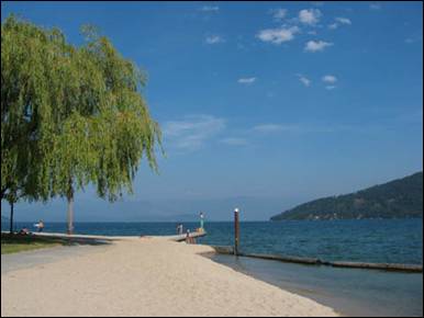
City Beach
on Lake Pend Oreille, Sandpoint
Bonneville County
Bonneville
County was established in 1911, named after Benjamin Bonneville
(1796–1878), a French-born officer in the U.S. Army, fur trapper, and explorer
in the American West. Bonneville is noted for his expeditions to the Oregon
Country and the Great Basin in the 1830s.
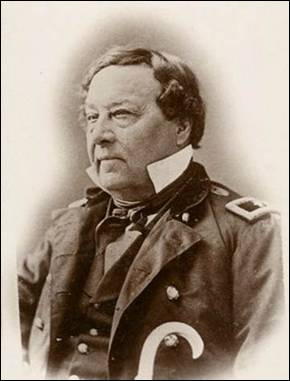
Benjamin Louis Eulalie de Bonneville
(April 14, 1796 – June 12, 1878) was a French-born officer in the United States
Army, fur trapper, and explorer in the American West. He is noted for his expeditions
to the Oregon Country and the Great Basin, and
in particular for blazing portions of the Oregon Trail.
Cities: Ammon, Idaho
Falls, Iona, Irwin, Ririe (partially in county), Swan Valley,
and Ucon.
As of the 2010 census, the county had a population
of 104,234. Its county seat and largest city is Idaho Falls. As the most populous county in
eastern Idaho, Bonneville
County currently ranks fourth in the
state, behind Ada,
Canyon and Kootenai.
The county was partitioned from Bingham County,
which was part of Oneida
County until 1885.
Bonneville
County, in southeast Idaho,
is part of the Upper
Snake River Valley.
Its eastern border is also the state border of Idaho
and Wyoming. Idaho Falls, originally
called Eagle Rock, is the county seat. Bonneville is the fourth largest county
in the state with a population of more than 104,000.
Boundary County
Boundary County
was created by the Idaho Legislature on January 23, 1915. It is so named
because it borders Canada,
the only county in Idaho
with an international border. It was formed from the adjacent Bonner County.
The county seat and largest city is Bonners Ferry.
Bonners Ferry grew out of
a river crossing for prospectors heading to gold discoveries in Canada
in the 1860’s. It is the county seat of Boundary
County, with a population of about
2,500 of Idaho’s
friendliest people. The quaint downtown has been revitalized with pedestrian
friendly street upgrades, improved parking, and a new visitor’s center. It is a
city that respects its past and is proactive towards the future.
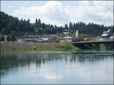
Bonner's Ferry and the Kootenai River
The county is bisected by the Kootenai River,
a major tributary of the Columbia River. The
river’s course between two great mountain ranges created the resource rich
valley that was the ancestral home of the Kootenai Tribe. Today, this great
floodplain is an agricultural gem, growing such diverse crops as hops, wheat, canola and nursery trees.
Forested mountains lie beyond the river
valley, giving our county its unique picturesque beauty. Lumber and related
forest products have been the mainstay of the economy since the settlement of
the area. The additional benefits from the National Forest lands include
camping, hiking, fishing, hunting, skiing and snowmobiling. The recreational
opportunities in our county are limitless.
Source:
City of Bonners
Ferry and Wikipedia.
Butte County
Butte
County was established in
1917, and its county seat and largest city is Arco. The county was named for the
volcanic buttes that rise from the desert plain; the largest is Big Southern
Butte, located in the southern part of the county. It rises 2,500 feet above
the desert floor and was used as a landmark by pioneers. The first white men in
the region were thought to be Donald Mackenzie and his Northwest Fur Company
trappers in 1818.
As of the 2010 census, the county had a
population of 2,891. Much of the eastern part of the county is the vast Idaho
National Laboratory, which extends eastward into neighboring counties.
Cities and towns: Arco, Butte City,
Darlington, Howe, and Moore
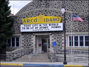
Arco, Idaho. Photo: David Wilson Main St.,
Arco, Idaho
Arco, the county seat and largest city in Butte County,
is located along the Big
Lost River.
Arco is a gateway to the Lost River Range from
the Snake River Plain. Craters of the Moon National Monument
is located along U.S. Route 20, southwest of the city. The Idaho
National Laboratory (INL) is located east of Arco.
Originally known as Root Hog, the original town site was
five miles south at the junction of two stagecoach lines (Blackfoot-Wood River
and Blackfoot-Salmon). A suspension bridge that crossed the Big Lost River funneled traffic through the
settlement. The town leaders applied to the U.S. Post Office for the town name
of "Junction."
The
Postmaster General thought the name too common and suggested that the place be
named Arco for Georg von Arco (1869–1940) of Germany
who was visiting Washington,
D.C. at the time. Georg von Arco
was an inventor and a pioneer in the field of radio transmission and would
become the lead engineer of Telefunken, a German company founded in 1903 that
produced radio vacuum tubes. The town later moved four miles southeast when the
stage station was moved to Webb Springs at Big Southern Butte. When the Oregon
Short Line railroad arrived from Blackfoot in 1901 the stage lines became
obsolete and the town of Arco
moved northwest to its present site.
Arco was
the first community in the world ever to be lit by electricity generated by
nuclear power. This occurred on July 17, 1955, powered by Argonne National
Laboratory’s BORAX-III reactor at the nearby National Reactor Testing Station
(NRTS), which eventually became the site of the Idaho National Energy
Laboratory, a predecessor of the current Idaho National Laboratory. NRTS made
further history on January 3, 1961, when the SL-1 reactor melted down, causing
three deaths. It was the world's first (and the U.S.' only) fatal reactor accident.

The Lost River Range, Idaho,
looking southwest from Iron Creek Point in the Lemhi Range. Borah Peak is to the right of center, and Leatherman Peak (and Pass) is just left of center.
The Little Lost River is a river
in the central part of the U.S.
state of Idaho.
The river is about 49 miles long and drains an arid farming valley, the Little
Lost River Valley, bordered by the Lost River Range on the west and Lemhi Range
on the east. Instead of emptying into a larger body of water, it disappears
into the ground at the edge of the Snake River Plain, a phenomenon that gives
it its name. The water feeds into the Snake River Aquifer, eventually reaching
the Snake River through a series of springs
farther west.
The southwestern portion of the county
includes the visitor center at the Craters of the
Moon National Monument and Preserve, which extends south &
west into three other counties.
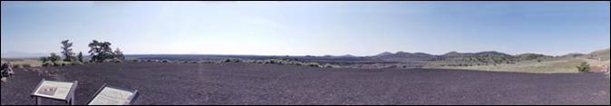
Part of a
panoramic photo of the Craters of the Moon
National Monument and Preserve from
the U.S.
20-26-93 scenic overlook. Photo: Mozillaman
Craters of the Moon National Monument
and Preserve is a U.S. National Monument and National Preserve in the
Snake River Plain in central Idaho.
It is along US 20 (concurrent with US 93 & US 26), between the small towns
of Arco and Carey, at an average elevation of 5,900 feet above sea level. The
protected area's features are volcanic and represent one of the best-preserved
flood basalt areas in the continental United States.
The Monument was established on May 2, 1924.
In November 2000, a presidential proclamation by President Clinton greatly
expanded the Monument area. The National Park Service portions of the expanded
Monument were designated as Craters of the Moon National Preserve in August
2002. It lies in parts of Blaine, Butte, Lincoln,
Minidoka, and Power counties. The area is managed cooperatively by the National
Park Service and the Bureau of Land Management (BLM).
The Monument and Preserve encompass three
major lava fields and about 400 square miles of sagebrush steppe grasslands to
cover a total area of 1,117 square miles. All three lava fields lie along the
Great Rift of Idaho, with some of the best examples of open rift cracks in the
world, including the deepest known on Earth at 800 feet.
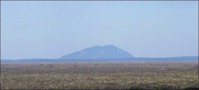
Big Southern
Butte as seen from Craters of the Moon NM was used as a landmark by pioneers. Photo by Daniel Mayer
Source: Wikipedia
Camas County
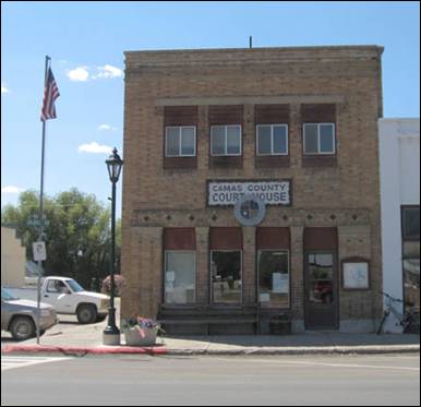
Camas County Courthouse
Camas County
was created by the Idaho Legislature on February 6, 1917, by a partition of Blaine County.
It is named for the camas root, or Camassia, a
lily-like plant with an edible bulb found in the region, which was used as a
food source by Native Americans and settlers. Camas County
covers 1,075 square miles or 688,000 acres.
When the cavalry was stationed at Fort Boise
the southern portion of the Camas Prairie was an important feeding ground for
their horses. In 1869, a treaty ratified by the US Senate provided a portion of
the "Kansas Prairie" instead of the "Camas Prairie" to be
retained by the Bannock Indians. The error may have made by the person who
transcribed the treaty. Since there was no "Kansas Prairie" in Idaho, the treaty rights
of the Bannocks were ignored. When they found a few settlers were allowing
their hogs to feed on the Bannocks' traditional food source, the camas root,
they objected (without results), which was a major cause of the Bannock War of
1878. Development of the region was slowed by the heavy snows of winter and the
Bannock War, but farmers and rancher soon found good water, timber, grass, and
an abundance of fish in the streams. Soldier was the first town established on
Camas Prairie located about four miles northeast of Fairfield. When the railroad was built across
the county it bypassed Soldier and when Camas was organized as a county Fairfield
became the seat and most of the population moved there. The Lava mining
district lies a few miles southwest of Fairfield,
which attracted miners in the 1880s, but the main attraction of Camas County
has always been its agricultural lands.
Camas
County is bordered by Blaine County
on the north and east, Lincoln and Gooding Counties
on the south, and Elmore
County on the west. Most
of the population lives in the Camas Prairie, a high plain at an elevation of
5,100 feet situated between the Soldier
Mountains, at the southern end of the Sawtooth
Range, and the Bennett
hills which separate the Camas Prairie from the Snake River Plain to the south.
The
prairie is 28 miles long and 3 to 11 miles wide and slopes from west to east
and from north to south. Land ownership in the county is: 65% Federal Lands
managed by The Bureau of Land Management (BLM) and the Forest Service, 30%
privately owned, and 5% State lands.
Indians were the first human beings on the
Camas Prairie. However, American explorers and trappers were in the area as
early as 1811 when the Wilson Price Hunt Party sent members of their party
through southern Idaho to the Oregon coast.
The
French trappers, under the leadership of Donald McKenzie discovered Camas
Prairie on his way from Little Lost River in 1820.
In 1824 Alexander Ross Party, in the
employment of the Hudson’s Bay Company, came in by way of the Salmon River,
thence over the divide to Big Lost River and from Lost River they came by Trail
Creek to where Ketchum is now located. The party of John Work, also employed by
the Hudson’s
Bay Company, covered some of the same territory as the Ross Party, in the year
1832. Work came through the Smoky area but made no mention of Camas Prairie.
Camp
Wallace, located on
Soldier’s Creek, was established June 8, 1865 and abandoned September 20, 1865.
There is some evidence that the spot where
the encampment was located was named Soldier before the Army established
quarters there.
In 1854 after the Ward Massacre in Boise Valley,
some other emigrants were killed on Camas Prairie, and the next summer, Nathan
Olney camped on Camas Prairie with some soldiers on his way to Fort Hall.
Mr.
Frank Croner procured an affidavit from someone who
claimed to have gone through Camas Prairie, coming from Oregon with a contingent of soldiers on the
way east to some other encampment. He said they called it Soldier Creek and Soldier Mountain
before 1865 and prior to the establishment of Camp Wallace.
Apparently, “Soldier” was the name chosen when application was made for a post
office there and it must have been the choice of the citizens who applied for
the establishment of the post office.
There is a probability that settlers who came
there in the year 1880 and following were unaware that the military encampment
was known as Camp
Wallace. Why Captain Ephriam Palmer chose that name is unknown, perhaps it was
to honor the first governor of Idaho
territory, Mr. William Wallace.
Nathanial Wyeth, J.K. Townsend and others
finished building a trading post at Fort Hall in the summer of 1834. After its
completion they left the Malade River
Valley and went up on
“Kamas Prairie” and camped on a branch of the Malade.
They passed through Camas Prairie on their way west on August 17, 1834. In 1852
to 1855 this route was used by emigrant wagons headed for western Oregon, and in 1862,
Timothy Goodale led a large emigrant party that way.
September 1, 1864 military expedition of
about 30 cavalry men and about 30 infantrymen were sent out from Fort Boise
through Camas Prairie to Fort Hall to clear the area in all directions of
hostile Indians.
1880’s were documented as large cattle and
horse drives going through Camas Prairie from Oregon
to Omaha, Nebraska.
Hill
City at one time was the
largest sheep-shipping center in the world.
Between 1880 and 1885 mining had reached its
apex and other means of making a living were being sought.
A partnership or association of Rice &
Foster recruited people from all parts of the nation to come to Camas Prairie.
There were two distinct waves of immigration.
The first one began about 1880 and continued on into the nineties, slowing down
as it advanced. Most of the settlers who came during this period had no way of
knowing what kind of crops would grow in the short growing season or the other
problems they would encounter such as frost (because of the high altitude of
the area), the uncertainty of rain, and the invasion of grasshoppers and
crickets.
As to determine who was the first to settle
on Camas Prairie, is difficult. There are stories of a mysterious settlement on
Chimney Creek, from which the creek derives its name. A group of people
attempted to settle there many years ago, even before 1860. The meager evidence
gathered after five years of research gives an indication that it was one of
the early Mormon settlements.
If it was a Mormon settlement, the head
office has no record of such a settlement, it lost
contact with the Church in Salt
Lake. It had all the
earmarks of being a Mormon settlement. It was built in a string like fashion
and there were outdoor chimneys built along the creek from its source to almost
down to where it empties into the river.
Prior to the settlement of Camas County,
the Bannock Indians used the prairie as their summer camping area. Here they
gathered the Camas and Yampus roots and hunted wild
game.
When the cavalry was stationed at Fort Boise
the southern portion of the Camas Prairie was an important feeding ground for
their horses. In 1869, a treaty ratified by the US Senate provided a portion of
the "Kansas Prairie" instead of the "Camas Prairie" to be
retained by the Bannock Indians. The error may have made by the person who
transcribed the treaty. Since there was no "Kansas Prairie" in Idaho, the treaty rights
of the Bannocks were ignored. When they found a few settlers were allowing
their hogs to feed on the Bannocks' traditional food source, the camas root,
they objected (without results), which was a major cause of the Bannock War of
1878.
Following the Bannock War of 1878 (see
Bannock War below), the summer gathering of roots
tapered off dramatically, but still continued into the 1950’s.
Development of the region was slowed by the
heavy snows of winter and the Bannock War, but farmers and rancher soon found
good water, timber, grass, and an abundance of fish in the streams. Soldier was
the first town established on Camas Prairie located about four miles northeast
of Fairfield.
When the railroad was built across the county it bypassed Soldier and when
Camas was organized as a county
Fairfield became the seat
and most of the population moved there. The Lava mining district lies a few
miles southwest of Fairfield, which attracted
miners in the 1880s, but the main attraction of Camas County
has always been its agricultural lands.
In 1877, the
government opened the area for settlement and within two years the first land
filings were recorded in Boise.
Six years later, the first school was established. Eventually, a total of 17
small schools dotted the prairie serving the educational and social purposes of
the scattered communities. By 1948, most schools had consolidated with the Fairfield system. The last
rural school closed in 1953.
At one time, up to nine small towns thrived
in what is now Camas
County. The town of Soldier, located two miles north of Fairfield, was a bustling center of commerce,
culture and social activity. Soldier’s decline, however, began during the
formation of Fairfield
in 1911 occasioned by the arrival of the Oregon Short Line Railroad.
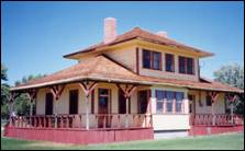
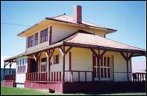
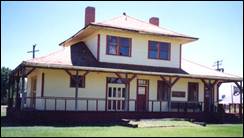
The railroad served the Camas Prairie
for a period of seventy years. A remnant of this bygone era and many of the
daily items from the pioneer days to the present still remain within the
historic Railroad Depot/Museum building located in Fairfield.
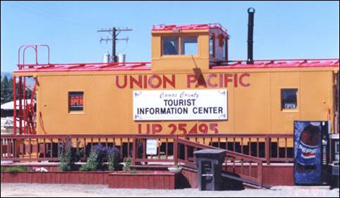
Renovated Caboose
Visitor Center
in Fairfield
Bannock War
The Bannock War was a series of conflicts in 1878
between various Bannock, Northern Shoshone and Paiute tribes against the United States.
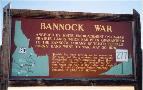
Camas (Camassia quamash) is a plant with a blue or purple flower which has
a nutritious bulb about the size and shape of a tulip bulb. For many of the
tribes in Idaho, Eastern Washington, Eastern
Oregon, and Western Montana, camas was a major
source of food. It was gathered in late spring or early fall. It was either
eaten raw or steamed in a pit for immediate consumption. To preserve the camas,
the bulbs were pounded in a mortar to make a kind of dough which was then
shaped into loaves, wrapped in grass, and steamed again. After cooking it for a
second time, the loaves were made into smaller cakes and dried in the sun.
Without adequate stock of camas, people would be ill prepared for the cold
winter months. In Idaho,
one of the most important camas areas was known as Great Camas Prairie.
The Bannock tribe was restricted to the Fort
Hall Reservation in Idaho
by the Fort Bridger Treaty Council of 1868. The tribe was experiencing a famine
as they competed with local settlers for game, and the rations provided by the
U.S government were too few to support the people on the reservation. In the
spring of 1871, the Bannocks and Shoshone traveled to nearby Great Camas
Prairie to harvest camas roots. They discovered that settlers had grazed their
hogs and livestock on the land, and many of the camas tubers had been eaten.
This increased the starvation pressure on the tribes and lead to increased
hostility.
General George Crook, a contemporary United States
military officer, commented that: "...it
was no surprise...that some of the Indian soon afterward broke out into
hostilities, and the great wonder is that so many remained on the reservation.
With the Bannocks and Shoshone, our Indian policy has resolved itself into a
question of war path or starvation, and being merely human, many of them will
always choose the former alternative when death shall at least be
glorious."
Source: Wikipedia, Camas
County, City of Fairfield,
Elmore County Press
Summer in El-Wyhee
Camas County
Camas
Chamber of Commerce
Canyon
County
In 1883
the landscape of what was to become Canyon
County was changed forever, when the
Oregon Short Line Railway (a subsidiary of the Union Pacific) made its way from
Granger, Wyoming to Huntington, Oregon.
The sagebrush-covered ground was cleared and leveled so tracks could be laid,
providing an opportunity for safer travel to the emigrants of the east. Towns
sprung up about every 10 to 15 miles along the tracks. The county was
established on March 7, 1891, with its county seat at Caldwell. It was partitioned from Ada County
and originally included Payette County (1917) and the southern portion of Gem County
(1915). Current sources attribute the name to the canyon of the Boise River
near Caldwell.
However, both John Rees and Vardis Fisher believed it
was named for the Snake River canyon which forms a natural boundary for the
county with Owyhee
County. The cities of Canyon County
include Caldwell, Greenleaf, Melba, Middleton, Nampa, Notus, Parma, and Wilder. Canyon County
currently has a population of 188,923.
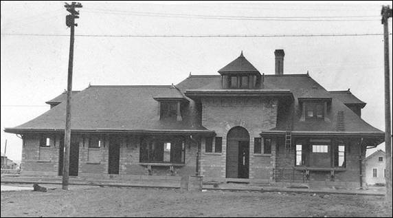
Caldwell Railroad Depot 1907
Caldwell started
out as nothing but desert, sage brush, volcanic soil, deer, and jackrabbits. Caldwell’s inception and
growth occurred largely because of the railroad. In fact, the towns established
by the railroad brought more people into the territory than the earlier gold
rushes. For a time, Caldwell was known as Hamburg, after Jake Ham
established a blacksmith shop. An early railroad camp for construction
employees of the Oregon Short Line Railroad nearby was dubbed Bugtown and the community shared this name as well. Caldwell burst into
existence suddenly and grew rapidly with its eleven saloons and a private water
pump – an oasis in the desert area of sage and ankle-deep alkali dust.
In August
of 1883 the original town site was platted parallel to the Oregon Short Line
rail tracks (later to become part of Union Pacific). The property was owned by
the Idaho and
Oregon Land Improvement Company, which was interested in persuading settlers
and businessmen to move here. The group
ignored compass and section lines and established the town site in honor of the
company’s president, C.A. Caldwell, ex-senator from Kansas. Others prominent in the company’s
operation included Robert E. Strahorn, vice-president
and Howard Sebree, Caldwell’s first mayor. By January 1884, there were more than 600
residents and 150 structures. The date of ordinance establishing Caldwell as a city is
January 15, 1890. The College of Idaho, a Presbyterian college, was founded in Caldwell in 1891.
City of Caldwell
John Greenleaf Whittier
Greenleaf
was named after Quaker poet and abolitionist John Greenleaf Whittier. The first
settlers in the Greenleaf area were dry land farmers who came to homestead on
the fertile agricultural land shortly after 1900. The soil quality was so good
that the first orchards in the region were watered with water carried by
horse-drawn wood water tanks from nearby rivers. Farming and settlement
expanded with irrigation projects in the early 1900’s. A rail spur extending
from the main line in Caldwell, Idaho through Greenleaf to the City of Wilder
was put in, with original plans of expansion to San Francisco, California
that did not come to fruition.
Due to
the fierce spirit of independence and close-knit culture of the community,
incorporation as a city was not a priority. The City of Greenleaf incorporated in 1973 in response to
the potential need for a community sewer system. With a water and wastewater
improvement bond levy election in 2000, the city took ownership and
responsibility for a water system and wastewater collection system operated to
that point by a private water and sewer association.
City of Greenleaf
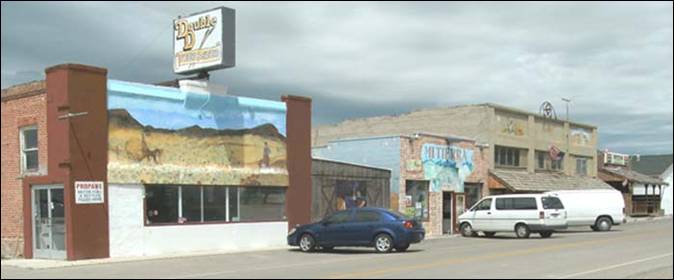
Photo of a few older
buildings in Melba
Settled
in the midst of sagebrush, Melba became an oasis in the desert to the
pioneers who had homesteaded south of there near the Snake
River at the beginning of the 20th Century. The only sign of life
was Sagebrush Annie, the train that went through the area and crossed the river
to Murphy everyday. Folks on the north side of the river got their groceries
and mail at the little town of Guffey
in Owyhee County on the other side of the river.
They walked across the train bridge or rode over on Perry’s Ferry.
Clayton
C. Todd was passing through the area on his way to Alaska to search for gold. He stopped over
in Weiser to visit a friend, Mr. Fuller. Fuller told him about the new sale of
state land going on. So, in August of 1912, Mr. Todd purchased 160 acres of
land at Rock Spur, a siding on the railroad, and laid out a town. He named it
after his little four-year-old daughter who was still in California with her mother, Bessie B. Todd.
It was a
boom town in the middle of the bustling farming community. Melba would always
be known as a farming community. Right after the First World War, it would
become famous for raising highbred sweet corn seed. While some were raising
carrot seed, onion seed, alfalfa seed, as well as corn, for years it would be
known as “The Seed Heart of America”.
Middleton
was named because it was midway between Boise
and an old ferry on the Snake River. Middleton
is the oldest settlement in Canyon
County, with the land
being parceled out in 1863 by William N. Montgomery. The Boise River
flooded in 1872 and cut a new channel, isolating the town on an island; as a
result, the town moved to a new location in the years after 1880. The town
incorporated as a city in 1910 (although the certificate wasn’t issued until
1971.)
City of Middleton

Panoramic view of Nampa
1907
It is
not known for certain where the name “Nampa”
came from. But as the Oregon Short Line was built through Idaho, unusual names were given to some of
the stations. Many of these unusual names were believed to be of Indian origin.
However, contrary to what many people thought, Nampa, Idaho
is not the only place in the world with this name. For example, there is a town in Canada named Nampa.
Alexander
and Hannah Duffes, with the encouragement of James
McGee, saw the possibilities in the land east of Caldwell, and in 1885 homesteaded on 160
acres with the express purpose of creating a town. The next year, Duffes and McGee formed the Nampa Land
and Improvement Company, dividing the property into lots. Duffes
was a very religious man and dreamed of a town with no saloons. He refused to
sell town lots to anyone who intended to build a saloon on them. This caused
people to refer to the town of Nampa
as “New Jerusalem”.
Boise had been bypassed by
the Oregon Short Line as they built west. But in 1887, the Idaho Central
Railway was built, connecting Boise with the main
line of the Oregon Short Line at Nampa.
A wood frame structure was brought in from King Hill to serve as a passenger
depot in Nampa.
But it
was the promise of irrigation that brought many emigrants to homestead in the
land surrounding Nampa.
During the season of 1890, the Phyllis
Canal brought irrigation water to Nampa and surrounding areas, and in 1891, the extension of
the Ridenbaugh
Canal was completed. With
the completion of these canals, an estimated 150,000 to 300,000 acres of prime
farmland adjacent to Nampa
could be cleared of sagebrush and put under cultivation. On April 17, 1891, a
municipal government was formed and the town of Nampa was incorporated.
City of Nampa
Homesteaders began arriving
in Wilder as early as 1904 with the hope of irrigation water being
provided soon with the development of the Boise Project. Referred to as a
barren tract of sagebrush land, the area bloomed into one of the most fertile
agricultural regions in the nation.
The name
“Wilder” is believed to have been named for Marshall P. Wilder, publisher of a
popular woman’s magazine, “The Delineator.” Mr. Wilder allegedly offered to
print a positive article about the community, if the town received his name.
Many of the townspeople wanted to name the town “Golden
Gate” after the first store built by E.M. Small named the Golden
Gate Store which was located along the Oregon Short Line Railroad Company.
Although the town did not acquire that name, other parts of the community did.
A store, school, canal, church, irrigation district, and the highway district
all received that name.
City of Wilder
Notus – Has a population of 458
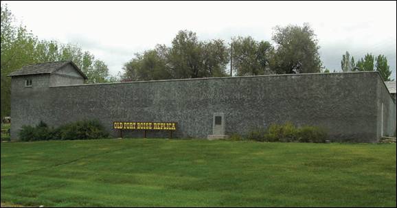
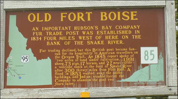
Parma – The Old Fort Boise is located in Parma.
City of Parma
Source:
Wikipedia, City of Nampa, City of Wilder, City of Melba, City
of Greenleaf, Caldwell Chamber of Commerce
Caribou County
Caribou County was formed on
February 11, 1919, by the Idaho Legislature by a partition of Bannock County.
It was the last county formed in the state, three days after Jerome County,
and was named for the Caribou
Mountains. Cities:
Bancroft, Grace, and Soda Springs
Caribou
County has the Oldest and the Youngest
County Seat in the State of Idaho.
In 1864, the Idaho Legislature created Oneida County and designated Soda
Springs as the County seat—(the oldest) after three years the county seat was
moved to Malad. The 1919 Idaho
State legislature passed House Bill
No. 4 and created Caribou County, also designating Soda Springs as the County
seat (the youngest), the last of the 44 counties in the State of Idaho. Hence the Oldest
and Youngest County Seat in the State of Idaho.
County Commissioners met and were sworn in
March 13, 1919.
The county area was 1,263 square miles
(808,320 Acres). This size remained until 1949 when a section of Bannock County was annexed. The addition enlarged
the area of the county to 1,799 square miles and 1,118,000 Acres. The size it
is today.
The first white men in the county were
trappers from the Wilson Price Hunt Expedition.
Donald McKenzie and his men were the first
white traders in the region.
The first wagons over the Oregon Trail
entered the county in 1830 on their way to Oregon and Soda Springs became a famous
stopping point.
The first settlers came in 1863, led by Col.
P. Edward Conner and established Fort
Conner.
The first mail service was from Bannock to
Soda Springs. Mail service was easy in the summer, but had to be carried on
snowshoes during the winter.
In the summer of 1882, the first railroad,
the Union Pacific Oregon Short Line, reached the County.
Cassia County
Cassia County
was created by the Idaho Territorial Legislature on February 20, 1879, by a
partition of Owyhee County, with the county seat at Albion.
A western portion became Twin
Falls County
in 1907. The county assumed its present boundaries when an eastern portion
became Power County on January 30, 1913. The county
seat was changed to Burley on November 5, 1918.
Named for Cassia Creek, which
was named for one of two words: cajeaux, peasent French for raft; or James John Cazier,
member of the LDS
Church and of the Mormon
Battalion, later a colorful captain of an emigrant train, whose name was
corrupted to cassia.
History
note: The Mormon Battalion was the only religiously based unit in United States
military history, and it served from July 1846 to July 1847 during the
Mexican-American War. The battalion was a volunteer unit of between 534 and 559
Latter-day Saints men led by Mormon company officers, commanded by regular US
army officers. During its service, the battalion made a grueling march nearly
2,000 miles long from Council Bluffs, Iowa, to San
Diego.
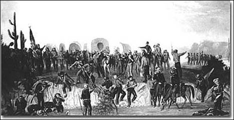
The battalion's march and service was
instrumental in helping the US
secure much of the American Southwest, including new lands in several Western
states, especially the Gadsden Purchase of 1853 of much of southern Arizona. The march also
opened a southern wagon route to California.
Veterans of the battalion played significant roles in America's westward expansion in California, Utah, Arizona, Idaho,
and other parts of the West.
Mormon Battalion Historic Site &
Museum in Old Town San Diego,
viewed from across Juan St on October 1st, 2011. The museum is owned and
operated by The Church of Jesus Christ of Latter-day Saints.
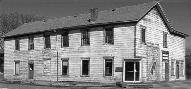
In 1879, Albion was the first county seat of Cassia County.
The Courthouse building began construction as a hotel in the same year. The
unfinished building was sold to the county commissioners for $1000 and remained
the county courthouse until 1919. The most famous trial to be held in this
first Cassia Courthouse was the trial of Diamond Field Jack in which William E.
Borah was one of the prosecuting attorneys.
The first known white settler to arrive in Cassia County
was Charles Gamble, a 22-year old man from Maryland. Gamble settled in the Raft River
area in December of 1866 with a herd of cattle and his cowboy associates.
Although Mr. Gamble may have been the first settler in these parts, he was
definitely not the first man to enter the boundaries of Cassia County.
In the 1860's, thousands of pioneers passed through the area which is now known
as the City of Rocks.
It was a common place for the wagon trains headed to Oregon
or California
to stop and rest. Local history enthusiasts have discovered that there are
approximately 230 miles of authentic emigrant routes crossing Cassia County.
By 1868, pioneers were settling in Marsh Valley
(now Albion). The next ten years saw people
moving to Malta, Elba, Almo, and Oakley. While
cattlemen and sheepmen grazed their herds, Mormon
pioneers began farming operations near the Oakley Basin.
Oakley became known as the educational and religious center for the Mormon
pioneers who settled in the area.
In the first year or two of the century, a
man named David E. Burley, a passenger agent for the Oregon Short Line Railroad
Company, traveled through this area. While working for the Oregon Short Line,
he became familiar with the area and its ability to grow sugar beets. In 1905,
a man named I.B. Perrine and five others platted a town on the south bank of
the Snake River. This town, of course, became
known as Burley, Idaho.
The town wasn't incorporated until July 19, 1909. It wasn't long after Burley
was established that the townsfolk announced that they would do everything they
could to move the county seat from Albion to
Burley. They weren't successful until 1918 when Burley officially became the
county seat of Cassia
County.
The smaller present-day towns of Almo, Elba, Malta Albion,
and Oakley were settled in the 1870's, and Burley was founded in 1905. On
November 5, 1918, the county seat was moved to Burley. The present day
courthouse was built in 1939 and is still being used for county government. It
is on the list of the U.S. Historical Buildings. The oldest building still in
use in the county is the Tracy Store in Almo which
opened in 1894. In 1995, Cassia
County had a population
of 20,811 people and comprised an area of 2,577 square miles.
At the turn of the century, many cattle and
sheep were being raised in the area. Eventually, cattlemen and sheepmen began to argue over grazing rights. One feud led
to the arrest of the famous hired gunman, Diamondfield
Jack Davis in 1897. Diamondfield Jack, who was hired
by a cattle rancher to keep sheepherders off his land, was accused of murdering
two sheepherders in February of 1896. It wasn't until November of 1900 that two
cattlemen confessed to the murders. Mr. Davis was eventually pardoned in 1902.
Documents from the trial proceedings involving Diamondfield
Jack are kept in the archives of Cassia
County.
In 1904, construction began on the Minidoka
Dam as the first government Reclamation Project in Idaho. Until that time, a few farmers had
built water wheels to move water from the river to their cattle and crops. With
the arrival of irrigation, more farmland was established. Grains, sugar beets,
potatoes and alfalfa were in demand across the country and the south-central Idaho soil and growing
season were perfect for growing these crops.
Albion
is one of the few cities in the Magic Valley region of Idaho founded before 1900. Beginning in 1893
it was home of the Albion State Normal School,
an institution of higher learning which trained many Idaho teachers.
Albion
State Normal
School was established by the Idaho Legislature
in 1893, as one of two Normal schools in the state. (The other, in Lewiston, is now
Lewis-Clark State College.) Citizens of Albion
had actively lobbied for the school's establishment, and donated land and labor
for the new campus.
The school remained a small institution
throughout its history, focusing on the training of teachers and drawing its
student body primarily from south-central Idaho. Albion Normal offered a two-year
teacher training program until 1947, when it was renamed "Southern Idaho
College of Education" (SICE) and authorized to confer baccalaureate
degrees. The school remained troubled by low enrollment and a lack of funding,
however, and was finally closed by the state in 1951. Its academic programs
were transferred to Idaho State College (now Idaho
State University)
in Pocatello.
During its existence, Albion Normal awarded
some 6,460 degrees. Perhaps the most notable alumnus of the college was Terrel Bell (1921-1996), who served as United States
Secretary of Education from 1981 to 1984.
The college's athletic teams were known as
the "Teachers" until 1935, when they became the "Panthers."
School colors were Cardinal and Black, and the annual student yearbook was
called The Sage.
After SICE closed in 1951, the campus
remained vacant until 1957, when Magic
Valley Christian
College opened at the
site. Magic Valley Christian, in turn, closed in
1969. The campus was deeded to the city of Albion the following year, which continued to
maintain the grounds while alternative uses for the property were explored.
Finally, the empty and deteriorating property was sold at public auction on
June 2, 2007; a group of Idaho
investors were successful with a bid of $810,000. The new owners have begun
rehabilitating a portion of the campus to serve as a conference and retreat
center, called "Campus Grove at Albion."
The campus is listed on the National
Register of Historic Places.
D. L. Evans Bank was founded in Albion in 1904. Although the bank's headquarters is now
located in Burley, it continues to operate a branch in Albion.
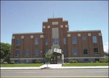
The Cassia County Courthouse is a historic building located at Fifteenth Street
and Overland Avenue
in Burley, the county seat. It was constructed in 1939. The courthouse was
added to the National Register of Historic Places on September 27, 1987.
Burley - In the first year or two of the century, a man
named David E. Burley, a passenger agent for the Oregon Short Line Railroad
Company, traveled through this area. While working for the Oregon Short Line,
he became familiar with the area and its ability to grow sugar beets. In 1905,
a man named I.B. Perrine and five others platted a town on the south bank of
the Snake River. This town, of course, became
known as Burley, Idaho.
The town wasn't incorporated until July 19, 1909. It wasn't long after Burley
was established that the townsfolk announced that they would do everything they
could to move the county seat from Albion to
Burley. They weren't successful until 1918 when Burley officially became the
county seat of Cassia
County.
Declo was
originally named Marshfield.
In 1916, the name was changed to Declo. The name is
an amalgam of the names of two resident families, Dethles
and Cloughly.
The
world's largest potato processing company was founded in 1923 near Declo by a 14-year-old entrepreneur named J.R. Simplot, who
had moved to the area with his family as a toddler. The corporate headquarters
for the J. R. Simplot Company are now located in Boise.
Malta:
The settlers in the Malta
area in the early 1880s had no central location for mail delivery. The mail was
delivered in open boxes. The Condit family secured a permit from the U.S. Post
Office Department to open a post office and name the community. Apparently it
seemed like an island in a wide expanse of sea, so they named it Malta after the island
of Malta in the Mediterranean.
Oakley was named for William Oakley, the proprietor of a 19th century stagecoach station
located at a spring currently located about 2 miles west of the present townsite known as Oakley Meadows. David B. Haight, former member of the Quorum of the Twelve Apostles,
of The Church of Jesus Christ of Latter-day Saints was born in Oakley. The
small hamlet has served as home to a surprising number of famous Americans. The
former governors of Utah and Massachusetts can trace their stock to
Oakley. Jon Huntsman of Utah is the grandson
of David B. Haight, and Mitt Romney, of Massachusetts is the son
of another famous Oakley-ite, George Romney. Yet
another Oakley Romney, Marion G. Romney, was a Counselor in the First
Presidency of The Church of Jesus Christ of Latter-day Saints.
Oakley is
also rich in old west lore, such as the tale of Diamondfield
Jack, and another story of intrigue, the story of Gobo Fango.
This town
of less than 800 people has turned out leaders in politics, business, and
entertainment. The town is also home to current Idaho's Assistant House Majority Leader
Scott Bedke.
Oakley
has become recognized world-wide for its Middle
Mountain quarries of Rocky Mountain
quartzite building stone known as Oakley Stone or Idaho
quartzite, a metamorphic rock. Quarry operators ship out thousand of tons a month to
locations around the globe.
The stone is quarried south of the city of Oakley in Cassia County, northeast of the three-state border with Nevada & Utah.
The quarries are located on the west slope of Middle
Mountain in the Albion
Mountains, northwest of the City of Rocks National Reserve.
Oakley stone is micaceous,
meaning it is a mica-bearing stone. This mineral gives the product a
fish-scale-like sheen. The stone is noted for its great variety of colors,
ranging from white and silver to browns, yellows, and golds.
Another stone in the area, Elba Quartzite, is a green micaceous
quartzite. The green color of the rock is a result of chromium in the mica
which is also known as fuchsite. The original sedimentary rock from which the
quartzite formed was a quartz-rich sandstone. During
the metamorphic process, the pressure caused the layers of clay within the
sandstone to thin and flatten into the mica-rich layers. The spaces between
planes of parting or foliation are consistent which makes it uniform in
thickness.
Today, many people remark that Oakley is the very last
"Mayberry" left in America,
and frequently visited for its Victorian homes.
Almo was established around a post
office in 1881. It had previously been part of a ranch and had often been
considered to be in Utah.
Almo is a short
distance away from the City of Rocks
National Reserve, a 14,300-acre area with granite
columns as much as 600 feet high.
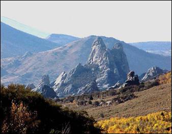
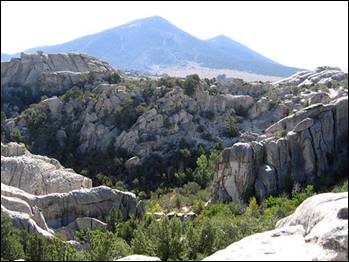
The City of Rocks National Reserve, also known as the Silent City of Rocks, is a United
States National Reserve and state park lying 2 miles north of the south central
Idaho border with Utah. It is widely known for its excellent
rock climbing and rock formations.
The rock spires in the City of Rocks and adjacent Castle Rocks
State Park are largely
composed of granitic rock of the Oligocene Almo pluton and Archean Green Creek
Complex.
California Trail wagon trains of the 1840s
and 1850s left the Raft River valley and traveled through the area and over Granite Pass
into Nevada.
Names or initials of emigrants written in axle grease are still visible on
Register Rock. Ruts from wagon wheels also can be seen in some of the rocks.
Source: Cassia County,
Cassia County Museum, Wikipedia,
Clark County
Clark County was established on February 1, 1919, partitioned from
Fremont County. It was named for State Senator
Sam K. Clark, an early pioneer on Medicine Lodge Creek. With the 2010 census, Clark County
became the state's least populous county with a population of 982, overtaking Camas County.
The county seat and largest city is Dubois.
Clark
County’s first
inhabitants were forerunners to the Northern Shoshoni. They were mainly big
game hunters and gatherers of wild food. These people used natural rock
outcroppings and caves for dwellings and places for butchering and storing
meat. The Nez Perce Tribe also used this general area as a route to their
buffalo hunting grounds in Montana.
In the early 1800’s the area was well traveled by early trappers and explorers.
In 1853 Lieutenant Mullen traveled through the Medicine Lodge Canyon from Montana into Idaho
on his way to Fort Hall. This same route which was historically used by the Nez
Perce became a well traveled route to and from the gold fields of Montana, into Idaho, and
then further south to Salt Lake City,
Utah. Birch
Creek Pass
and Monida
Pass were well traveled. Today Monida
Pass is the main route running north
and south between Idaho and Montana.
Beaver Stage Station was
the first settlement in Clark
County. The settlement
began as a stagecoach station in the early 1860’s but by 1870 was a boom town
for lumber enterprises. The town thrived as a frontier community until the
railroad forced the residents to move to Spencer in 1897 due to the depth of
snow at Beaver Station and the need for more level ground. Beaver Canyon
is located along Beaver Creek in Clark
County south of the Montana
border; this canyon was the route the Utah
and Northern Railway used in 1880 and is still used by Union Pacific Railroad
today. In the late 19th century stagecoaches would ferry tourists from the
railroad station near Monida
Pass to Yellowstone National Park.
Union Pacific later built a branch line to Yellowstone
for tourist use.
The settlement of Dry Creek began in 1880
after the arrival of the first steam locomotive. Dry Creek was later named
Dubois after Fred Dubois, a prominent U.S. Senator from Idaho. In 1910 Dubois boasted a population
of 600 people (Historical Society, 1985). Spencer Idaho is located fourteen
miles north of Dubois and was named for Hyrum H. Spencer a shipper, President
of Ogden Rapid Transit, and Vice President of Amalgamated Sugar. Spencer Idaho
contains the largest Opal Mine in the United States. The Spencer Opal
Mine was discovered in 1948 by two deer hunters who filed a mining claim in
1952. The mine was bought by the Stetler family in
1968 and is still owned and operated by the Stetler
family.
From a stagecoach station and Pony Express
route, to a railroad stop, and a consistent thoroughfare for transporting goods
Clark County Idaho continues to maintain its rural community setting. After
losing its importance as a railroad center in 1927, with the relocation of the
Roundhouse to Lima Montana, the county lost most of its
population. Today the County relies on livestock and agriculture for its
livelihood. The two largest communities in Clark County,
Dubois and Spencer, house the majority of commercial businesses. Dubois
consists of a resident population of 647 while Spencer is much smaller with a
population of 38. The remainder of the county’s population lives in rural areas
of the County.
Dubois was named in 1892 for Fred Dubois (1851−1930),
the state's prominent politician in its early years. He came to Idaho in 1880 and was
the state's first U.S. Senator and served for two non-consecutive terms (1891−97,
1901−07).
Spencer is noted as being the "Opal
Capital of America". The mine is located 5–6 miles outside of
town.
Source:
Clark County & Wikipedia
Clearwater County
Clearwater County was
established in 1911. The county was named after the Clearwater
River. The population was 8,761 at the 2010 census, down from
8,960 in 2000. The county seat is Orofino.
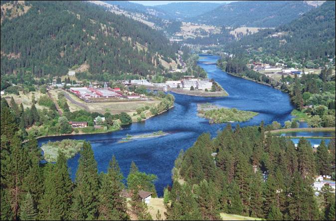
Clearwater River near Orofino
The county is home to North Fork of the
Clearwater River, and a small portion of the South Fork and the main Clearwater. Also in the
county are the Dworshak Reservoir, Dworshak State Park, Dworshak
National Fish Hatchery, and the Dworshak Dam, third
highest dam in the U.S.
The modest Bald Mountain ski area is located between
Orofino and Pierce. Cities and towns include Elk River,
Orofino, Pierce, and Weippe.
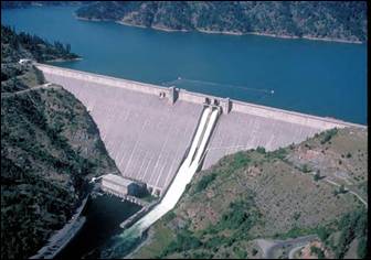
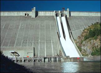
Dworshak
Dam is a concrete gravity dam in the western United States, on the North Fork
Clearwater River in Clearwater County, Idaho. The dam is
located approximately 4 miles northeast of Orofino and impounds the Dworshak Reservoir for flood control and hydroelectricity
generation. At 717 feet high, Dworshak is the third
tallest dam in the United States
and the tallest straight-axis concrete dam in the Western
Hemisphere. Construction of the dam by the U.S. Army Corps of Engineers
(USACE) began in 1966 and was completed in 1973.
The Clearwater River and Lolo Pass,
in the southeast corner of the county, were made famous by the exploration of
Lewis and Clark in the early 19th century. Following an arduous trek through
the Bitterroot Mountains, suffering through a
mid-September snowstorm and near starvation, the Corps of Discovery expedition
camped with the Nez Perce tribe on the Weippe Prairie
outside of present-day Weippe in 1805. With the
assistance of the Nez Perce, the expedition recuperated and constructed
burned-out canoes at Canoe Camp in October 1805 and then paddled down the Clearwater, Snake, and Columbia
rivers and met the Pacific Ocean a month later at present-day Astoria, Oregon.
Elias D. Pierce and Wilbur F. Bassett made
the first discovery of gold in Idaho,
on Orofino Creek (Canal Gulch) in 1860, 1 mile north of present-day Pierce.
Until 1904, Clearwater
County was part of Shoshone County
to the north. It was annexed by Nez Perce County for several years and then was
established as a new county in 1911. The original county seat of Shoshone County
was Pierce, in today's Clearwater
County. It was the first
gold rush area of present-day Idaho (then Washington Territory)
in 1860 and was made the county seat of a vast Shoshone
County in 1861, two years prior to the
establishment of the Idaho
Territory. When the Silver Valley
population rose dramatically in the 1880s, the seat was moved to Murray in 1884 (and to
Wallace in 1898) to better serve the majority of the county's population. The
population of the southern area increased with homesteading in the Weippe area in the late 1890s. The vast distance and time
required for travel to Wallace from the Clearwater River
area prompted the move of the southern portion to Nez Perce County.
Orofino ("fine gold" [ore]
in Spanish) is along Orofino Creek and the north bank of the Clearwater
River. The population was 3,142 at the 2010 census, and the city
is the county seat of Clearwater
County. Nearby is the
historical "Canoe Camp," where the Lewis and Clark expedition built
five new dugout canoes and embarked on October 7, 1805, downstream to the Pacific Ocean. Just 4 miles north of town is the Dworshak National Fish Hatchery and the Dworshak
Dam, third highest dam in the United
States, completed in the early 1970s.
Originally the name was two words, Oro Fino, applied to a gold mining camp established in 1861 two
miles south of Pierce, that is now a ghost town. When the Nez Perce reservation
opened to settlers in 1895, Clifford Fuller set up a trading post on his new homestead
and the town (Orofino-on-the-Clearwater) was established the next year. The
railroad, later part of the Camas Prairie Railroad, arrived from Lewiston in 1899.
Orofino is home to both the Idaho
Correctional Institution - Orofino and Idaho State Hospital North. These two
facilities are located adjacent to Orofino
High School, which now
includes the junior high grades. The school mascot is a "Maniac," one
of only two high schools in the country with that nickname. Orofino hosts the
annual Orofino 4 July Celebration, as well as the Clearwater County Fair and
Lumberjack Days in late summer.
Pierce
was the first county seat for Shoshone
County, which was established in
January 1861 in Washington Territory and for a most of its first year included most
of present-day Idaho and Wyoming. The Pierce Courthouse, constructed
in 1862, is Idaho's
oldest public building. Idaho Territory was established in 1863, and the county
seat moved north to the Silver Valley in Murray
in 1884 (and to Wallace in 1898). Present-day Clearwater
County, formed in 1911, was part of Shoshone County
until 1904, when it was annexed by Nez
Perce County.
The first discovery of gold in Idaho (then Washington
Territory) was made by
Elias D. Pierce and Wilbur F. Bassett on Orofino Creek (Canal Gulch) in October
1860, a mile north of Pierce.
The Bald Mountain Ski Area is located 11
miles northwest of Pierce.
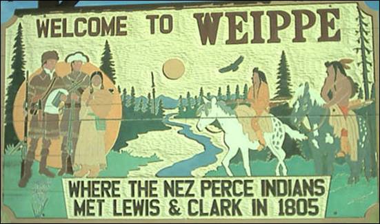
Weippe
with a population of around 441 at the 2010 census, up from 411 in 2000.
Near present-day Weippe, the Lewis and Clark
expedition first met with the Nez Percé in September
1805 on the Weippe Prairie.
Source:
Clearwater County, Orofino, and Wikipedia.
Custer County
Custer County is a rural mountain county
located in the center of Idaho.
Established in 1881, it was named for the General Custer Mine, where gold was
discovered five years earlier (shortly after Custer's death at the Battle of the Little Bighorn in eastern Montana).
The Salmon River and Big Lost River
flow through Custer
County. The county seat
is Challis.
Cities: Challis, Clayton, Lost River, Mackay,
Stanley. Unincorporated community: Ellis.
Ghost
towns: Bayhorse, Bonanza, Custer
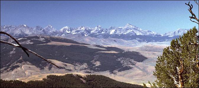
The Lost River Range looking southwest from Iron Creek
Point in the Lemhi
Range. Borah Peak
is to the right of center, and Leatherman
Peak (and Pass) is just
left of center. Photo: G. Thomas at en.wikipedia
The Lost River Range, the state's highest
mountains, is located in eastern Custer
County. The highest is
Borah Peak, the highest natural point in Idaho
at 12,662 feet. On the western border of the county is Idaho's
famous Sawtooth
Range; the tallest is Thompson Peak
in Custer County,
above picturesque Redfish
Lake. Twenty miles east
are the White Cloud
Mountains, the tallest of which is Castle Peak at 11,815 feet.
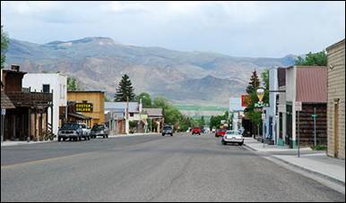
Challis photo: Pitamakan
at en.wikipedia
Challis
was founded in 1878 and named for A.P. Challis, who was a surveyor when the townsite was laid out. Challis post office was established
in 1878.
Clayton
is the town that refuses to die. This was the premier silver producing area of
the state from 1880 to 1984. Today it is the world's largest producer of lube
grade molybdenum, which is also used as a hardener in the production of steel,
is located at the Thompson Creek Mining facility in the Clayton area.
Lost
River with its name referring to its location near the Big Lost River has a population of approximately
68 according to the 2010 census.
Mackay was
dedicated in August of 1901 and after gaining the signature of 250 residents
petitioning for incorporation, county authorities appointed a governing body.
On October 14, 1901, the community was incorporated and Mackay officially
became a town. By 1904, Mackay boasted two churches, a brick schoolhouse, one
bank, an opera house, two major hotels, a number of lodging houses, and dozens
of company-owned homes. Please see Mackay History.
.
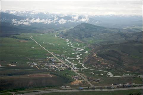
Aerial view of Stanley,
Idaho. Photo: Sam Beebe
Stanley
Fur trappers of the Hudson's Bay Company discovered the Stanley Basin in the
1820s, but it was mostly avoided due to scarcity of beaver. Captain John
Stanley, a Civil War veteran, led a party of prospectors through the area in
1863 (or 1864), but they found little gold and moved on and discovered the Atlanta lode on the south
end of the Sawtooths. The site was not considered a
town until 1919 when its streets and lots were surveyed and recorded.
Bayhorse is a ghost town in Custer
County, founded in 1877.
In 1976, the entire community was added to the National Register of Historic
Places. The town property was purchased by the state in 2006 and opened to the
public in 2009 as part of the Land of the Yankee Fork
State Park.
Custer is a ghost town in Custer County, Idaho,
United States.
Established in 1877, it is located at an elevation of 6,470 feet. It lies along
Yankee Fork Road southwest
of the city of Challis, within the Challis National Forest.
In 1981, the community was listed on the
National Register of Historic Places as a historic district. Although the
district covers an area of 29 acres, only seven buildings retain enough
historic integrity to qualify as contributing properties.
Most of Custer is now included in the Land of
the Yankee Fork State Park,
which also includes the historic Yankee Fork gold dredge, nearby.
Ellis
is an unincorporated community located on U.S. Route 93 15.5 miles northeast of
Challis. Ellis has a post office with ZIP code 83235.
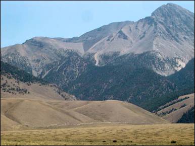
A picture of Borah Peak with
the fault scarp from the 1983 Borah Peak
earthquake shown as a line, near the base of the tan hill in the foreground.
Attribution: Qfl247 at en.wikipedia.
On Friday, October 28, 1983, the Borah Peak Earthquake occurred at 8:06
am MDT, measured at 6.9 on the Richter Scale
(originally reported at 7.3). The Challis-Mackay region experienced rather
thorough damage, with 11 commercial buildings and 39 homes with major damage;
while another 200 houses were damaged, minor to
moderately. Mackay in particular, about 50 miles southeast of Challis,
experienced the most severe damage. Most of the city's large buildings on its Main Street were
damaged, to some extent; eight of these buildings were deemed condemned and
closed down. Most of these buildings were built from materials such as brick,
concrete block, and stone, each varying. The two fatalities of the earthquake
were in Challis; a store front fell on two children walking to school.
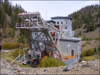
Yankee
Fork Gold Dredge - it was powered by two 350 horse Ingersoll-Rand, 7
cylinder diesel engines, burning 400 to 500 gallons of fuel a day. Photo: Jerry
Willis from Tomé, NM.
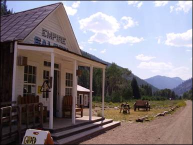
Empire Saloon, General store for Custer Ghost Town. Photo: Shelleylyn
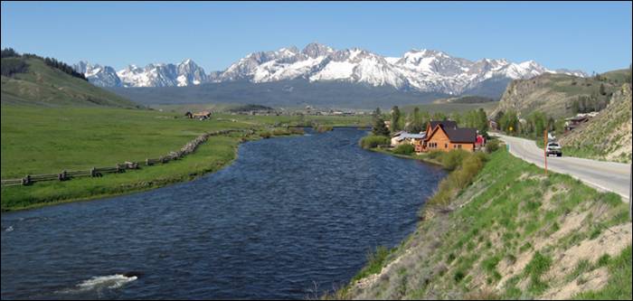
The Sawtooth Mountain Range
and Salmon River in Idaho. Photo
Fredlyfish4 at en.wikipedia
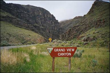
Grand View
Canyon (US Route
93) between Mackey and Challis. Photo: Rolf Blauert
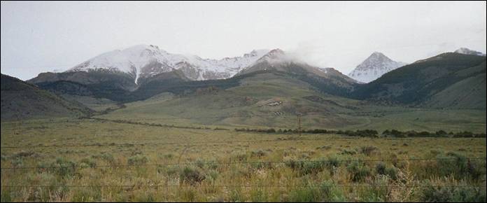
Leatherman Peak, 12,228,
second highest in Idaho, in the Lost River Range in eastern Custer County. Photo by
Rolf Blauert
Source:
Custer County,
City of Challis, City of Clayton,
City of Mackay, City of Stanley, and Wikipedia.
Elmore County
Elmore
County was established
February 7, 1889, with its county seat at Rocky Bar. Named for
the Ida Elmore mines, the area’s greatest silver and gold producer of the
1860’s.
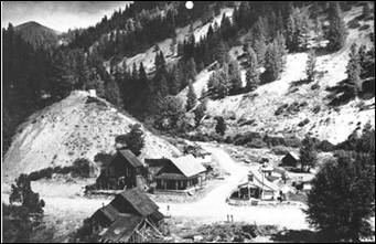
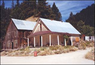
Rocky Bar, now a ghost town in Elmore
County, was founded in December 1863 soon after gold was discovered along the
nearby Feather River. Within two years it became
the main settlement in the area and was even considered as a possible capital
for Idaho Territory. At its height in the late 19th
century Rocky Bar boasted a population of over 2,500 and served as county seat
of Alturas County from 1864 to 1882. It was also
the original county seat of Elmore
County when it was
created in 1889.
Rocky Bar is a ghost town in Elmore County.
At its height in the late 19th century Rocky Bar boasted a population of over
2,500 and served as county seat of Alturas
County from 1864 to 1882.
It was also the original county seat of Elmore County
when it was created in 1889.
(Alturas
County was a county in Idaho Territory
and later the state of Idaho
from 1864 to 1895. It covered an area larger than the states of Maryland, New Jersey,
and Delaware
combined. Most present-day southern Idaho
counties were created at least in part from the original Alturas County
area. The name Alturas comes from a Spanish word for “mountain summits” or
“mountainous heights.”
Alturas
County was created by the
Idaho Territorial Legislature in February 1864. Later that year the mining camp
of Rocky Bar was designated the county seat. The county seat was moved to
Hailey in 1882.
In 1889, the Idaho Territorial Legislature
created Elmore County
and Logan County
from parts of Alturas
County. On March 5, 1895,
to circumvent a recent state Supreme Court decision striking down an earlier
county reorganization, the Idaho Legislature combined Alturas and Logan
Counties into a new county called Blaine.
Two weeks later on March 18, the southern portion of the newly-created Blaine County
was split off to form Lincoln
County with its county
seat at Shoshone. Hailey remained the county seat of what was now Blaine County
and Alturas County
disappeared from the Idaho
map.)
Rocky Bar was founded in December 1863 soon
after gold was discovered along the nearby Feather River.
Within two years it became the main settlement in the area and was even
considered as a possible capital for Idaho
Territory. The town was destroyed
by fire in 1892. Although it was rebuilt, afterwards it began a slow decline.
Rocky Bar has not had a permanent population since the 1960s.
Rocky Bar is located 62 miles northeast of
Mountain Home.
Atlanta is an
unincorporated town in Elmore
County. It was founded in
1864 during the Civil War as a gold and silver mining community and named by
Southerners after a rumored Confederate victory over General Sherman in the
Battle of Atlanta, which turned to be wholly false, but the name stuck. While
the official website for the town indicates it was settled in 1863, the town
was not settled until 1864. Mining activity near Atlanta preceded its establishment as a
mining community. The John Stanley party discovered gold on the nearby Yuba River
on July 20, 1864, just two days prior to the battle back in Georgia. That November, John
Simmons made the discovery of the Atlanta
lode which contained both gold and silver.
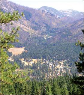
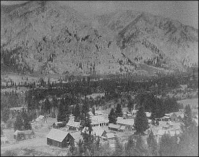
The town of Atlanta, Idaho. Photo
(above left) taken by John Hazlett on 8/31/2005 from China Basin Road, north
of town. Atlanta, 1906 (above right) – The early mining boom was over and at
the turn of the 20th Century the town had settled into a mountain
community, hidden away in the Sawtooth Mountains. The
only road in was over James
Creek from Rocky Bar and Featherville. There were stores, saloons, and a brewery.
Mining was still the main business. Greylock Mountain
is in the background.
See “Atlanta, The First
Gold & Silver Discoveries” by John Hiler in March 2012
El-Wyhee Hi-Lites page 3.
Atlanta is at
an elevation of 5383 feet above sea level surrounded by the Boise National Forest,
located near the headwaters of the Middle Fork of the Boise
River, approximately 2 miles east of
the mouth of the Yuba
River. The Sawtooth Mountains are directly north, and Idaho City
is approximately 35 miles due west, as the crow flies.
Though founded as a mining community, and a
number of private claims remain in the area, no significant commercial mining
has occurred in the area for over 50 years, though more recently inquiries into
opening a new plant have seen some headway. In place of mining, Atlanta has diversified
into areas such as tourism, back-country activities, and preservation of the
town’s lengthy historic legacy.
During this early westward period the
majority of emigrants passed through Idaho on
their way to California or Oregon. Only a handful of pioneers settled
in Idaho and
they mostly were merchants who supplied the needs of the wagon trains. But in
the early 1860’s the discovery of gold in Idaho resulted in a population boom. For the
first time in our nation’s history a reverse migration eastward occurred. The California miners returned to Idaho
and Alturas County,
later to become Elmore
County. Alturas is a
Spanish name that means “mountain summit or heavens” and was one of the
original counties in Idaho.
Established on February 4, 1864, Alturas encompassed a huge area in southern
Idaho, extending from the north fork of the Boise River, south to the Snake
River, and from American Falls west to Indian Creek.
In the beginning years, the county’s
population was concentrated in what was known as the South Boise Mines,
including Rocky Bar, Atlanta Esmerelda and Junction
Bar. These early mining communities reflected the disruption of the Civil War
then raging in the East, making a mixture of people from all walks of life.
Some were petty thieves, shysters, and restless unfortunates who rushed from
strike to strike with visions of wealth bright in their eyes. Some were miners
from the earlier gold rush to Elmore Mining District in Alabama who went to
California as ‘49ers and then came to Idaho Territory, bringing their southern
names with them. Their influence is evident
in the names of a town, Atlanta
and gold mines the Jeff Davis, and
Southern Confederacy. Also participating in the early mining camps were
the Chinese. A census in 1870 showed that a large portion of miners were
Oriental. The Chinese miners were often willing to work for less, almost slave
wages, and had the reputation for being very industrious and clannish miners
keeping to themselves and living a frugal and healthy lifestyle.
When mining activities in the camps began to
show results the character of the mining camps changed. On the heels of the
prospectors came permanent settlers. The camps had attracted not only faro
dealers, bawdy houses, and dance hall girls but also merchants, lawyers, and
editors, men and women who were willing to endure the rugged life for the high
prices that their services could demand. The largest camps are now only ghost
towns, with only memories remaining.
By 1896 the district had produced 100,000
ounces of gold. But gold, silver, and other precious metals were not the only
things to come out of the Alturas mining camps. A wealth of western stories
involving shootings, hangings, and other assorted skullduggery were produced
during the heyday of the camps. The stories and characters were always full of
grit, courage, warmth, and perseverance.
Early farmers and ranchers arrived upon the
heels of the miners. Small ranches and farms began to spring up around the way
stations. The families settled on land near transportation routes and water.
Settlement was encouraged by the offer of up to 320 acres to each individual
who could make the required land improvements and locate water. This process
was called “proving up the land”. The ranchers and farmers continually expanded
operations to supply agricultural products to the booming mining communities.
Many farm and ranch families came to Elmore County
because of land schemes promoted by the railroad and land developers.
Promotional campaigns referred to Idaho as the
“Switzerland of the west”,
and Mountain Home as the garden spot of southern Idaho. Settlers were promised successful
crops, plentiful water, and a healthful climate. The claims, although
exaggerated, contained some truth. The land was rich, producing 3 to 5 times as
many bushels per acre as land in Illinois, Virginia, or Tennessee.
The land was also capable of producing a variety of crops, and prosperous
farmers invested in cherries, plums, apples, grain, cattle, horses, and sheep.
Cattle, horse, and sheep raising
became important industries in Elmore
County. By 1888 the
county had 35,000 cows, 60,000 sheep, and 8,000 horses. Wool and mutton
production rivaled the cattle and horse industry. Sheep adapted well to the
desert and high mountain ranges, although according to cattlemen they ruined
the ranges for grazing cattle. Conflict resulted between the Glenns Ferry cattlemen and the Mountain Home sheepherders.
The disagreements persisted until sheep production became more profitable than
cattle. From the 1890’s until after 1918 Mountain Home was one of the Horse
Capitals of the world and Kitty Wilkins was known everywhere as the “Horse
Queen of Idaho.”
Young Basque men from the Pyrenees Mountains,
between France and Spain,
provided the labor for the sheep industry. In their native land they had been
fishermen, craftsmen, and farmers, but in America, they turned their hands to
sheep herding and shearing. These Basque emigrants had a significant cultural
impact on Elmore County.
As the communities of Mountain Home and Glenns Ferry grew, Rocky Bar and Atlanta
declined the Alturas
County seat was changed
to Hailey as it was reached by the railroad in 1882. Almost immediately
residents began to push for a new county and the creation of Elmore County
was hotly debated. Finally, as its last act, the last Territorial Legislature
created Elmore County on February 7, 1889. The county
seat was first returned to Rocky Bar but soon changed to Mountain Home.
The period from 1890 to 1913 was known as the
growth years for the county. The completion of the Oregon Short Line (OSL)
railroad in 1883 allowed for the shipment of mining and agricultural products
to world markets. The outbreak of WWI intensified demand for these products;
especially wool that was used to manufacture military uniforms. The end of the
war also was the end of the agricultural boom. The slump that began in the 20’s
intensified during the Great Depression. Many small farmers and ranchers lost
their land. Economic conditions did not improve significantly in the county
until 1941 when construction was begun on Anderson Ranch Dam, then the highest
earth-filled dam in the world and then with the outbreak of WWII crop prices
improved and construction of Mountain Home Air Force Base began.
|
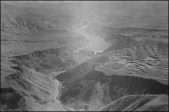
|

|
|
Anderson Dam
|
Mountain
Home Air Force Base June 1945
|
The post-war era heralded permanent changes
in the character of the county. The mining industry had collapsed, cattle
replaced sheep, and farming exploded with the introduction of high lift pumping
and new technologies. The Air Base remained after the war, although it
de-activated for brief periods between 1945 and 1964. The base had a tremendous
impact on the community. First, it became the largest employer in the county.
Second, the influx of military personnel and their families resulted in a rapid
growth of population. Thirdly, business sectors grew to meet the needs of the
air base and its military family. And, finally a diverse military population
provided the community with a wealth of cultural diversities unique in the
state of Idaho.
Early settlers were attracted to Elmore County
because of the promise of unlimited opportunities. These opportunities still
exist today. And the future promises to be as exciting, turbulent, and
unpredictable as the past.
Elmore
County is located in Southwestern
Idaho. It is bounded on the north by Boise
County, on the east by Blaine, Camas, Gooding, and Twin Falls
counties, on the south by Owyhee County, and on the west by Ada County.
Elmore is a large county covering more than
3,000 square miles. Approximately 60% of the county is mountainous. The
remaining 40% slopes gently down into the Snake River
plain. Elmore County has altitudes ranging from 2500
feet to over 9700 feet. Seventy percent of the county is owned by varying
departments of the federal government including the U.S. Forest Service, the
U.S. Department of Defense, and the Bureau of Land Management. Approximately
22% of Elmore County’s lands are designated farm
lands.
The topography of Elmore County
is extremely varied, from low elevation plains to high, steep mountainous
terrain. The county is divided into two district provinces, the Northern rocky
Mountain Province-Idaho Batholith, and the Columbia
Plateau Province-Snake River Plain in the southern 1/3 of the county.
High glaciated mountains in the northern province, especially
the area north of Atlanta,
are dotted with several hundred glacial lakes. The terrain is very steep,
rocky, and rugged, and much is granite rock covered with alpine vegetation.
The Snake River Plain supports both irrigated
agriculture and spring-fall grazing for cattle and sheep. The major limitation
to further expansion of agriculture in this area is water. Soils also are a
limited factor in a few sections of the Snake River Plain.
Elmore
County is Idaho’s
14th most populous county and ranks as the sixth largest in area of Idaho’s 44 counties.
Seventy-two percent of the county is federally owned. The county’s population
has experienced some ups and downs through the years but during the 10-year
period of 1997 to 2007 it increased by 6.2 percent, down from the 9.6 percent
recognized from 1996 to 2006. This increase amounts to 1,688 new residents
since 1997, 475 of this total came in 2007 alone. Elmore
County is home to the Mountain Home
Air Force Base located in the southwestern corner of the county near the city
of Mountain
Home. The base is home to a significant population of military personnel and
their families.
Cities in Elmore County:
Glenns Ferry & Mountain Home
Other
communities: Atlanta,
Featherville, Hammett, King Hill, Pine, Prairie,
Rocky Bar (ghost town), and Tipanuk. Mountain Home
Air Force Base, located 10 miles southwest of Mountain Home, is a military
community.
|
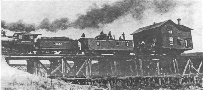
|
|
Back in
the early days they moved houses by use of the railroad such as this house near
King Hill.
|
Glenns Ferry was one of the most famous river crossings on
the Oregon Trail. Pioneers forded the Snake River at the Three Island Crossing until 1869, when
Gustavus “Gus” Glenn constructed a ferry about two
miles upstream, primarily to expedite freight but also for emigrants. His boat,
which could hold two wagons, cut nearly twenty miles from the former route.
|
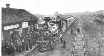
|
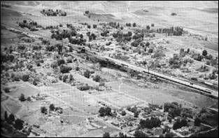
|
|
Glenns Ferry Rail Road Station
1889
|
Early Glenns Ferry
|
Glenns Ferry History
Become a Facebook
Fan of Glenns Ferry
Three Island
Crossing State
Park, opened in 1971, is home to The Oregon Trail History and Education Center, where visitors can learn about
pioneer emigrants and Native American history.
The townsite was
platted in 1871, just downstream from the ferry site, and the first bridge
across the Snake River was built here in 1908.
Mountain Home
originated as a stage stop (Rattlesnake Station, founded in 1864) for the
famous Overland Stages eight miles from its present location. When the railroad
(Oregon Short Line) came through in 1883 it brought with it a new mail delivery
service. The postmaster and stage agent, Jule Hage, packed up the post office and moved it down the hill
to the railroad. Along with him came the name and settlement of Mountain Home.
Mountain Home was incorporated as a village
in 1896. The initial village board consisted of A.B. Clark, R.F. Whitney, W.J.
Turner and G.F. Mahoney.
|
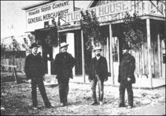
|
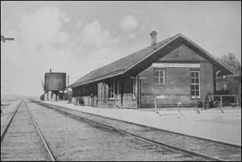
|
|
Mountain
Home pioneers
|
Mountain Home Rail Road Depot
|
Mountain
Home History
Mountain Home became a shipping and
distribution center for the livestock, mining and logging business.
When irrigation systems were built, with
the help of high-lift pumping and the construction of irrigation dams, the
agricultural industry became stronger and much of the desert land was opened to
farming. Thousands of acres of land could now produce grain, hay, sugar beets,
potatoes, and beans.
Livestock production and, more recently, the
dairy industry have also made a considerable contribution to the local economy.
Mountain Home has a current population of
approximately 14,600 and is a community of diverse cultures. It sets at an
elevation of 3,143 feet. The hottest month is July and the coldest is January. Average
annual precipitation is 10.7 inches.
Mountain Home is especially proud of its
parks, visitor’s center, golf course, and museum.
Being centrally located in Elmore County,
Mountain Home is referred to as “The Hub of Elmore County”.
Mountain Home Air
Force Base, located 10 miles from Mountain Home, was established during
the early stages of World War II. The Air Base would become one of the major
life lines for Mountain Home.
Prior to December 7th the War Department had
begun building Army Air Fields and Camps. With the beginning of the war the
schedule was accelerated and suddenly many small towns found that they were to
be the host of a large military establishment. This is exactly what happened to
a little town with a `940 population of 1,163, Mountain Home, Idaho
suddenly was a big player in winning the war.
Early in 1942 the base establishment
commission began looking at southern Idaho
for places to put Army Air Fields. They found one at Pocatello
and Gowen Field in Boise was authorized. Jerome, Idaho
was carefully reviewed for a base but the commission thought that land there
was too expensive at between $5 and $25 an acre. The commission came to
Mountain Home. The community was on the railroad main line and astride Highway
30. Meteorological records were reviewed and it was found that there was little
problem with bad weather or fog. Land was easily had for $.50 to $1.50 per
acre, the base could be removed from all encroachment, water was available from
deep wells and there was an abundance of Federal lands available for a large
training range. In short order a deal was struck and Gus Nelson and Father King
the local Catholic priest sold the US Army a large tract of land for about
$1.00 an acre. The Sagebrush desert was perfect for the long level runways to
be built for those airplanes that were still on the drawing boards waiting for
engines to power them into the sky. In a few weeks construction began.
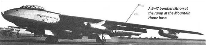
The photo above is of a B-47 Stratojet as it sits on the ramp at Mountain Home
AFB. A true jet bomber it
changed US
airpower and was designed and built to last almost forever. (photo
courtesy Mountain Home Air Force Base)
F-111F at
Mountain Home Air Force Base.
Mountain Home AFB
F-15s in flight.
Previous
names:
Army
Air Base, Mountain Home, Nov 1942
Mountain
Home Army Air Field, 2 Dec 1943.
Mountain
Home Air Force Base, 13 Jan 1948–Present
Source: Wikipedia, John Hiler, MHAFB, El-Wyhee Hi-Lites
Franklin County

Franklin County Courthouse,
Preston, Idaho. Photo Ken
Lund
Established in 1913, Franklin
County was named after Franklin D. Richards, an Apostle of The
Church of Jesus Christ of Latter-day Saints, and it is
the only Franklin County in the United States that is not named
after Benjamin Franklin.
The Bear River Massacre took place in present
day Franklin County on January 29, 1863.
Cities and towns: Clifton,
Dayton, Franklin,
Mink Creek, Oxford, Preston,
Thatcher, Weston, and Whitney
Clifton
was originally settled by Thomas Charles Davis Howell and his sons in the
spring of 1869. A Latter-day Saint branch was organized here with William Jared
Pratt as president latter that year. A post office was set up in 1870. A ward
was organized here in 1877.
Dayton
- In 1867 Joseph Chadwick and family settled on Five Mile Creek and built a log
cabin. In one room he had a supply store to accommodate the few settlers and
freighters. He was followed by Peter Poole, Robert Taylor, Stephen Callan, George Mendenhall, Richard Wickham and their
families. The locality was originally known as Franklin Meadows. It was latter
known as Five Mile Creek, then Chadville, and in 1890
Card. In 1906 William B. Preston gave it the name of Dayton.
Franklin -
Founded by Mormon pioneers led by Thomas S. Smart on April 14, 1860 in what was
then Washington Territory. The town received its name
after Franklin Richards, an Apostle for The Church of Jesus Christ of
Latter-day Saints. Franklin is the first
permanent European settlement in present-day Idaho. However, the town’s founders believed
the townsite was in Utah Territory.
Its political status remained ambiguous until an 1872 survey determined the townsite was in Idaho
Territory about 1-mile north of the Utah Territory
border.
Franklin
is the location of a portion of the filming of the movie Napoleon Dynamite. The
chicken farm scenes of the movie were filmed on Ritewood
Egg Farms property, and the supervisor’s character is loosely based on Marlow
Woodward, a late Franklin
resident and one of the farm’s founder.
Preston -
In 1866, LDS pioneers arrived in the northern end of the Cache
Valley, stretching across southeastern
Idaho and northeastern Utah. They founded a community in that
location and named it Worm Creek, but later changed it to Preston.
Preston was named after Preston, England, the center of early [LDS] proselytizing
in the UK.
Source: Wikipedia
Fremont County
Fremont County was established in 1893, and was named for the
explorer John C. Frémont. As of the 2010 census the
county had a population of 13,242. The county seat and largest city is St.
Anthony.
Cities/communities – Ashton, Drummond, Island
Park, Last Chance, Newdale, Parker, St. Anthony,
Teton, and Warm River
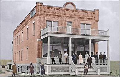
One of the first buildings in Ashton is
the original Ashton Hotel built in 1906 and destroyed by fire circa 1920.
Standing on stairs, right, is H. G. “Fess” Fuller who was the first Mayor of
Ashton. Photo by Wikipedia
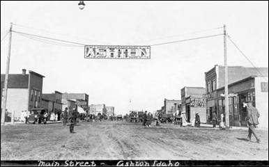
Busy day
looking east down Main Street
in Ashton, Idaho circa 1918.
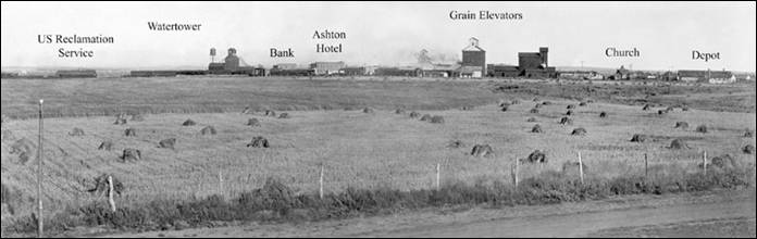
Ashton, Idaho circa 1910 as viewed from the West.
Ashton - In 1900, the Union Pacific
Railroad, under the careful watch of the OSL (Oregon Short Line) and St.
Anthony Railroad Company, brought the railroad into the Upper Snake River
Valley from Idaho Falls to St. Anthony, Idaho, 14 miles southwest of what
became Ashton, Idaho. The venture had considerable local support and official
support from the LDS
Church. Following
successful construction and operation of the St. Anthony Railroad, Union
Pacific, under the careful watch of the OSL and the Yellowstone Park Railroad
Company, began plans for another railroad from St. Anthony to the Madison River
entrance of Yellowstone National Park or to what is now known as West Yellowstone. For years, Union Pacific wanted
improved rail access to Yellowstone’s geyser
basins and now to Old Faithful Inn, that opened in 1904. Old Faithful Inn was
only 30 miles from the Madison River entrance, nearly half the distance from
the Northern Entrance at Gardiner,
Montana that was served by the
Northern Pacific Railroad. The planned route for the new railroad was through
Marysville, up Warm River Canyon
into the forested Island
Park country, and on over
the Continental Divide at Rea’s Pass into what became West Yellowstone,
Montana.
Despite the obvious economic advantages and
support, the residents of Marysville, perfectly happy without a railroad,
resisted the new railroad intruding upon their land and into their lives. The
matter was expeditiously resolved when Union Pacific decided to build the
railroad through a new town one mile west of Marysville named after the OSL
Chief Engineer, William Ashton. The founding of Ashton and the first scheduled
train service to Ashton both occurred in 1906 with predictable results. Ashton
quickly sprang to life while Marysville slowly declined into near oblivion. One
of the two founding fathers, H. G. “Fess” Fuller, became the long-time Mayor of
Ashton and the other, Charles C. Moore, went on to become Governor of Idaho.
The Yellowstone Branch, as the new railroad
was known, was very unusual in that it was built primarily for passenger
service and secondarily for freight. Aesthetic stone depots, rather than
standard wooden ones, were built at Rexburg, Idaho and at West Yellowstone, Montana to lure and
impress tourists traveling to Yellowstone
National Park and to Old
Faithful Inn. In addition to regular freight and passenger service, there were
two special named trains, the Yellowstone Special and the Yellowstone Express
that ran to West Yellowstone in the summer
tourist season. From Ashton north, the railroad was never plowed of snow,
except in spring, so that Ashton became the wintertime rail terminus for the
entire region.
Beginning in 1910, Ashton was the railhead
used for the construction of Jackson Lake Dam in Grand Teton National Park by the Bureau of
Reclamation. For several years, materials and equipment were freighted by wagon
from the Reclamation Building in Ashton to the dam site at Moran, Wyoming on what was known as the Ashton-Moran Road or Reclamation Road, as the locals called
it, which ran 56 miles over the north end of the Teton
Range. Union Pacific then built the Teton Valley Branch railroad
to Driggs and Victor from Ashton and completed in
1912. They built an engine house and other railroad facilities in Ashton to
service the Teton Valley Branch and the Yellowstone Branch. These and further
developments in the area soon made Ashton prosper and become one of the more
important towns in Eastern Idaho.
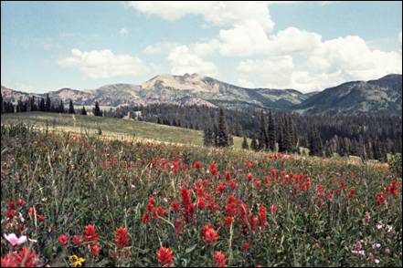
Mt. Jefferson in Island
Park, Idaho with Wild
Flowers
Island Park) is a city in Fremont
County, Idaho, United States. The city's
population was 286 at the 2010 census, up from 215 in 2000. The city was
incorporated by owners of the many lodges and resorts along U.S. Route 20 in
1947, primarily to circumvent Idaho's
liquor laws that prohibited the sale of liquor outside of city limits. It is only
500 feet wide in most locations and, at 33 miles, claims to have the longest
"Main Street"
in the world.
Island
Park Chamber:
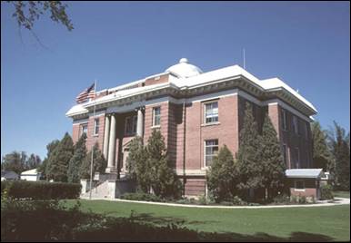
Freemont County Courthouse
St. Anthony is the county seat of Fremont County
and largest city with a population of around 3,542. Freemont County
was named after John C. Freemont, the pathfinder who surveyed the west for the
government.
Gem County
Named for the state nickname, "Gem State,"
the county was established on March 15, 1915, partitioned from Canyon County
and Boise County. Fur trappers were in the area as
early as 1818, and Alexander Ross explored Squaw Creek in 1824. Prospectors and
miners moved through the county in 1862 in route to the gold rush in the Boise Basin
around Idaho City,
and by the next year irrigation began along the Payette River.
The Black Canyon diversion dam on the river was built
in the early 1920s, east of Emmett.
City
- Emmett
Unincorporated
communities – Letha, Ola, Sweet
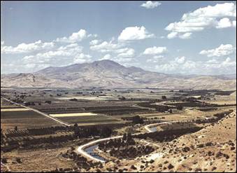
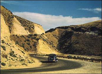
Photo left: Emmett in the 1930s. Dominating the valley, the lady watches over her people and lands.
The mountain in the background, Squaw Butte,
was so named by the American Indians that once lived in the valley, because the
profile of an Indian maiden can be seen.
Photo right: Road cut into the barren
hills which lead into Emmett. Emmett,
Idaho, July 1941.
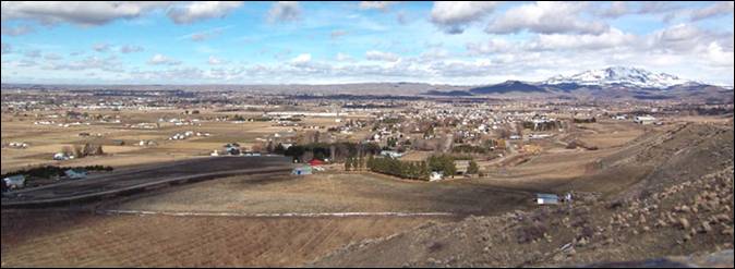
Photo - Aerial view of Emmett by John D
Emmett
- Rising some 5,906 feet above sea level, Squaw Butte, named by Native
Americans who used this area as their winter resort, stands at the north end of
the valley. The Payette River was named after Francois Payette, a fur trader
from Quebec who was put in charge of old Fort Boise
in 1818 and traveled through the area. Permanent settlement began in the early
1860s, after gold discoveries in the Boise
Basin brought people over
the established stage and pack train routes. Two of these trails joined at the Payette River north of the present river bridge
in Emmett.
Originally called "Emmettville,"
it was primarily a post office named after Emmett Cahalan,
the son of Tom Cahalan, an early settler of the area.
The post office was later moved but retained the name. A few years later the
"ville" was dropped and the post office and
town became simply Emmett. In 1883 James Wardwell had the town platted, and in
1900 the town was incorporated as Emmett. Later, in March 1902, the Idaho
Northern railroad came to the valley.
After the closing of the mines in 1906, the
power lines were extended to Emmett. A series of irrigation projects made it
possible for more rapid expansion of the town as the major service center for a
farming and fruit-growing valley. In the early 1900s fruit packers adopted the
label of "Gem of Plenty" because of the fertility of the valley.
During the mining era the valley was known as the "garden" for the
mining regions.
Until 2001, the city was home to a Boise
Cascade manufacturing facility. The Black
Canyon diversion dam on the Payette River, built in the early 1920s, is east
of the city.
Letha
is located approximately 9 miles west of Emmett. Letha was founded by W.W.
Wilton and a Colonel Barnard and named for Wilton's daughter, Letha Wilton. It was built
approximately midway along the railway running from Emmett to New Plymouth,
with anticipation that it would become a major rail center; although this never
occurred, Letha today remains a service center for the adjacent farms and ranches.
The community includes an elementary school, fire department, post office,
general store, and motor vehicle service station. Higher education, police,
medical and legal services are found at nearby Emmett.
Ola is located approximately 30 miles north of Emmett
and was established as a post office July 22, 1882, by Carroll Baird. It serves
the Upper Squaw Creek
Valley.
The first
post office in this area was "Upper Squaw Creek," established in
September 1875, by Carroll Baird. Baird homesteaded along Squaw Creek, less
than half a mile west of the present-day site of Ola.
Nellie
Ireton Mills writes that the Bairds built their cabin
where the old Indian trail crosses the creek. The trail was also used by miners
and others taking the short cut to, or from, Oregon
and the Boise Basin. Prior to the 1875 post office,
the mail was delivered by pack horse and snowshoes along the Brownlee Trail
from Horseshoe Bend (Boise County) to Warren (Idaho County).
Six weeks
after the post office was established, Bairds'
bachelor neighbor to the north, Fred Hoffman was appointed postmaster, a
position he held until the post office closed the end of January 1877, when
mail was sent to Cascade (Valley County). Mills writes that first wedding in
the community was between Fred Hoffman (aka Huffman) and school teacher Ella
Drake March 6, 1879.
When the
post office was re-established July 1882, Baird chose the name of Ola,
"for an old Swede that happened along."
Sweet is an unincorporated community in Gem
County, Idaho, United States. It is located in
open countryside approximately 16 miles northeast of Emmett, along a county
highway 8 miles due north of its intersection with State Highway 52.
Founded in
1885 by Ezekiel Sweet, the community initially was a supply location and post
office for farmers and ranchers in the nearby Lower Squaw
Creek Valley.
Sweet grew significantly as a result of the later Thunder Mountain Mines gold
strike; by 1900, it supported three saloons, three hotels, several businesses
and a newspaper, which lasted until the gold mines petered out. Several
subsequent fires destroyed most of the historic downtown. Today, a smaller
Sweet is the location of a restaurant and post office.
Gem County
History
Gooding County
Gooding County was created by the Idaho
Legislature on January 28, 1913 by a partition of Lincoln County.
In the 1880's it was part of Alturas
County. Named for Frank R. Gooding, pioneer sheep rancher, early mayor of
the city of Gooding,
later Idaho Governor and U.S. Senator.
History note: Alturas
County was a county in Idaho Territory
and later the state of Idaho
from 1864 to 1895. It covered an area larger than the states of Maryland, New Jersey,
and Delaware
combined. Most present-day southern Idaho
counties were created at least in part from the original Alturas County
area. The name Alturas comes from a Spanish word for "mountain
summits" or "mountainous heights."
Alturas
County was created by the
Idaho Territorial Legislature in February 1864. Later that year the mining camp
of Rocky Bar was designated the county seat. The county seat was moved to
Hailey in 1882.
In 1889, the Idaho Territorial Legislature
created Elmore County
and Logan County
from parts of Alturas
County. On March 5, 1895,
to circumvent a recent state Supreme Court decision striking down an earlier
county reorganization, the Idaho Legislature combined Alturas and Logan
Counties into a new county called Blaine.
Two weeks later on March 18, the southern portion of the newly-created Blaine County
was split off to form Lincoln
County with its county
seat at Shoshone. Hailey remained the county seat of what was now Blaine County
and Alturas County
disappeared from the Idaho
map.
Mountain men and fur traders trapped the Malad
River extensively in the
early 1800s. Settlers came to the rich agricultural lands of the Hagerman Valley in the 1860s. The county seat is
located in the City of Gooding.
The county contains the cities of Bliss, Gooding, Hagerman and Wendell. The
county has a population of over 14,461. Gooding County
has been one of the fastest growing and prosperous counties in South Central
Idaho. The economy is increasingly influenced by the dairy industry, and growth
has been strong in the last decade. Gooding
County also is one of the largest
trout producing areas in the United
States. The scenic Thousand Springs and the
temperate weather of the City of Hagerman
make tourism a significant industry with boat trips, fishing, and other water
sports. In the north the Gooding City of Rocks (pictured below), carved from
Miocene rhyolite ignimbrites of the Twin Falls
Volcanic Field, forms the south flank of the Mount Bennett
Hills.
Bliss - The community was named for David B.
Bliss, an early settler in the area. Estimated population
287.
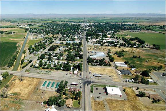
Aerial view
of the City of Gooding,
population approximately 3,384. Gooding
County has been one of the fastest growing
and prosperous counties in South Central Idaho.
The Village of Gooding was incorporated on April 25, 1906 and became the City
of Gooding on November 21, 1910.
Gooding - The history of Gooding goes back to
the time when nothing existed but a railway station called “Toponis”. Toponis was the
name given to the Oregon Short Line railway station built during 1882 and
1883. The Toponis
post office was built five years later in 1887.
Toponis became the Village of Gooding
on November 14, 1907, the first day a Gooding lot was sold. The Village of Gooding
was incorporated on April 25, 1908. The Village of Gooding
became the City of Gooding
on November 21, 1910. Population of Gooding now is approximately 3,384
City of Rocks
Little City of Rocks is an area of unusual and highly scenic
rock formations. Erosion has carved fascinating spires and hoodoos from the
underlying deposits of solidified volcanic ash. Excellent
hiking, sightseeing and solitude.
The location is about 15 miles north of Gooding
on Highway 46, turn west at the BLM sign for City of Rocks. Follow the signs and travel about 7.5
miles on a generally well-maintained dirt road, which is suitable for passenger
vehicles if conditions are dry.
Hagerman - The City of Hagerman,
which gives the valley its name, was originally the site of a stagecoach stop (Overland Trail Route)
along the Oregon Trail. Remains of this
historic pioneer route can still be seen along the west side of the Snake River.
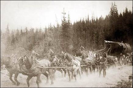
Horse team
on the Overland Trail.
The town itself was officially established
in 1892 when Stanley Hageman and Jack Hess opened a combination Post
Office/General Store. The town was actually named for Stanley Hageman but a
misspelling in the central post office registry changed its official name to
Hagerman.
There was only one store in Hagerman in
1893, when Billy Coltharp established his saloon,
originally a barrel of whiskey and a tin cup. Billy lived in two small rooms in
the rear of the saloon he built (now the Masonic Hall). He also built the
original part of the old Morris Roberts store (now the US Bank). He established
the park, which today bears his name and built the Park Opera House (now the
American Legion Hall). Billy also helped organize the Hagerman State Bank
(located in a corner of the Morris-Roberts Store) and served as its director.
This bank later became the National Bank and moved to a new building in 1909
(now the Historical
Society Museum).
Billy also served as director there.
Today, the valley is the largest producer of
commercial trout in the world. The mild climate and abundance of year round
open water make the valley a preferred stop-off for migrating waterfowl. This
same abundance of water also provides numerous water sport opportunities.
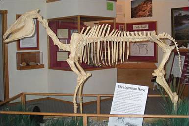
Hagerman Horse - Equus
simplicidens (formerly called Plesippus
shoshonensis) - mounted skeleton in the visitor
center of Hagerman Fossil Beds
National Monument, Idaho
The Hagerman horse (Equus
simplicidens), also called the Hagerman zebra or the
American zebra, was a North American species of equid from the Pliocene period and the Pleistocene period.
It was one of the oldest horses of the genus Equus.
Discovered in 1928 in Hagerman, Idaho, it is believed to have been like the Grévy's zebra of East Africa.
It is the state fossil of Idaho.
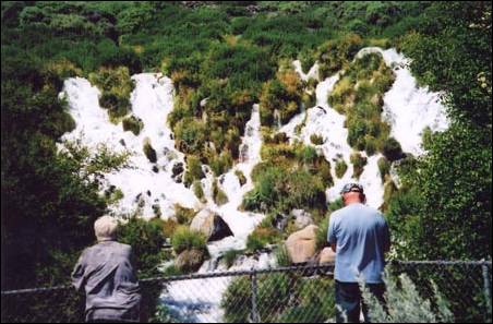
Tumbling down the canyon side at 250
cubic feet per second, Niagara Springs is a sight you won't soon forget. The
churning, icy blue glacial water is a National Natural Landmark and part of the
world-famous Thousand Springs complex along the Snake
River. The park provides a great opportunity to drive into the
350-foot-deep Snake River
Canyon, but be cautious.
The road is narrow and steep and not recommended for either motorhomes
or large trailers. Once inside the canyon, you'll find year-round fishing in Crystal Springs Lake,
including a handicap accessible site. Waterfowl and other wildlife are
abundant.
The Thousand Springs Scenic Byway is a
picturesque section of old US 30 in southern Idaho between the towns of Bliss and Buhl, dipping down
into the Hagerman Valley and a canyon of the Snake
River. The byway takes its name from the numerous streams and
rivulets springing forth out of the east wall of that canyon, many of them
plainly visible from the road, with the panoramic river in the foreground.
These springs are outlets from the Snake River Aquifer, which flows through
thousands of square miles of porous volcanic rock and is one of the largest
groundwater systems in the world. The aquifer is believed to be fed by the Lost River
which disappears into lava flows near Arco, about 90 miles northeast of
Hagerman.
Wendell -
The community was named for Wendell Kuhn, son of W.H. Kuhn, who financed an
irrigation project. It was established in 1909 and incorporated in Idaho
Wendell Chamber of Commerce
Source: Wikipedia, Gooding
County, Elmore County
Press
Idaho County
Idaho County was originally founded as a region of Washington Territory
in 1861, named for a steamer called Idaho that
was launched on the Columbia River in 1860. It
was reorganized by the Idaho Territorial Legislature on February 4, 1864. In
this context, the name of the county predates both the Idaho
Territory and the State of Idaho. The county seat
is Grangeville. Previous county seats were Florence
(1864–75) and Mount
Idaho (1875–1902).
Idaho
County is the largest County in Idaho. It covers 8,503 square miles, and has 6,925
square miles of National Forest land within the county.
Mount Idaho
is a ghost town in Idaho
County. The town served
as county seat of Idaho
County from 1875 to 1902.
A 45-mile stretch of trail opened in 1860 in
the Mount Idaho area is believed to be one of the
earliest examples of a toll road on record in the region. According to local
legend, the owner of this road, Mose Milner, was
forced to sell the area to Loyal P. Brown after being permanently disabled in a
fight with a mountain lion. Brown is considered the founder of Mount Idaho.
The town of Mount
Idaho was
founded around 1862 as an outpost serving nearby gold mining areas. By 1873 Mount Idaho
was connected by stagecoach with Lewiston.
During the 1877 Nez Perce War a hotel in Mount Idaho
served as a hospital. Some of the dead from that conflict were buried in the
town's cemetery.
By
1892 Mount Idaho
was in competition with nearby Grangeville, some 3.5 miles away, as the main
town in Idaho County. The county seat was moved from Mount Idaho
to Grangeville ten years later. By 1922, when the town's post office closed, Mount Idaho
had been effectively assimilated by Grangeville.
Cottonwood began in 1862 as a
series of way station shelters for prospectors and mining suppliers on their
way south to Florence and Warrens. It was named for the dense growth of
trees that formerly lined Cottonwood Creek.
Main
Street Grangeville in July 2008
Grangeville is the largest city in and the county seat of Idaho County.
Its population was 3,141 at the 2010 census.
For over nine decades, the Camas Prairie
Railroad served the city. Grangeville was the eastern terminus of its
second subdivision, known as the "Railroad on Stilts" due to its
abundant timber trestles. Citing lack of profitability, its new owners received
permission from the federal government to abandon the line in 2000. The final
freight run to Grangeville was on November 29, and the 17 miles of track from
Grangeville to Cottonwood were removed in 2003
for salvage. The line was revived by BG&CM, but now terminates in Cottonwood. Passenger service to Grangeville was
discontinued decades earlier, in August 1955.
Kooskia (pronounced
kōō′·skē) is at the confluence
of the South and Middle forks of the Clearwater River,
combining to become the main river. The population was 607 at the 2010 census.
The name of the town is likely a contraction
of the Nez Perce word "koos-koos-kia" which
refers to the Clearwater River. The town was
first named Stuart, after James Stuart (1863–1929), a Nez Perce surveyor and
merchant. The railroad arrived in 1899 and named its station "Kooskia," because there already was a railroad station
named "Stuart" in the state. The town went by both names for the next
decade until it was formally renamed in 1909.
Kooskia is
within the Nez Perce Indian Reservation. Similar to the opening of lands in Oklahoma, the U.S. government opened the
reservation for white settlement in November 1895. The proclamation had been
signed less than two weeks earlier by President Cleveland.
Riggins is nestled deep in a canyon
at the confluence of the Salmon River and the Little Salmon River in west
central Idaho, approximately 150 highway miles
north of Boise, and 120 highway miles
south-southeast of Lewiston.
The elevation of Riggins is 1,821 feet above sea level, and the population was
419 at the 2010 census. US-95, the only highway for the state connecting the
Panhandle to the south, runs through Riggins as Main Street. Along this route, Riggins is
the northwestern most town in the Mountain time zone.
The Pacific time zone begins just north of Riggins,
upon crossing the Salmon River.
Riggins was named for Richard L. Riggins,
local businessman and postmaster.
Stites,
located in the lower canyon of the South Fork of the Clearwater River, was
named for Jacob Stites of New Jersey, who homesteaded the land in 1897
which became the city. He sold two years later and exercised his option to name
it. Stites became the eastern terminus Northern
Pacific branch line up the Clearwater
in 1900, later the Camas Prairie Railroad's first subdivision line. It climbed
the main river eastward from Lewiston
to Kooskia and then turned south to ascend the lower
South Fork. The abandoned spur was removed in the 1980s, and the city
incorporated in early 1905.
White Bird, located at the southwest
corner of the Camas Prairie, is near the Salmon River
crossing point for the Lewis and Clark expedition. It is also the location of
the 1877 Battle of White Bird Canyon, which was the
first fight of the Nez Perce War and a significant defeat of the U.S. Army.
Chief White Bird was a leader of the tribe. The summit of White Bird Hill is
2700 feet above the city, ascended via U.S. Highway 95.
White Bird was established in 1891, and was
named for a Nez Perce chief.
Source: Wikipedia
Jefferson County
Jefferson County is named after Thomas Jefferson; the third president
of the United States,
the county was established in 1914 with the county seat at Rigby. As of 2010, the population was 26,140.
The Idaho Department of Commerce offers the
following description: "Jefferson
County is located in eastern Idaho. It ranks 14th
among Idaho
counties in population and 28th in area. The federal government owns nearly 47
percent of the county. Agriculture and food processing are the largest basic
industries and dominate the economy, but government and trade sectors provide
the largest employment. Annual average total civilian employment increased 10.8
percent from 1996 to 2006. Major employers include Blaine Larsen Farms Inc., Broulim’s Foodtown, Idaho Fresh
Pak Inc., Idaho Pacific Corporation, Rigby Produce Inc., Jefferson
County government, Jefferson, Ririe and West Jefferson schooldistricts and the Idaho Transportation
Department."
Cities/communities: Hamer,
Lewisville, Menan, Mud Lake,
Rigby, Ririe, and Roberts
Lewisville,
with a population of around 458, is the home of Idahoan Foods, makers of
instant mashed potatoes.
Lewisville
was established in 1882. For the city's important role in Idaho's potato industry, Governor Butch
Otter proclaimed August 11, 2007 "Lewisville Day" statewide.
Menan has a population of approximately 741. It was the
first settlement of Latter-day Saints in the Snake River Valley.
It was founded in 1879
Mud Lake
has a population of approximately 358 at the 2010 census. In 1919 the
Latter-day Saint settlers in Mud
Lake were organized into
a branch.
Rigby
is the county seat of Jefferson
County. The population
was 3,945 at the 2010 census.
Rigby is part of the Idaho Falls Metropolitan
Statistical Area, and is located directly between the two larger Idaho cities of Idaho
Falls and Rexburg, providing its residents with a wide
variety of shopping, entertainment and cultural choices. Many Rigby citizens
commute to jobs in Rexburg or Idaho
Falls, and a number of residents work for the federal
government or federal contractors through the Idaho National Laboratory (INL),
locally called "The Site".
Rigby was founded by members of The Church of
Jesus Christ of Latter-day Saints in 1884 and incorporated in 1903. The
community was named after William F. Rigby, a prominent early settler and
member of the LDS church. A significant majority of Rigby's residents, as well
as those of the outlying communities, are members of the LDS faith. Baptist,
Presbyterian, and Lutheran faiths also have current local congregations.
Ririe
is a city in Bonneville and Jefferson counties (mostly Jefferson) with a population
of about 660.
Ririe was named for
one its first homesteaders, David Ririe. A Utah resident, Ririe settled in the area in 1888, and began cultivating a
small claim of land. In 1891, Joseph Lovell and his family settled on an
adjoining area and began farming. That winter, however, Joseph died of illness,
leaving his family alone and isolated. David Ririe
helped the widowed family to establish their farm, and eventually married one
of the Lovell daughters, Leah Ann. The families flourished in the area, and
David eventually built a large stone house, which stands today, to house his
large family. As more residents settled in the area, the common need for
schools and churches help foster a community. However, the city of Ririe
was formally established in 1914. That year the railroad was routed through the
city and Ririe was given its name by railroad
officials. The small community of Shelton was
absorbed by Ririe, but several buildings and sites
continue to bear the Shelton name, such as the Ririe-Shelton
Cemetery.
A large fire during the early 1980s destroyed
much of the southern half of the town, but since then, the Elementary
School/High School complex, an athletic field and an LDS Stake Center have been built in the area.
Since 2007, nearly a thousand acres (4 km²) have been annexed into the town,
ostensibly in anticipation of future development.
Roberts has a population of 580 at the 2010
census. In Roberts there is general store, a café, a restaurant, a library, gas
station, and an old school where children who live in the town go and play in
the gym. There is an elementary school, but students, who go to middle school,
junior high, or high school, go out of town to Rigby.
Source:
Idaho
Department of Commerce, Wikipedia
Jerome County
Jerome County was created by the Idaho Legislature on February 8,
1919, by a partition of Lincoln
County. Jerome County
was created in 1919 from the parent Counties of Gooding, Minidoka and Lincoln.
In the 1880's it was part of Alturas County, which no longer exists.
The county seat is Jerome believed to be
named after Jerome Hill who was commissioned by Kuhn to find a suitable area
for a town site. Traveling all day Jerome Hill and his group found themselves
lost in the lava and sagebrush so made camp for the night. Morning brought a
wonderers view of the Sawtooth
Mountains to the North and Twin Falls to the South
and all agreed they had searched far enough, markers were placed at the
location and Jerome town site began her legacy.
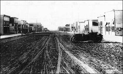
Early Main Street in Jerome
Photo: Jerome County Museum
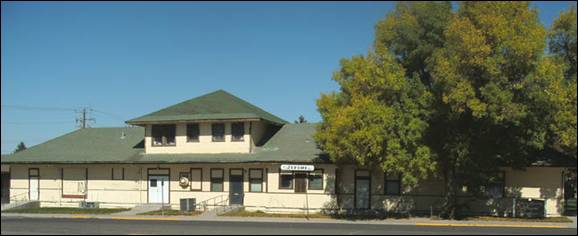
Jerome Railroad Depot was built in 1911
and is now home to the Jerome County Museum
The land opening was held on September 30,
1907, where two lots were offered for public auction, following choices of lots
were drawn by lottery. 1907 land was set aside for a cemetery and in 1914
received a deed for said property. The first train "Idaho Southern
Railway" entered Jerome on December 28, 1908, coming from Gooding. The
Pioneer Newspaper owned by H. A. Stroud and John D. Nims
released the first edition on November 12, 1908. Adeline Becker became Jerome's
first postmaster with the Post office beginning service on August 24, 1907.
1908 brought the first telephone service to Jerome, managed by Ed Churchman. Jerome School District
was organized in 1908 and in 1911 the District became Jerome Independent
School District # 33,
Transporting students by school wagon began in 1909. 1922 crystal radio sets
made an appearance in Jerome, which was enjoyed by many residents.
Jerome
County consists of the
small farming communities of Eden, Hazelton, and Jerome.
Towns and Settlements left behind but not
forgotten Falls City,
Greenwood,
Hillsdale, Hunt, Pleasant Plains and Barrymore.
The Minidoka
Relocation Camp, one of ten Japanese American internment camps
set up during World War II, was located in Jerome
County, six miles north of Eden.
Jerome is the seat of Jerome County
and the center of a large Carey Act irrigation project. The town was
established in 1907 by the Kuhn Brothers, as part of the North Side Twin Falls
Canal Company. It takes its name from Jerome Hill, one of the investors in the
project, and a brother-in-law of W.S. Kuhn. The city of Jerome became a municipal corporation on
March 24, 1919.
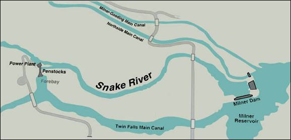

Milner Dam was authorized for
construction as a privately capitalized venture under the 1894 Carey Act, a
precursor to the 1902 Reclamation Act. Ira Burton Perrine, a local rancher,
chose the site and recruited financial backers, including Salt
Lake City banker Stanley
B. Milner and eastern investors Frank H. Buhl and Peter L. Kimberly. The
Buhl-Kimberly Corporation built the dam and the Twin Falls Canal
in 1903-1905. Milner Dam's primary purpose is irrigation but it also produces
hydroelectricity.
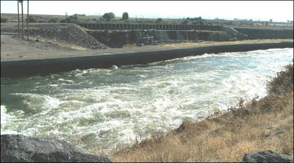
Northside Main Canal at Milner
Dam
The city of Jerome
is the economic center of Jerome
County. Farming and
Agricultural related industries still dominate the economy of Jerome, but the
city is broadening its economic base in the service sector, manufacturing and
retail trade. Jerome's downtown serves as a civic and retail center.
Jerome is in an advantageous position,
having a relatively compact city center, a diversifying economy, and attractive
neighborhoods. Jerome has a rich architectural heritage which is evident in the
city's downtown, handsome homes, and numerous lava rock structures.
Eden
is a city in Jerome
County. The population
was 405 at the 2010 census.
Hazelton is
a city in Jerome County. The population was 753 at the
2010 census.
Hunt is an
unincorporated rural area north of Eden in Jerome County.
The area was named after Frank W. Hunt, a former Governor of Idaho. It was the
home to a Japanese Interment Camp now marked by the Minidoka National Historic
Site.
Source: Wikipedia, Jerome
County, NPS, Elmore County
Press
Kootenai County
Kootenai County was
formed on December 22, 1864, from the northern section of Nez Perce County. It
was named after the Kootenai, because it lies in the traditional area of
settlement of the tribe.
Kootenai County
is located in northern Idaho,
an area known as the Panhandle, surrounded by scenic mountains and more than
twenty pristine lakes--an outdoor enthusiast's dream.
Once
comprising most of the western Panhandle, the county's present boundaries were
established in 1915, following the formation of Benewah County
to the south. Bonner County to the north had been formed in 1907 from Kootenai County;
Bonner County
was also divided in 1915 with the formation of Boundary County.
The Kaniksu National Forest (pronounced "Kuh-NICK-su")
is a U.S. National Forest located in northeastern Washington,
the Idaho panhandle, and northwestern Montana. It is one of
three forests that are aggregated into the Idaho
Panhandle National
Forest, along with the Coeur d'Alene National Forest and St. Joe
National Forest. Kaniksu National Forest has a total area of
1,627,833 acres. About 55.7% is in Idaho,
27.9% in Montana, and 16.4% in Washington.
The
name Kaniksu is from a Kalispel
Indian word which means "black robe." It was used to refer to the
Jesuit missionaries who brought their faith to North Idaho and Eastern Washington.
Lake Coeur d'Alene in Kootenai County
Latah County
Latah County was created in 1888 and
named for Latah Creek in its northwest corner. The name is Nez Perce and means
"the place of pine trees and pestle", because the tribe found stones
here suitable for pulverizing camas roots and shade under the white pine trees
in which to work.
The county comprises the majority of the
eastern portion of the Palouse, famous for its rolling hills and rich
agriculture. Latah County is the only county in the U.S. established by an act of
Congress; it was originally part of Nez Perce County, which was reluctant to
lose its most populated area.
The county seat and largest city is Moscow, the home of the University of Idaho,
the state's flagship and land-grant university.
Cities: Bovill, Deary, Genesee, Juliaetta,
Kendrick, Moscow, Onaway, Potlatch, and Troy.
Latah
County has the distinction of being
the only county in the United
States created by an Act of Congress. Latah
and Kootenai County were first created by the act of
December 22, 1864, and the two unorganized counties were attached to Nez Perce
County until they were organized. The act provided that when fifty or more
inhabitants petitioned the governor, he was authorized to appoint three
commissioners, until an election could be held. Three separate efforts at
county organization failed, due to the opposition of Lewiston, the county seat of Nez Perce County
In 1887, Fred T. Dubois, Idaho's delegate in Congress, was asked to
introduce a bill in the United States Congress which was passed and approved by
President [Grover Cleveland] on May 14, 1888. The act confirmed the boundaries
and named the first board of county commissioners.
Bovill was named for a settler. Hugh Bovill was an Englishman who bought the Warren Meadows
homestead in 1901 to ranch. With the rapid infusion of loggers, homesteaders,
and sportsmen, Bovill and his wife Charlotte opened a
hotel in 1903, which included a store and post office in 1907. The railroad
arrived that same year and as logging activity increased nearby, the town
became too wild for the couple and their two daughters, and they left in 1911
(Hugh died in 1935 in Oregon, Charlotte
in 1947 in California).
The Bovill Opera
House, at 2nd and Pine, was listed on the National Register of Historic Places
in 2010.
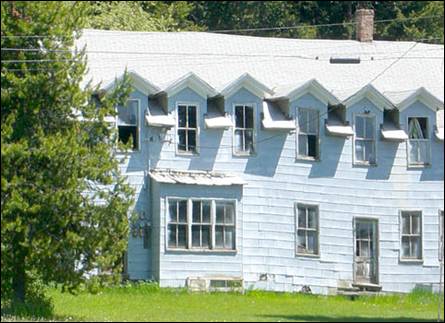
Historic Hotel Bovill
Juliaetta
was originally called Schupferville for Rupert Schupfer, an original homesteader in the area. The town was
named in 1882 by the first postmaster, Charles Snyder. He named the town in
honor of his two daughters, Julia and Etta.
The Bank of Juliaetta
is a historic building located on Main
Street. It was built in 1889 and is now houses a
restaurant. The building was placed on the historic register in 1998.
Moscow is the county seat and
largest city of Latah
County. Moscow
is the home of the University of Idaho, the land grant institution and primary
research university for the state, as well as the home of New Saint Andrews
College. Eight miles west
is Pullman, Washington,
home of Washington's land-grant university, Washington State University.
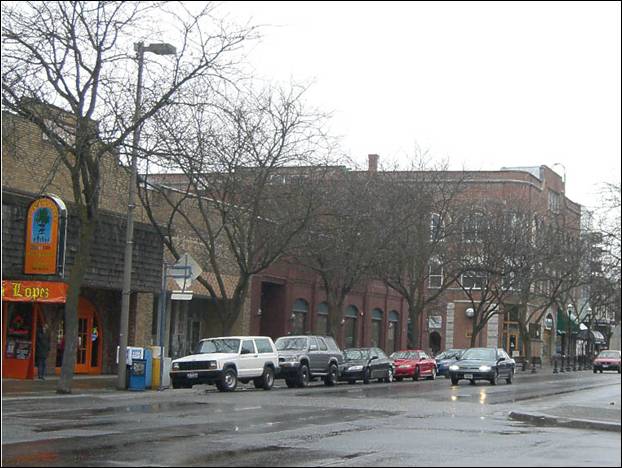
Downtown Moscow on a rainy Sunday in March 2007, at Main & 5th streets.
Miners and farmers began arriving in the
northern Idaho
area after the Civil War. The first permanent settlers came to the Moscow area in 1871. The
abundance of camas bulbs, a favorite fodder of pigs brought by the farmers, led
to naming the vicinity "Hog Heaven." When the first US post office opened in 1872, the town was
called "Paradise Valley," but the name was changed to "Moscow" in 1875. The
name Paradise persists with the main waterway through town, Paradise Creek,
which originates at the west end of the Palouse
Range, flows south to the Troy Highway, and
west to Pullman where it enters the South Fork
of the Palouse River.
The precise origin of the name Moscow has been disputed, but there is no proof that it
was named by a Russian or for the Russian city (the Russian municipality is
pronounced 'MoskVA' and the Idaho municipality is
pronounced 'MosCO'). It was reported by early
settlers that five men in the area met to choose a proper name for the town,
but could not come to agreement on a name. The postmaster Samuel Neff then
completed the official papers for the town and selected the name Moscow. Interestingly,
Neff was born in Moscow, Pennsylvania
and later moved to Moscow, Iowa.
The business district was established by 1875
and the town was a center of commerce for the region. By 1890, the Oregon
Railroad and Navigation Company's rail line (later the Union Pacific) and the
Northern Pacific railroad line helped to boost the town's population to 2000.
The capital of the Idaho
Territory was relocated from Lewiston to Boise
in December 1864. In the late 1880s, statehood for the Washington Territory
was nearing. Because its commercial and transportation interests looked west,
rather than south, the citizens of the Idaho Panhandle passionately lobbied for
their region to join Washington, or to form an
entirely separate state, rather than remain connected with the less accessible
southern Idaho.
To appease the residents of the north, the territorial legislature of Idaho in Boise placed the
new land grant university in Moscow, which at
the time was the largest city other than Boise
in the state. The University
of Idaho was chartered in
January 1889, and first opened its doors to students in October 1892.
Onaway has a population of
approximately 190. The name supposedly sources from the mill works at nearby
Potlatch to the west, as workers would frequent the bars after work. When a
wife called and asked where her husband was she would be told he was
"Onaway" home. Onaway is located between Potlatch and Princeton on State Highway 6.
Potlatch
was founded in 1905 as a company town by the Potlach
Corporation. The townsite was chosen because of
proximity to Potlatch Corporation's large holdings of Western White Pine on the
Palouse River. Potlatch was chosen as the mill
site.
Most of Potlatch was built in 1906 and 1907.
A total of 143 houses were built in 1906, with 58 more built the following
year; other building constructed during that period include boarding houses, an
ice house, a Catholic church, hotel, school, and general store.
The company developed and ran Potlatch on a
model mostly patterned after that used by Pullman Company for its company town
in Illinois.
It provide police and fire protection, a school,
churches, a hospital, an inexpensive company store, and recreational amenities.
It banned prostitution, prohibited alcohol, and encouraged its workers to marry
by allowing only married couples to rent the houses it owned. The paternalism
was profitable, even though rents were low: during 1943 the company showed a profit
of $59,000 for its "townsite" services.
Less than a decade later, with labor costs significantly reducing its townsite profit, the mill sold most of the homes and other
buildings it owned, and Potlatch was incorporated.
In 1981 the mill was shut down, shortly after
the town was sold to the residents. Five years later, part of the town's
commercial district, was listed on the National Register of Historic Places.
After the mill's closure, Potlatch became a
bedroom community for the university towns of Moscow
and Pullman, Washington.
Troy,
located in the eastern part of the Palouse region, has a population of about
865.
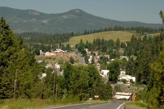
South
entrance to Troy. Photo was
taken in 2008
Source:
Latah County,
Bovill, Juliaetta, Moscow, Potlatch, and
Wikipedia
Lemhi County
Lemhi
County was established
January 9, 1869 with its county seat at Salmon. Named for Fort Lemhi,
the L.D.S. Salmon River Mission,
which was named for King Lemhi in the book of Mormon. Lewis and Clark
were the first white men in this area.
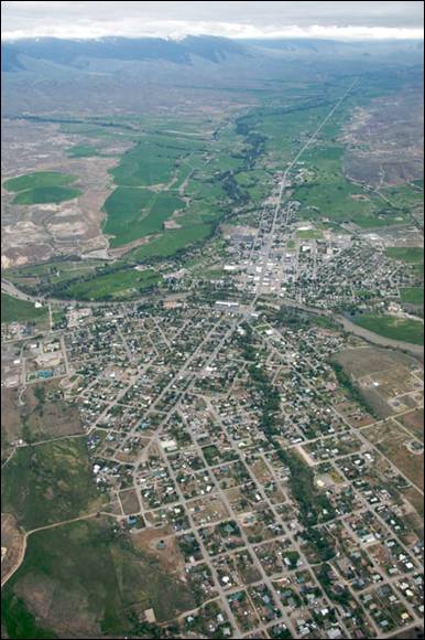
Aerial view of Salmon, Idaho
Lemhi
County is rich in
heritage and natural beauty. It is comprised of several communities such as
Salmon, Leadore, North Fork, Gibbonsville,
Shoup, and Lemhi Idaho. The county also consists of several
ghost towns for visitors to explore. The county has been shaped through the
years by the history that has ran through it such as
Sacajawea, the Lewis & Clark Expedition, and the Gilmore & Pittsburgh
Railroad.
The Salmon River
was named the "River
of No Return" by the Lewis & Clark Expedition. The
river provides exciting whitewater adventure and scenic beauty. Furthermore,
the river provides some of the best steelhead and salmon fishing in the west as
well as rock climbing opportunities.
The town of Leadore
dates from 1910, when the Gilmore and Pittsburgh Railroad was
constructed from Armstead,
Montana over Bannock
Pass and into the Lemhi Valley.
This occurred because the original location for the train station in the town
of Junction had
to be altered when the owner of the land refused to sell. The town was home to
the railroad's repair shops, and was the point where the railroad's branch line
to Gilmore connected with the main line. Though the railroad ceased operating
in 1939, Leadore has remained the largest town in the
immediate area.
In 2001 a replica of the town's old railway
station was constructed in Leadore. The new building
serves as the town's community center.
The Lewis and Clark Expedition crossed the
continental divide at Lemhi
Pass, 30 miles to the
southeast of Salmon. They followed the Salmon River through the present site of
the city, then ascended the North Fork of the river to
cross into present-day Montana
near Lost Trail Pass. The sole female in the party, Sacajawea, was born in the Lemhi Valley
near Salmon. The Sacajawea Interpretive, Cultural and
Educational Center was opened in Salmon in August 2003.

Postcard
photo of a Gilmore & Pittsburgh train at the railway's depot in Leadore, Idaho, August 1912. J. Foster Adams, photograph.
From 1910 to 1939, Salmon was the western
terminus of the now-defunct Gilmore and Pittsburgh Railroad.
Source:
Wikipedia
Lewis County
Lewis County was established March 3, 1911 with its county seat at
Nezperce. The
County was named for Meriwether Lewis of the Lewis and Clark Expedition. The Nez Perce Indians made this area their
home and knew no whites until the Lewis and Clark expedition. The expedition spent a month in the Clearwater River Valley
near the town of Kamiah on its return from the Pacific Coast in May 1806.
Craigmont
is named for Colonel William Craig (1809–69), a mountain man who had a Nez
Perce wife. He settled at Lapwai near his
father-in-law Hin-mah-tute-ke-kaikt or James in 1840
when he gave up being a fur trapper due to the collapse of the market for
beaver. A town named "Chicago",
one mile west of the current Craigmont, was founded in 1898. In response to not getting their mail
from the Post Office, it was renamed "Ilo"
four years later, after Ilo Leggett, daughter of town
founder and merchant W.O. Leggett. A fire burnt the town in 1904 and shortly
thereafter the Camas Prairie Railroad bypassed the town and started a
settlement, platted by Lewiston
financier John P. Vollmer, on the northeast side of the railroad tracks, and he
named it "Vollmer." Ilo
responded and moved its community to the southwest side of the tracks, adjacent
to Vollmer. After a decade-long feud and the consolidation of the school
districts, the communities merged in 1920 to become Craigmont.
Kamiah is largest city in Lewis County, it extends only a small distance into Idaho County,
south of Lawyer Creek. The population was 1,295 at the 2010 census, up from
1,160 in 2000. The city lies in the narrow valley of the Clearwater River;
downstream are Orofino and Lewiston, at the
confluence with the Snake River.
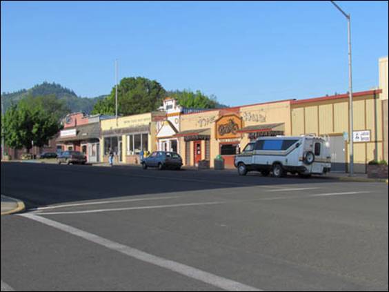
Main
Street Kamiah, Idaho 2012. Kamiah is the largest city in
Lewis County with a population of about 1,300, it extends only a small distance
into Idaho County.
The Kamiah area has been inhabited by the Nez
Perce for centuries. The name "Kamiah" is Nez Perce for "many
rope litters," as Nez Perce manufactured "Kamia"
ropes in the area to fish steelhead. Also according to Nez Perce tradition, the
Appaloosa horse was first bred in the area.
On their return trip east, the Lewis and
Clark Expedition camped in the Kamiah area for several weeks during the spring
of 1806, waiting for snows to melt.
Winchester was
named in 1900 during a meeting to establish a school district. While
considering the possibilities, an individual looked at the stack of Winchester rifles at the
door and suggested the name, which was approved. The sawmill
closed in May 1965 after the mature timber in the area had been cut. The mill
was operated by Boise Cascade for its final five years; its closure followed a
fire which destroyed much of downtown Winchester
in November 1964.
A half mile outside of town is Winchester Lake
State Park, planned in 1966 and established in 1969. Originally it was
a mill pond, created in 1910 by damming Lapwai Creek.
Source:
Lewis County, Craigmont,
Kamiah, Wikipedia
Lincoln County
Lincoln County was
created by the Idaho Legislature on March 18, 1895, by a partitioning of Blaine County,
which was created earlier that month by a merger of Alturas and Logan Counties.
Lincoln County
itself was partitioned on January 28, 1913, with a western portion becoming Gooding County
and an eastern portion becoming Minidoka
County. The county
assumed its present borders on February 8, 1919 when a southern portion became Jerome County.
Lincoln
County is named after
President Abraham Lincoln. The Idaho
Territory was created in
1863, during the Lincoln Administration of 1861–65.
Cities:
Dietrich, Richfield,
Shoshone
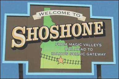
Shoshone
- In contrast to the Shoshone Native American tribe for which it is named, the
city's name is correctly pronounced "Show-shown," with a silent 'e'.
Shoshone was laid out in 1882 in anticipation
of the soon to follow Union Pacific short line railroad. Shoshone became not
only the town with the widest main street in the world, but also one of the
wildest towns in the West. Even before being formally established it was filled
with miners from Hailey, railroad men and sheep herders.
By 1883, reportedly 10-15 arrests were being
made daily. Offenders were placed in a hole in the ground. The bars were guards
with Winchester
rifles, who were ordered to shoot at any head sticking above the rim of the
hole. Prostitution was legal until the mid-1950’s,
when it was rumored to have been abolished by the mayor’s wife (while the mayor
was out of town).
It was said in an attempt to stabilize the
town & attract families, the townsite company
gave two building lots to churches and the business owners donated $75.00
toward the building fund of any church or school. The Methodists &
Catholics were the first to take up the offer. They were followed quickly by
the Espiscopalians.
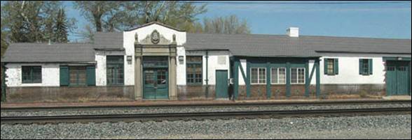
The Union Pacific RR Station, located in Shoshone, was
built in 1929 and is brick and adobe construction. It is no longer used as a
train station, but is still in use by Union Pacific for its rail crews
stationed out of Shoshone. Stations built like this can be seen in many
television shows and movies.
By the turn of the century Shoshone was a
major railhead for sheep ranchers. The 1920’s and 30’s brought bootlegging. The
40’s brought celebrities on their way to Sun Valley
or staying in the area to hunt. Since its wild beginnings, Shoshone has seen
all the changes that created many ghost towns. Perhaps shaped and inspired by
the surrounding desert, residents have always adapted and found new ways of
life to keep the town alive.
Shoshone has long been considered the main
railroad station in Idaho's Magic Valley
region. The much larger community of Twin Falls
26 miles to the south never developed a strong railroad presence due to the
logistical issues presented by its location south of the Snake River Canyon.
For many years Shoshone was the only Amtrak stop in south central Idaho.
|
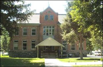
|
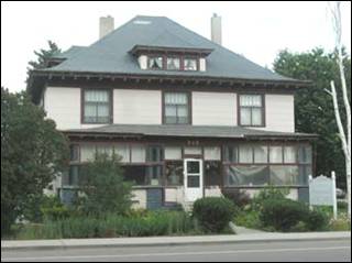
|
|
Lincoln County Court House
|
Governor’s Mansion
|
The Lincoln
County Court House (111 West
B. Street) was completed in 1904. The original oak
furniture has been restored and is still in use. Inside you will find a display
case containing some of the early items used in the court house. Early pictures
of the area are also displayed on the walls. The jail in the basement is
reported to be the last remaining “flat-iron” jails in existence in the West.
The Governor’s
Mansion (West C. Street & South Greenwood), now a Bed and Breakfast,
was built by Frank R. Gooding, Governor of Idaho from 1901-1905. The Gooding
family immigrated to the United States
from England
in the 1800’s. After trying their luck in Michigan
and California,
the family settled in the Shoshone area where Frank and his brother became
known as “Sheep Barons”.
|
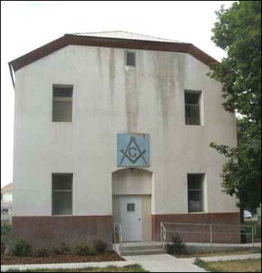
|
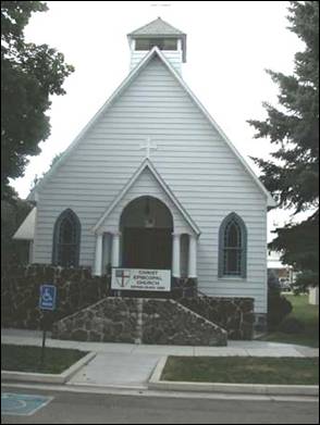
|
|
Bethany
Lodge #21, A.F. & A.M.
|
Episcopal
Church
|
Sometime before October 1886, when Idaho was yet a
territory, 10 Masons living in the Shoshone area sought to form a lodge. A
dispensation was issued for Bethany
Lodge UD (112 West B. Street) located at Shoshone, Alturas County, Idaho
Territory on October 12, 1886. The meetings were held in a building
belonging to the Knights of Labor located somewhere behind the present
Manhattan Café. On September 18, 1887 a charter was issued to Lincoln Chapter
No. 42, Order of the Eastern Star. Both groups have had close fraternal
relations ever since. The present building known as the K of P Hall was
purchased from R.J. Watkins for $1,000.00 in October 1934. This has been the
meeting place for Bethany Lodge and the Lincoln Chapter since. Many meetings
both public and private have been held in the building over the years.
As early as 1886
occasional Espicopal services were held in Shoshone.
The first records of an organized congregation are from 1889. The Episcopal Church (110 West B. Street) was formally
established in November of 1889. The church building was constructed in the
summer of 1902. A fire in 1960 caused considerable damage to the interior
requiring remodeling to its present form. The Jennings Parish House located
next door was at one time the residence of the rector. In recent years the
Episcopal congregation has invited the E.C.L.A. Lutheran Outreach to jointly
use the church.
|
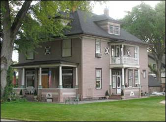
|
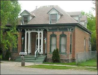
|
|
Zech House
|
Geil Home
|
Called “Colonial” at the time (Zech House, West C. Street & South Apple), this large square
two story frame house has hip-roof dormers. There is a porch across the front,
also hip-roofed, and a bay window on the South side. Detailing is “Colonial”
only in Tuscan porch posts and three ox-eye windows in the second story. Fancy
cut shingles add textural interest to the dormers and porch. The exterior is
unaltered. The house was purchased in 1986 by, and is the current residence of
Dr. and Mrs. Terrill W. Zech.
Geil Home (311
North Cherry) – The land was originally purchased by William L. Richards on October 20, 1884. He purchased the land from the United
States Government at the Hailey Land Office of Alturas County, Idaho Territory.
The land was later purchased by Sarah Brown, whose husband was Justice of the
Peace in and for Alturas County,
Idaho Territory. J.C. and Sarah
finished building the house in 1886 as moted on the
keystone above the front entrance. J.C. and Sarah resided here with their two
children until Sarah’s death in 1894. As bricks were not manufactured locally
until 1902, it is said that the bricks were shipped in from Boston, Massachusetts
by railway. The hard wood flooring and other building materials were likewise
shipped.
|
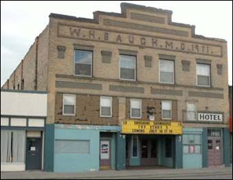
|
|
|
Sundae
Matinee
|
Manhattan Café
|
Sundae
Matinee (South Rail Street)
- The Hotel located above the Movie Theater and ice cream parlor was the last
known residence of Shoshone’s last Madam. Referred to as
“Whispering Ted”, because she was reported to never speak above a whisper.
This eccentric was said to abhor baths, ate every meal at the Manhattan Café (133 South Rail) for
years and was noted as having the classic “heart of gold”.
|
|
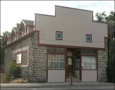
|
|
United Methodist Church
|
Doncaster
|
Although locally accepted as the oldest building
in Shoshone, United Methodist Church
(West C. Street & South Apple) actual date of construction is a debated
topic. Church records approximate construction between late 1890’s and 1903.
The Methodists and Catholics were the first to formally establish congregations
in the area, in the early 1880’s. Two other buildings were used prior to the
completion of this building. Local lore reports that a lot of volunteer help
was offered in the building of the current lava rock structure. The building in
use by the church, at the time, was considered a local eye-sore. Building funds
were started with a donation of $75.00 given by town businessmen.
Listed in the Historic Register as a
“Boarding House”, no memory or evidence exists that Doncaster (109 North Greenwood) ever served
that purpose. Rather during Prohibition it was known to be a “Speak-Easy”. In
World War II, it was the hottest club in town, known as the “Sunshine Club”.
Following that time the building was Mrs. Coffee’s Animal Museum
for over 10 years. The Doncaster
is listed on the National Historic Register as the, “Galo
Boarding House”. It is a lava rock structure.
|
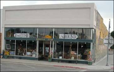
|
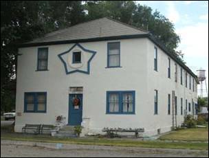
|
|
Whistle
Stop
|
Soloaga Basque
Boarding House
|
Although the actual age of this building is
not known, Whistle Stop (104 South
Rail) appears in town photos from the early 1900’s. The store was leased by the
JC Penny Company and opened as store #46 on April 5, 1913. The store operated from 1913 to May 18, 1957. Sales performance was never out standing, in
1928 sales were just over $100,000.00. During the depression in 1932 the store
actually operated at a net loss with sales below $50,000.00. After the store’s
closure in 1957 it was purchased and re-opened by its manager, Mr. Douglas H.
Hansen, who continued it’s operation as a department
store for a number of years.
The Soloaga Basque
Boarding House (201 East Avenue A. Street) was recently
purchased and is being restored by Jann M. Thomsen
and her two sons Joe and Matt. Built from 1904 to 1907, by
the grandparents of Jack Soloaga, prominent Basque
Sheep ranchers. This two-story white stucco building has 28 rooms. The
private quarters for the family and the hotel-keeper are found on the first
floor, towards the back of the building near the kitchen. The second story contains
dormitory-style rooms for boarders. It is said to be haunted by Nuns, who were
unhappy with the goings on in the hotel as it serviced “all” the needs of the
Basque sheepmen.
Shoshone has long been considered the main
railroad station in Idaho's Magic Valley
region. The much larger community of Twin Falls
26 miles to the south never developed a strong railroad presence due to the
logistical issues presented by its location south of the Snake River Canyon.
For many years Shoshone was the only Amtrak stop in southern Idaho.
A few miles north of Shoshone are the Shoshone Ice Caves,
hollow subterranean lava tubes that stay cool enough for the ice inside them to
remain frozen throughout the summer.
Shoshone, located in Central Idaho at the
junction of U.S. Highway 93, 26 and scenic State Highway 75, is the Gateway to
Idaho’s High Desert, the Sawtooth Mountains
wilderness and famed Sun Valley Resort.
The town is a small friendly rural area,
where agriculture is the main economical base and a gateway leading to
many natural wonders such as: Shoshone
Ice Caves,
Mammoth Caves,
Craters of the Moon, Malad Gorge, 1000 Springs Scenic
Route, Natural Hot Springs, Fossil Beds, City of Rocks,
Balanced Rock, Oregon Trail, Shoshone Falls, Snake River Canyon
and much more! Such as
the many State Parks, Museums, Ski Resorts, Lakes, Rivers and Dams. The
outlets to scenic sites, tours and a variety of activities for everyone!
Shoshone Ice
Caves

Shoshone
Ice Caves
is located 16 miles north of Shoshone on Highway 93. This natural wonder is
actually a subterranean
lava tube that is 1,000 ft. long and
varies between 8 and 30 ft. in height. It remains cool enough for the ice inside
to remain frozen throughout the summer.
In the days before refrigeration, this feature, coupled with the
railroad, made Shoshone popular with travelers as "the only place for
hundreds of miles where one could get a cold beer."
These caves are one of the natural wonders of
the world. Trained guides explain the geologic, volcanic, and historical
background in these large lava ice caves. A museum contains Indian artifacts,
gems, and minerals of local and world interest.
Take a tour and explore the trails, but be sure to
dress warmly, even during the summer months.
Source: Elmore
County Press, Shoshone
Historic Walking Tour, Summer in El-Wyhee, &
Wikipedia.
Madison County
Madison County
was originally settled by members of The
Church of Jesus Christ of Latter-day Saints (Mormons). Before February 1913,
the county was part of neighboring Fremont
County. The newly
established county was named for American president James Madison. BYU Idaho,
formerly Ricks College (named after early local LDS
settler Thomas Edwin Ricks) is located here. Madison County
was declared a national disaster area after the Teton Dam flood of June 5,
1976.
Cities:
Rexburg & Sugar
City
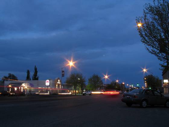
Minidoka County
Minidoka County
was created by the Idaho Legislature on January 28, 1913, by a partition of Lincoln County.
The name Minidoka is of Dakota Sioux origin
meaning "a fountain or spring of water." Minidoka was first used in
1883 as a name for the Union Pacific's Oregon Short Line, a railroad spur in
the middle of the Snake River Plain. The spur later became the site of a
watering station along the line. The village
of Minidoka grew up next
to the station. The Minidoka name was then given to a reclamation project under
then President Theodore Roosevelt which included the construction of the
Minidoka Dam, completed in 1904. Minidoka National Historic Site (in Jerome County)
was part of the original reclamation project and hence shares the name.
Minidoka County
Historical Society is a
non-profit organization dedicated to preserving Minidoka County
history. The museum is home to the original Rupert Union Pacific Depot, built
in 1906 and relocated to the museum in 1989. It is full of old time pictures and
personal histories from the towns of Rupert, Paul, Heyburn, Acequia,
Minidoka, Adelaide
and Kimama.
Acequia (pronounced ah-SEE-kwa)
has a population of approximately 150.
Heyburn
was named after Weldon Heyburn, a U.S. Senator from Idaho from 1903-12. The population was 2,899
at the 2000 census.
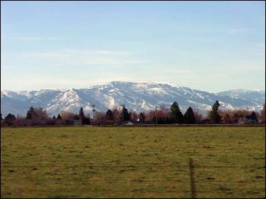
An image taken from Heyburn, Idaho,
looking South
towards the Albion Mountains
surrounding Albion.
Heyburn, Its Origin and
Some Early History written from observation by J.
A. Handy. Historical photographs of Heyburn can be found on the City of Heyburn historical
photographs website.
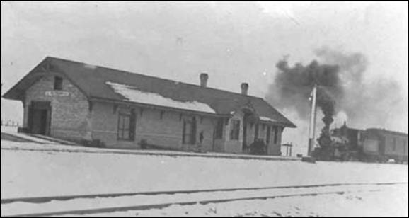
The first depot built by brick by the railroad company
was built at Heyburn.
Minidoka
is one of Idaho's
most strongly Hispanic communities, with over three quarters of the population
claiming Hispanic or Latino nationality. Population of Minidoka is about 130.
The town of Paul received its name from Charles H.
Paul, an engineer on the Minidoka Reclamation Project. It has a population of
around 1,000.
Rupert,
founded in 1906, sprung up after the announcement of the Minidoka Reclamation
Project, which provided irrigation and electricity following the completion of
the Minidoka Dam in 1906. Electricity was plentiful after the building of the
dam and led to Rupert being one of the first cities in the world to have its
streets lighted by electricity. The population was 5,554 at the 2010 census.
Rupert officially became "Christmas
City, USA"
in November 1987.
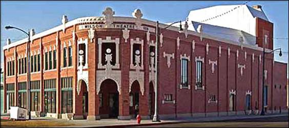
When it was completed in 1920, the Wilson Theatre
was a big hit. Silent movies, and later, talkies, made the theatre the center
of activity. The City of Rupert
purchased the building in 1999 and the Renaissance Arts
Center group began the
restoration of the theater to its 1920s glory. It is in the National Register
of Historic Places.
The Minidoka Dam is an earthfill dam on the
Snake River in south central Idaho.
The dam, originally completed in 1906, is east of Rupert on county highway 400;
it is 86 feet high and nearly a mile in length, with a 2,400-foot wide overflow
spillway section. The dam and power plant were listed on the National Register
of Historic Places in 1974. Walcott
Park, close to the dam,
is a popular summertime picnic area.
The Minidoka dam was the first Reclamation
Service project in Idaho,
part of the Minidoka Project of dams, reservoirs and canals. Construction
began in 1904 and by 1906 most of the dam's canals and laterals were
finished. By 1909, Minidoka Dam's power plant, the first federal power plant in
the northwest, was completed. By its completion, the total cost of the dam was
$5.8 million, which exceeded estimates. The Minidoka project brought water into
the southeastern areas of Idaho
near the cities of Rupert and Burley. The project was successful, as what was
once an uninhabited sagebrush desert is now bountiful farmland.
Source: Minidoka
County, City of Rupert,
City of Heyburn,
and Wikipedia
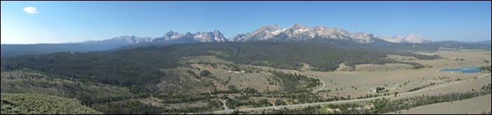
Nez Perce
County
Nez Perce
County was originally established by the Territorial Legislature of
Washington in 1861, Nez Perce County
quickly moved on to become one of the four original Idaho counties from which our current 44
were carved.
The county as we know it today was
established February 4, 1864 by the Idaho Territorial Legislature with its
county seat at Lewiston
and present boundaries set by 1911.
With a total land area of 855 square miles,
it encompasses the cities of Culdesac (population 380), Lapwai (1,137), Lewiston (31,894) and Peck (186), and the communities of Lenore, Leland, Gifford, Myrtle, Waha, Cameron and Southwick.
The total population for the county in 2010 was 39,265.
Lewis and Clark were the first white men to
enter the area in 1805 that would later be named for the Nez Perce Indians who
occupied it. Lewiston served as the territorial
capital for twenty-two months before the capital was moved to Boise.
The area that is today Lapwai
was the home of Hin-ma-tute-ke-kaikt, also known as
Big Thunder and latter as James. It was hear that Henry H. Spalding established
a Protestant mission among the Nez Perce in 1836. This was also the general
region that Bill Craig settled since his wife was James' daughter.
The city's predecessor, Fort Lapwai,
operated on the site from 1863 to 1884. The village of Lapwai was incorporated in
1911, with a model rural school.
The word "Lapwai"
means place of the butterflies, as the area had thousands in early summer in
earlier years.
The first people of European ancestry to
visit the Lewiston
area were members of the David Thompson expedition of 1803. Thompson was
looking to establish fur trading posts for the Hudson's
Bay Company of British North America (now Canada). Thompson established the
first white settlement in Idaho,
MacKenzie's Post. But it soon failed as the local Nez
Perce tribe's men considered beaver trapping to be women's work, the tribe was
migratory and apparently women thought they already had enough to do. This was
followed by the Lewis and Clark Expedition in October, 1805. At the future townsite they encountered settlements of the native Nez
Perce. Lewis and Clark passed through the valley on the return trip from the
Pacific in 1806 also.
The town is believed to have been named after
Meriwether Lewis and after Victor Trevitt's hometown
of Lewiston, Maine; but people don't know that was the
reason Vic Trevitt shouted the idea out. He simply
stated the "Journal of Lewis and Clark" talked about being in the
valley. The town was founded in 1861 in the wake of a gold rush which began the
previous year near Pierce, northeast of Lewiston.
The first newspaper in present-day Idaho, the
Lewiston Teller began publication in the city of Lewiston,
Washington Territory in 1862, and was joined by the
present (and only) newspaper, the Lewiston Morning Tribune in September 1892.
In 1863 Lewiston became the capital of the newly
created Idaho Territory. Thomas J. Beall,
one of the first three white settlers in Lewiston,
wrote many of the Lewiston Tribune's first articles, and continued to do so
until his death at the age of 89.
The first territorial capital was at Lewiston. The town was
founded in 1861 in the wake of a gold rush which began the previous year near
Pierce, northeast of Lewiston.
In 1863 Lewiston became the capital of the
newly-created Idaho
Territory.
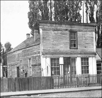
Capitol building in Lewiston
Lewiston's
stint as a seat of the new territory's government was short-lived. As the gold
rush quieted in northern Idaho, it heated up
in a new mineral rush in southwestern Idaho,
centered in Idaho
City, which would become
the largest city in the Northwest in the mid-1860s. A resolution, to have the
capital moved from Lewiston to Boise, was passed by the Idaho Territorial
Legislature on December 7, 1864, six weeks before the territorial legislature's
session legally began, and after litigation, on a split decision decided by one
vote on the territorial Supreme Court on geographic lines. Boise became the capital in 1866. The move
was very unpopular in northern Idaho
and in violation of a court order. So, the territorial governor, Caleb Lyon and
the territorial secretary took the territorial seal, archives and treasury and
fled from Lewiston,
their territorial capital. Lyon went down river to Portland, Oregon,
a trip marked by the alleged theft of the treasury from his steamship cabin.
The territorial secretary departed southward for Boise to avoid the public outrage that was
sure to erupt. North Idahoans were somewhat placated in 1889 when the University of Idaho
was awarded to nearby Moscow,
30 miles north, and began instruction in 1892. Lewiston
State Normal
School, now Lewis-Clark State College, was established in
1893, as was another normal school or teacher education college, now defunct,
in the south at Twin Falls.
These were the state's first three institutions of higher education. Lewiston was the site of the first public school in Idaho, beginning in
1862. Hence, it carries the designation of Lewiston Independent
School District #1. (Boise was second, opening school doors in 1865.)
Lewiston's
history has been researched and documented extensively by former Mayor
(1982-1992) Dr. Gene Mueller, who published Lewiston:
From pack trains and tent saloons to highways and brick stores: a century of
progress, 1861-1962 and Lewiston:
A pictorial history.

Panorama-
Lewiston and sister city Clarkston, WA looking northwest. Taken in
February of 2013

View from
north of Lewiston (left) and Clarkston, Washington
(right).
Oneida County
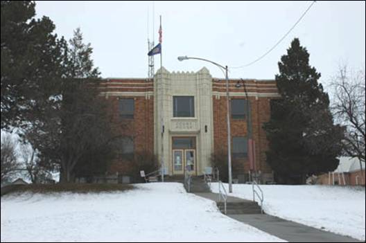
Oneida County Courthouse in Malad, Idaho is an Art Deco
building built in 1939. It was listed on the National Register of Historic
Places in 1987. Author Tricia Simpson
Oneida County
was organized on January 22, 1864, as the second county organized under Idaho Territory.
The name, an Indian word for a member of an Iroquoian tribe once in New York State,
was chosen by the legislature because some of the early settlers were from Oneida, New York. Soda Springs was designated to be the county
seat. Brigadier-General Patrick Edward Connor had laid it out the previous
summer, 1803. With three companies of
soldiers, and some families of Morrisites, he
established Fort Connor, and created the first hotel and
general store. However, treaties with
the Bannock and Shoshone Indians in the fall of 1863 brought about by the
presence of troops made travel along the Oregon Trail
safe for the first time. As immigration dwindled,, the
strategic importance of the military post declined. A bill of the Territorial Legislature passed
on January 5 1866 moved the county seat to Malad City.
For two years the county government was maintained in the upper level of
Connor’s adobe hotel in Soda Springs.
In 1854 the Waldron family, LDS converts
from England settled the
lower valley, and probably helped in building the old Malad
Fort near Portage, Utah.
However Indian hostilities around 1860 drove them back to Utah. No further attempt
to colonize was made until 1864, when seven men and boys from Utah
began to irrigate farming community where the present Malad City now stands. Benjamin Thomas built
the first house, made from willows and mud. His son David was the first white
Child born in the settlement. By 1886 Malad City
was the fastest growing village in eastern Idaho.
While older and more populous settlements
existed within the boundaries of the new county, the original county seat was
established at Soda Springs in present-day Caribou
County because those older settlements
were believed to be in Utah Territory until the southern boundary of Idaho Territory
was surveyed in 1870. The county seat was moved to Malad City
in 1866 because of its population growth and location on the freight road and
stagecoach line between Corinne, Utah, and the mines in Butte, Montana.
Once among Idaho’s
largest counties in area and population, a portion was stricken to Dakota
Territory in 1864 and additional territory was included in Wyoming Territory
at its formation in 1868. Even after Bear
Lake County
was formed from southeastern Oneida County in 1875, Oneida
County managed to be the most populous
of Idaho’s
counties at the 1880 census with a population of 6,964. The county’s area was
further reduced with the establishment of Bingham County
in 1885. A portion was taken to form Franklin
and Power counties in 1913.
A mule deer
in Curlew National Grassland, Idaho
(photo Ken Timothy). Curlew National Grassland is a
National Grassland located in Oneida
and Power counties. It has a land area of 47,790 acres. The land used to make
the grassland was purchased between the years 1934 and 1942. The primary goal
of the grassland was to improve soil and vegetation in the area. The grassland
is administered by the Forest Service together with the Caribou-Targhee National
Forest from common headquarters located in Idaho Falls, Idaho.
There are local ranger district offices in Malad City.
Malad City Hall (photo Ntsimp)
Malad City
(also commonly known as Malad) is the only city in Oneida County.
It is named after the nearby Malad River,
the name being French for “sickly”. Malad City
is located along Interstate 15 on the east side of the Malad
Valley 13 miles from the Utah/Idaho border.
Established in 1864, Malad
is one of the oldest communities in the state of Idaho. The community received its name from
Donald Mackenzie, a Scottish-Canadian trapper, who passed through the valley between
1818 and 1821 with a party of trappers. Some of his men became sick while
camped here and, believing that the illness was caused by drinking water from
the valley’s principal stream, he named it “Malade”
meaning sick or bad in the French language. Actually, the water had nothing to
do with the men’s illness, as it was later learned by the second party led by
Jim Bridger between 1832 and 1835. The men had eaten some beaver that were
nibbling on the poisonous roots of a certain tree that put a
natural arsenic into their flesh. The beaver would have likely been
immune to the poison because of long-term adaptation, but the trappers suffered
from their feast.
Malad began
largely as a Welsh Mormon settlement whose settlers brought their Welsh
traditions with them. In addition to the Mormon majority, some of the leading
families in the community belonged to either the Presbyterian Church or the
Reorganized Church of Jesus Christ of Latter Day Saints. These two
denominations each built a place of worship in the town. Some of the minutes
from early town meetings were taken down in both English and Welsh. The city is
very proud of its Welsh heritage. Malad lays claim to
having more people of Welsh descent per capita than anywhere outside of Wales.
Malad celebrated its Welsh heritage by holding an
annual “eisteddfod”, patterned after the music and poetry contests held in Wales
for over 900 years. The eisteddfod was an all-day event with people coming from
all over southeastern Idaho.
The event featured music, songs and storytelling of Wales. The custom continued until
1916 and the outbreak of World War I. With the goal of renewing the old
eisteddfod tradition in Malad, in 2004, the annual Malad Valley Welsh Festival was established.
In the summer of 1843 John C. Fremont and
his party of 39 men passed the spot where Malad City now stands.
Mormon prophet Brigham Young came through
the Malad
Valley in 1855. In 1856,
at his request, Utahn members of The Church of Jesus
Christ of Latter-day Saints migrated to the region. This party of 15 families
led by Ezra Barnard traveled to the Malad Valley
and established a community by the name of Fort Stuart.
The following year in 1857, Fort Stuart was renamed Malad City. A post office was later set up in
1865.
By 1886 Malad City
was the fastest growing village in eastern Idaho. The city was an important commercial
center between Salt Lake and Butte,
Montana. In 1906, the railroad
reached Malad
City, allowing travel to Salt Lake City in only a
four hour ride by rail. The population of the city would double over the next
15 years as a result. Malad City
experienced a flood when the earthen Deep Creek Dam, northeast of the city,
broke June 19, 1910.
Malad
City, as the county seat of Oneida County,
developed into a thriving and self-sufficient small town during the second
through the fifth decades of the 20th century. LaGrande
Hall was a dance hall where live music was played when ballroom dancing was a
popular activity. Young people, not just Malad
residents, but those from surrounding communities, met there on Saturday nights
to enjoy dancing to the popular music of the 1920s through the 1940s (the
community swimming pool is now located in that building). Malad
also became home to the #5 J. C. Penney Store. Malad
had two movie theatres: the Star and the Aldea. The
Star featured first run films, and had a bank night weekly, where a winning
ticket (name) was drawn for $100 in the 1950s. The Aldea
catered to the younger set with Friday night and Saturday matinee cowboy movies,
horror movies and comedies such as the Three Stooges and Abbott and Costello.
The two locally established banking institutions were the J. N. Ireland Bank
and the First National Bank. In addition to several grocery stores and service
stations, there were bars, cafes, hardware stores, appliance stores, Dives
Furniture Store and the Great Northern Hotel which included a cafe and the
Greyhound bus depot. The Hotel was lost in a fire in the late 1940s, which
required fire engines from the Salt
Lake City fire department to bring it under control.
The Hotel Thomas was built to replace it during the early 1950s. The Reynolds
family ran a pick-up and delivery dry cleaning business. Malad
had a bowling alley with about eight lanes and manual pin setting. The old post
office was located east of the First National Bank and the Idaho Enterprise
(weekly) Newspaper presses and office were housed in the basement of the post
office building. The bank and post office buildings were beautiful examples of
period architecture of the early 20th century, but have since been dismantled.
In the 1950s Malad had two drug stores, each with its
own soda fountain with made-to-order soft drinks and a variety of ice cream
treats. There was a downtown building next to the Chevron service station which
had medical offices for two physicians on the main floor and apartments on the
upper floor. There were separate GM, Ford and Chrysler dealerships. As a
farming community, farm machinery could be purchased locally. Malad had three barber shops. In the late 1950s a drive-in
restaurant with car hops was established and continues (but under new
ownership). There was a ladies dress shop called “Hazels,” next to the Star
Theater. There was even a store which sold bicycles and bicycle supplies and parts.
A favorite business, B’s, was the place to go for candy, soft drinks, snacks,
beer, movie magazines, comics, sheet music and to play pin ball machines.
A magnitude 6.1 earthquake shook the Pocatello Valley near the Idaho-Utah border March
27, 1975. The epicenter was only 15 miles southwest of Malad City which was hit hardest by the quake.
Nearly 2/3 of its homes and businesses had some sort of damage.
Malad City
received national news coverage when a corporate jet carrying eight people
including four Coca-Cola executives crashed January 15, 1996 killing all
onboard. The large twin-engine turbo-prop was flying from Salt
Lake City, Utah to Pocatello, Idaho
for a Coca- Cola sales meeting. The Mitsubishi MU-2 aircraft crashed and burned
at the base of a canyon 8 miles northwest of Malad.
According to the National Transportation Safety Board in its published
SEA96MA043 Accident Report, the cause of the accident was listed as ice on the
wings.
Malad
City has the oldest department store
in the state of Idaho.
Evans Co-op opened in 1865 and is still in business today. Malad City
also has the longest running weekly newspaper in Idaho, called “The Idaho Enterprise” which
published its first issue on June 6, 1879.
Owyhee County
On December 31, 1863, Owyhee County
became the first county organized by the Idaho Territorial Legislature. While Boise, Idaho, Nez Perce
and Shoshone counties were organized under the laws of Washington
Territory, they were not recognized by
the Idaho Territory until February 1864. The original
county seat at Ruby City was moved to nearby Silver City
in 1867.
The name, Owyhee,
comes from early fur trappers. In 1819, three natives from Hawaii,
part of Donald McKenzie’s fur-trapping expedition, were sent to trap a large
stream that emptied into the Snake River. When
they did not return, McKenzie investigated and found one man murdered in camp
and no sign of the others. The stream was named in their honor. “Owyhee” is an
early spelling for the word Hawaii.
The Oregon Trail, the earliest road in the area, was used by emigrants for over
30 years on their long trip to the Oregon
country. The part of the Trail in Owyhee
County was known as the South Alternate Route
or “dry route”. The Owyhee road was shorter
but much harder than the main trail. Gold was discovered in rich placer
deposits in the Owyhee
Mountains in May, 1863. A
search for the source of the gold led to quartz ledges on War Eagle Mountain. Before the fall of 1863
several hardrock mines were being developed. Three
towns grew to supply the miner’s needs. Booneville, Ruby
City and Silver City
were the first three settlements in the county. Only Silver City
still stands, its well-preserved buildings a silent testimonial to the lively
mining days. The beautiful ruby silver ore and the wealth of gold taken from
the mountains made the mining district world famous. While Ruby City
was named the first county seat, its population and businesses soon moved to a
better location two miles upstream on February 1, 1867. Silver City
was closer to most of the mining operations and had a better winter location.
In 1934, after the decline of mining, the county government was moved to
Murphy, more central to the livestock and agricultural sections of the country.
Owyhee
County’s original boundary was the
portion of Idaho Territory
south of the Snake River and west of the Rocky Mountains. Less than a month after the creation of Owyhee County,
Oneida County was formed in January 1864 from
the eastern portion of the county. The formation of Cassia County
in 1879 took further territory in the east. The county gained its present
boundaries in 1930 after an election approved moving a portion of Owyhee County
near Glenns Ferry and King Hill to neighboring Elmore County.
In 1934 the county seat was moved from the nearly abandoned Silver City
to its present location in Murphy.
Owyhee
County’s history is inextricably
linked to the mining boom that dominated Idaho Territory
in the second half of the 19th Century. Silver
City and Ruby City
are among the state’s most noteworthy ghost towns from the period. At its
height in the 1880s, Owyhee County was among the most populous places in Idaho. Today it is among
the least populous, at 1.4 persons per square mile.
The first white men in the Owyhee country were fur trappers. They were part of the
Donald McKenzie expedition of 1818. In fact, it is this expedition that gave
the area its name. Three Hawaiian Islanders accompanying the party disappeared
while exploring the Owyhee
River. Afterwards both
the river and the entire region became known as “Owyhee”, a variation of the
word Hawaii.
Early fur traders also named another river in this high desert. The name Bruneau
River comes from the
French trappers phrase “le brun
eau” or the brown water.
The trappers were few in number and they
didn’t stay long. It was the discovery of gold that brought many more people to
the Owyhees. Idaho
was already a mecca for gold seekers by the early
1860s. As prospectors fanned out throughout the state they eventually found
their way into the Owyhee
Mountains. It was a
worthwhile trip for the group that discovered gold there in 1883. The small
stream that yielded the treasure was named Jordan Creek
after the leader of the party. Other miners quickly poured in to seek their
fortune and towns like Booneville, Ruby
City and Silver City
were born.
The strikes were rich and Silver City
and other mining towns thrived. Before long entrepreneurial
ranchers saw an opportunity in feeding the throngs of miners. Eventually
ranchers established large herds of cattle on the sage covered plateaus and
along the canyons carved by the Owyhee and Bruneau rivers. But life in the harsh desert terrain wasn’t
easy for those early pioneers. Rough-hewn log cabins miles from nowhere stand
as a testament to their challenge of the desert.
The Owyhee Canyonlands
are a vestige of the great American west. The sparsely populated high desert
located in southwestern Idaho, northern Nevada, and eastern Oregon may be the most remote area in the
lower forty-eight. It is a vast and rugged landscape of about six million
acres. The topography of the region includes rolling sagebrush steppe, plateaus
of volcanic rock, juniper covered mountains and sheer walled canyons. Most of
the area is public land administered by the Bureau of Land Management.
North Fork Owyhee River
along Owyhee Uplands Back Country Byway.
More on Owyhee
County and Idaho Byways at:
Summer in El-Wyhee
Majestic Idaho Road
Trips
Bruneau
Pierre Bruneau
discovered the Bruneau River
and Canyon in 1815, while employed by the Hudson Bay Company, as a chartographer.
The spectacular desert gorge on the Bruneau
River is 1300 feet wide,
800 feet deep and 60 miles long with one accessible overlook from which to view
the canyon. Bighorn sheep and antelope can be seen in the area.
Pierre Bruneau
was born in 1796 at Maskinouge, Quebec
and served as a Captain in the War of 1812. He was on an assignment in Oregon, shortly after the Lewis and Clark exploration and
decided to travel on, into Idaho.
He was honored by the Hudson Bay Company, when they named his new chartered
area, in his name.
In the early 1870s approximately forty
ranchers lived in the Bruneau valley. The area was
used to grow grain, corn, lettuce, and Chinese sugar cane. The first store
opened in Bruneau in 1881.
The area was used for sheep range land, but
water was a scarcity and had to be hauled to the sheep camps. In the fall the
sheep were driven to railheads in Mountain Home and Murphy.
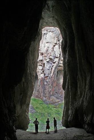

This cave draw (left) is in the Jarbidge Rivers Wilderness area located on the high basalt
plateaus of Owyhee County in southwestern Idaho.
Bruneau Dunes
State Park
The Bruneau Dunes
are unique in their formation, and are in vivid contrast to the surrounding
plateaus. Most dunes form at the edge of a natural basin; these dunes form near
the center. They include the largest single structured sand dune in North America, with a peak 470 feet above the surrounding
desert land.
The combination of a fairly constant wind
activity, a source of sand, and a natural trap have caused sand to collect in
this semicircular basin, (aka Eagle Cove) for about 15,000 years. Unlike most
dunes, these do not drift far. The prevailing winds blow from the southeast 28
percent of the time and from the northwest 32 percent of the time, keeping the
dunes fairly stable. The two prominent dunes cover about 600 acres. So if or
when you visit please feel free to kick off your shoes while you stand atop one
of these amazing dunes, every step will be incredible!
Desert Habitat
The park contains lake, marsh, desert,
prairie and dune habitats. Since most desert wildlife is nocturnal, early
morning and late evening are the best times for spotting the park’s
inhabitants. However, a sharp eye often is rewarded with a daytime glimpse of
lizards and rabbits, or raptors such as owls, hawks and eagles. Look for tracks
in the sand, night creatures leave endless imprints creating small shadows
along these breath taking dunes. There is no hunting in the park—except with
cameras and binoculars. Motorized vehicles are not allowed on the dunes.
The Lakes
Since the 1950’s, small lakes have appeared
adjacent to the sand dunes. These small
lakes have brought additional plant life and animal life to the park area. They
are known to provide an excellent bass and bluegill fishery. The locals say
it’s one of the better fishing spots for bass. But locals warn, “Take plenty of
bug spray, for those hungry horse flies!” Sport fishing from the shore, non
motorized boats, canoes, rubber rafts and float tubes are welcomed.
The Observatory
The Bruneau Dunes
Observatory invites you to reach for the stars. This public observatory is one
of the largest in the Pacific Northwest and is
perfectly positioned away from city lights and smog. Treat yourself and don’t
go another summer without setting aside one evening to take advantage of a
unique opportunity to see the night sky like you never have before. View deep
space wonders from the Obsession telescope, it opens a door into the heavens
above, leaving many who have looked through it speechless. This amazing custom
made 25 inch reflector is the main event of the evening and is housed in a
rotating observatory building. Discover those mysterious space wonders like the
rings of Saturn or man’s first steps on the moon! You will first watch a short
orientation program inside the auditorium and then just a few short steps away
survey the heavens through the observatory’s collection of telescopes. The
Natural Science Center is open to the public at dusk each Friday and Saturday
night from March thru November. You’ll spend very little and you’ll walk away
with memories to carry for a lifetime. The observatory is adjacent to the
largest sand dune. Group programs and private showings are available; please
call the park for program details. The observatory is brought to you by the
Idaho Department of Parks and Recreation, the Boise Astronomical Society,
corporate sponsors and private donors.
Grand View
The first recorded history of Grand View
began in the early 1880’s when people in search of new homesteads began
settling in the Grand View valley area. This valley was lush with tall grass
for cattle and sheep grazing. The small streams and the Snake
River brought hopeful promise of productive agriculture. Hence, it
gained the name of Grand View. To this day, agriculture - farming and ranching
- is the basic economic strength in the area. There are many family farms still
in operation. Several cattle companies run livestock on the BLM rangelands
during the summer and in their family pasture lands during the winter. There
are still a few sheep companies in the area, though those are diminishing.
The town of Grand View was established in 1888. Since
that time the town and businesses have grown and decreased! Until the bridges
were built, to access Grand View from the north, people had to take one of the
ferries that operated along the Snake River.
At one time there were entertainment halls and bars, a movie theater, a hotel
and lobby with a restaurant, three stores, a post office, a cheese factory, a
slaughter house, auto repair shops, irrigation supply center, parts stores, a
diatomaceous (silica) plant, a bank, a barber shop, and several other small
businesses. Today many of these businesses are closed and the locations of some
are no longer evident in the community.
The history of the valley is closely tied to the development of several
irrigation projects. In 1887, the Snake River Land Irrigation Company of Rhode Island began construction of the dam on the Bruneau
River to provide water
for the valley. The dam was washed out by flood water in 1890, but was rebuilt
in 1892 by the Owyhee Land and Irrigation Company, also of Rhode Island. But promoters were not able to
develop the land until the turn of the century. In 1910, the Bruneau Dam again broke and the Grand View Irrigation
District was formed to reconstruct the dam. Early promoters were also aware
that there was gold in the Snake River. In
1892, 26 placer mining claims were filed on the Snake
River in the vicinity of Grand View. By 1904, Grand View boasted
two ferries that were busy taking travelers and freighters across the Snake River. Established prior to 1894, the Hall Ferry
crossed the Snake River several miles above the mouth of the Bruneau River.
The Dorsey Ferry at first worked the Bruneau River near its mouth. After several
years it moved to the Snake River. It became
the nucleus for the town sometimes called Dorsey and later named Grand View. In
1921, the townç—´ first bridge was constructed a few
yards upstream from the Grand View Ferry.
In 1909, a third crossing, the McKeeth Ferry,
began operation six miles down river from Grand View and continued service
until 1939.
Raising hay for the many sheep companies that wintered in the valley
helped to develop the area. The Elmore Times in 1915 estimated 150,000 sheep
were fed that winter. The area was promoted for raising fruit, berries and
melons.
The years from 1910 to 1921 saw continued growth of the town with the
construction of the two-story brick bank building, a dance hall and ice cream parlour, two general stores, a saloon and pool hall. a four-room brick schoolhouse and several other businesses.
(Source: City of Grand
View)
Homedale
Homedale is the largest of the many towns
that dot the landscape of Owyhee
County. Jacob Mussell was the first known permanent settler in the area
when, in 1898, he built a ferry boat to help people cross the Snake
River.
It was just 11 years later when the official
townsite was platted, a mayor and council were put
into place, and a town name was selected by drawing names from a hat.
The region is significant in Idaho History
for many reasons. Not only is Owyhee
County the second largest
in the state, it was also the first county formed by the Idaho Territorial
Legislature in 1863.
One branch of the Oregon Trail crossed
through Owyhee County. And rich mineral deposits
brought miners high into the Owyhee Mountains to places like Silver City.
Much of Silver City is still standing and is a popular
recreational destination.
With a new town established, a two-story
brick school house soon followed in 1913. That same year the Union Pacific
Railroad built a line connecting Homedale to Nyssa, Oregon.
The railroad, coupled with irrigation, helped turn Homedale and Owyhee County
into a productive farming region.
The ground surrounding Homedale produces
alfalfa seed, sugar beets, potatoes, corn and grain. The area on the other side
of the Snake River also produces hops and a
bounty of wine grapes.
Two cultures play a major part in the
community of Homedale: Basque and Austrian. A large number of people with
Austrian heritage live in an area south of the city called Austrian Town.
They were lured to Homedale in 1914 by unscrupulous land speculators who “sold”
them the ground. After making the trek to Idaho, the settlers found
that not only was the ground undeveloped, but they still had to purchase
the land from the government.
Homedale continued to grow over the years
with the first bridge spanning the Snake River
in 1921. At one time there were 15 churches serving Homedale. And even though
many people over the years have migrated to larger cities, Homedale has
continued to prosper.
The town now attracts people looking for the
quiet, comfortable and close-knit life that can be had here in rural Idaho.
Homedale is more than a small rural Idaho town; it’s a place
of quality country living. Homedale is located along the great Snake River in Southwest Idaho. Its rolling hills are tailored and
groomed with alfalfa, corn, wheat crops and Idaho’s treasured vineyards. Matching the
rolling hills are the majestic Owyhee
Mountains to the south.
The sunsets will captivate your desire for the serenity of country living and
family values. Community is the essence of Homedale which offers more than a
place to live, work and do business; it offers a way of life - like it used to
be.
City
of Homedale
.
Marsing
Marsing, known as
the Gateway to Owyhee
County, is a land of
diverse opportunity and activity. Marsing is the home
of one of the few Jet Sprint Boat race tracks in the United States. Small boats race
against time on a narrow, twisting water track. The sport provides chills,
thrill and lots of spills.
Murphy
With a population of about 50, the town of Murphy is perhaps the
nation’s smallest county seats. It is located approximately 30 miles west of
Grand View on Highway 78.
Murphy is the county seat of Owyhee County,
the second largest county in Idaho
with 7,639 square miles.
Murphy was named after Cornelius Murphy, the
crew boss on the private railroad which was being constructed by wealthy mine
owner Colonel William H. Dewey. The railroad was supposed to have extended on
to Dewey’s Owyhee mines. Because of the drop
in ore prices, construction was halted.
Murphy became the county’s only railroad
terminal and became very busy with passengers, freight and mail. The railroad
operated from 1899 until 1947 and led the Pacific
Northwest in the number of livestock shipped by rail.
In its heyday, Murphy had a lumber company,
a harness shop, restaurant, two livery barns, three saloons, two hotels, two
grocery stores and a railroad warehouse. Today, very little remains of these
buildings.
The Historical Museum
in Murphy can provide you with a very good detailed history of the area. Also,
Murphy General Store has a very good cafe!
Silver City
Silver
City is a ghost town in Owyhee County, Idaho,
United States.
At its height in the 1880s it was a gold and silver mining town with a
population of around 2,500 and approximately 75 businesses. Silver City
served as county seat of Owyhee
County from 1867 to 1934.
Today, the town has about 70 standing buildings, all of which are privately
owned. Many of the owners are third- or fourth-generation descendants of the
original miners. There are a handful of small businesses, but no gas or service
stations.
|
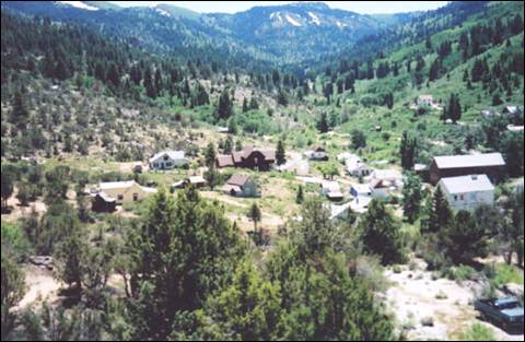
|
|
Silver City at its
height in the 1880s was a gold and silver mining town with a population of
around 2,500 and approximately 75 businesses.
|
Silver
City was founded in 1864 soon after
silver was discovered at nearby War
Eagle Mountain
(elev. 8,065 ft. The settlement grew quickly and was soon considered one of the
major cities in Idaho
Territory. The first
daily newspaper and telegraph office in Idaho
Territory were established in Silver City.
The town was also among the first places in present-day Idaho to receive electric and telephone
service.
The placer and quartz vein mines became
depleted around the time Idaho
became a state in 1890. Due in part to its extremely remote location, Silver City
began a slow decline but was never completely abandoned. Small-scale mining
continued off and on until World War II; the last mine to be operated all year
round in Silver City was the Potossi, managed by Ned
Williams. The Idaho Hotel in Silver
City was restored and
re-opened in 1972.
In 1972, the townsite
and its environs were listed on the National Register of Historic Places as a
historic district, the Silver City Historic District, with a total area of
10,240 acres.
Editor’s note: Check with Owyhee Publishing
in Homedale, Idaho
on other published materials about Owyhee
County and Silver City.
Source:
Summer in El-Wyhee, Owyhee Co. Gov., & Wikipedia.
Payette County
Payette County
was established in 1917, partitioned from Canyon County.
It was named after the Payette
River, which was named
after French-Canadian François Payette. Payette, originally a fur trapper with
the North West Company, was the first white man in the area in 1818.
Payette
County is one of the few counties in Idaho to be the home to the endangered Idaho ground squirrel.
Cities and towns are Fruitland, New Plymouth,
and Payette.
Fruitland is a small rural community of just over 4,500
residents located near the Oregon border in
southwest Idaho.
The original town site consisted of 160 acres, mostly planted in orchards of
apples and prunes.
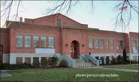
Historic
Fruitland High School was designed by Tourtellotte and Hummel in 1928. The building served as the
Fruitland Senior High School from 1928 until 1986.
From 1986 until 1995, the building was used as the Fruitland Middle School.
New Plymouth
is a city in Payette
County. The population
was 1,538 at the 2010 census, up from 1400 in 2000. It was incorporated on
February 15, 1896. It is the host of the annual Payette County Fair.
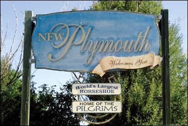
New Plymouth
was a colony town, bought and planned before it was settled. It was the
combined project of a group of people purportedly dissatisfied with city life
in Chicago, who
in 1895 formed what they called "The Plymouth Society of Chicago" and
William E. Smythe, who was the chairman of the
executive committee of the National Irrigation Congress and a famous irrigation
promoter. Mr. Smythe was determined to found a colony
to serve as a striking argument in favor of his project - irrigation. He spoke
throughout the east, urging young and old men to go west in colonies and develop
the country with the help of irrigation. He wanted the first colony to be
called New Plymouth — after Plymouth, Massachusetts — and wanted it located in southwestern Idaho in the Payette
Valley, which he had found apt for his
purpose because of the extraordinary water supply via the nearby Payette River.
The Plymouth Society of Chicago selected a
committee to investigate the irrigated Payette
River Valley
in the five-year-old state of Idaho, and
another site in Colorado,
to be purchased for the colony. The present city of New
Plymouth was on the drawing boards in Chicago, designed as a town able to be
self-reliant through the use of irrigation, solidly built on an agricultural
and railroad economy.
In February 1896, each colonist purchased 20
shares of stock at $30 per share, which entitled him to 20 acres of land and a
town lot. He was to clear the land of sagebrush and plant fruit trees,
preferably apples. The town was platted with a horseshoe shape with its open
end facing to the north, toward the railroad and the river. This area was
planned as an industrial zone, and the acre tracts around the horseshoe were
the residential lots.
The homes were to be built on the street side
and the balance of the acre for garden and pasture for the family cow and the
driving team. Two streets, separated by an 80-foot park, curve around the town
in a horseshoe shape. This mile-long (1.6 km) park and the streets that enclose
it were called "The Boulevard." The park was planted with grass and
shade trees. Plymouth Avenue,
the main street and principal business thoroughfare, was surveyed (16 feet off
the section line) down the center of the horseshoe from the railroad on the
north through the Boulevard on the south.
The community was at first called the New
Plymouth Farm Village and was governed by a colony board of directors until it
incorporated as a village in 1908, dropping the last two words in the name. It
was designated a city in 1948.
Payette is
a city in and the county seat of Payette
County. The population
was 7,433 at the 2010 census.
The settlement was originally named
"Boomerang," a construction camp for the Oregon Short Line from
1882-84 at the mouth of the Payette
River. Logs were floated
down the river to the sawmills at the camp to produce
railroad ties. After completion of the railroad, the settlement moved upstream
to its present site and incorporated in 1891 as "Payette," to honor
François Payette, a French-Canadian fur trapper and one of the first white men
to explore the area. He arrived in present-day Idaho
from Astoria and was later the head of the Fort Boise
trading post for the British Hudson's Bay Company from 1835-44. A large merry
man, Payette was highly regarded for his helpful assistance to the many
travelers who came through the fort. After his retirement in 1844, he returned
to Montreal,
but the rest of his life is a mystery.
Power County
Power County
was created by the Idaho Legislature on January 30, 1913, by a partition of Cassia County.
It is named for an early hydroelectric power plant (1902) at the American Falls. As of the 2010 Census the county had a
population of 7,817. The county seat and largest city is American
Falls.
Cities and towns: American Falls, Arbon Valley,
Pauline, Pocatello (partially in county), Rockland
American Falls
was a landmark waterfall on the Snake River,
named after a party of American trappers whose boat went over the falls. The
Wilson Price Hunt expedition in 1811 camped at the falls one night and the
expedition of John C. Frémont was here in 1843. The Oregon Trail passed north of town, through the
present-day reservoir. Power plants first sprang up at the falls in 1901.
American Falls was the first town in the U.S. to be entirely relocated; it
was moved in 1925 to facilitate construction of the nearby American Falls Dam.
The old townsite sits at the bottom of the reservoir,
northeast of the present city. A larger dam was completed in 1978, downstream
from the deteriorating 1927 structure, which was later demolished.
City
history states the first permanent settlement of American Falls
was founded in 1800 and located on the West bank of the Snake
River, on the opposite side of the river from the present
location. In 1888 the "town" was moved across the river to the (what
is now called) "original town site".
In 1925, the Bureau of Reclamation,
began the job of moving American Falls once
again to make way for the American Falls Dam. In all 344 residents, 46
businesses, three hotels, one school, five churches, one hospital, six grain
elevators, and one flour mill were moved from the original town site, making
this the largest government relocation project of its time! Depending on the
quality of the building, dwellings would be relocated to one of three
neighborhoods on the east, south and west side of the new town square.
Arbon
Valley lies within the Fort Hall Indian Reservation, just west
of the city of Pocatello.
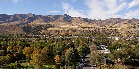
Pocatello as seen from Red Hill, October 2009 (Author Michlaovic)
Pocatello
is the county seat and largest city of Bannock
County, with a small portion on the Fort Hall Indian Reservation in neighboring
Power County,
in the southeastern part of the US
state of Idaho.
It is the principal city of the Pocatello
metropolitan area, which encompasses all of Bannock and Power counties. As of
the 2010 census the population of Pocatello
was 58,255. Please see Bannock
County for more
information.
Founded as an important stop on the first
railroad in Idaho
during the gold rush, the city later became an important center for
agriculture. It is located along the Portneuf River
where it emerges from the mountains onto the Snake River Plain, along the route
of the Oregon Trail. The city is named after
Chief Pocatello of the Shoshoni tribe, who granted the right-of-way for the
railroad across the Fort Hall Indian Reservation.
The section of the city along the Portneuf
River was inhabited by
the Shoshoni and Bannock peoples for several centuries before the arrival of
Europeans in the early 19th century. In 1834, Nathaniel Jarvis Wyeth, a U.S.
fur trader, established Fort Hall as a trading post north of the present
location of the city. The post was later acquired by the Hudson's
Bay Company and became an important stop on the Oregon
Trail, a branch of which descended the Portneuf
through the present-day location of the city. A replica of the Fort Hall
trading post is now operated as a museum in southern Pocatello.
The discovery of gold in Idaho
in 1860 brought the first large wave of U.S. settlers to the region. The Portneuf
Valley became an
important conduit for the transportation of goods and freight. In 1877,
railroad magnate Jay Gould of the Union Pacific Railroad acquired and extended
the Utah and Northern Railway, which had
previously stopped at the Utah border, into Idaho through the Portneuf Canyon. "Pocatello Junction",
as it was first called, was founded as a stop along this route during the gold
rush. After the gold rush subsided, the region began to attract ranchers and
farmers. By 1882, the first residences and commercial development appeared in Pocatello.
Pocatello
absorbed nearby Alameda in 1962 and briefly
became the largest city in the state, ahead of Boise. Pocatello was the second largest city
in the state (behind Boise) until the late 1990s, when rapid growth in the
Treasure Valley of southwestern Idaho placed Nampa and Meridian ahead of Idaho
Falls and Pocatello, which are now the state's fourth and fifth largest cities,
respectively.
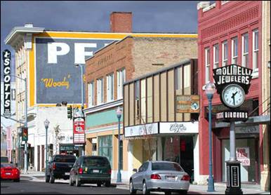
Historic downtown Pocatello, Idaho
(taken Oct.18. 2004
- Matthew Trump)
Rockland
claims it’s founding in 1879, 11 years before Idaho achieved its statehood in 1890. The Rockland Valley was traveled by trappers before its
founding, but its first permanent settlers entered the valley in 1878. At that
time, Hildalgo Guadelupe
Valdez herded his cattle into the valley and chose the valley as his home. In
efforts to establish his home he dug a ditch from the East Fork Creek as means
to irrigate his 30 acres of land. Thus, he was granted his "Water
Right" on Feb. 15, 1879. Not only was he the first settler in the valley,
but also the first irrigated farmer in the valley.
The population was 295 at the 2010 census.
Source: City of American
Falls, Arbon
Valley, Pocatello,
Rockland, &
Wikipedia
Shoshone County
Shoshone County
is several years older than the State of Idaho
itself. It was established in January 1861. At that time, it was much larger
than the present State of Idaho.
The official boundaries, which were made in 1861, were comprised of all the
country north of the Snake River between the Columbia River and the Rocky Mountains, and north to the Canadian border.
Shoshone
County was established
with its county seat at Pierce and named for the Native American Shoshone
tribe. In 1885 the county seat was moved to Murray, in 1890 to Osburn,
and finally to Wallace in 1893.
The county's seven incorporated cities
(Kellogg, Mullan, Osburn,
Pinehurst, Smelterville, Wallace, and Wardner) are stretched along the Interstate-90 corridor,
from Pinehurst on the western side to the Montana border to the east. This corridor is
also known as the Silver
Valley. It is part of a
beautiful, mineral rich, and history laden landscape that was once known as the
High Coeur d'Alenes.
Mining is and almost always has been the
county's best known industry. The county's Silver Valley
is one of the nation's greatest mining regions.
Shoshone
County is also forest
country. Until recently, timber has been a mainstay of the county's natural
resources economy.
Shoshone
County stretches over a
large land area. It covers 2,636 square miles of mountains and valleys. Fully
eighty-seven (87) percent of its land area (or 1,888,941 acres) is classified
as "forest uplands." Less than one (1) percent (only 6,027 acres) is
"urban or developed."
Kellogg
is named after a prospector named Noah Kellogg. Legend has it that his donkey
wandered off during the morning of September 4, 1885; Kellogg found the animal
at a large outcropping of galena, which became the site of the Bunker Hill and
Sullivan Mines; those mines led to the founding of Kellogg, a city where a
local sign reads "This is the town founded by a jackass and inhabited by
his descendants." Noah Kellogg is buried in the city's cemetery.
After nearly a century of bustling activity
in the mines, including a history of disputes between union miners and mine
owners, the Bunker Hill Mine (& smelter) closed in 1981, leaving thousands
out of work and a history of lead contamination. Other mines reduced
operations, as well. Since the mines have closed, Kellogg has been moving more
towards a resort town as the development of new condos, hotels, restaurants,
shops, a water park, and a new golf course continues at the base of the Silver
Mountain Gondola. Kellogg was featured in the New York Times travel section as
an up-and-coming ski resort.
The Silver Mountain Resort is a ski resort
which includes Kellogg Peak at 6,300 feet and Wardner Peak
(6,200 feet) and is accessed by taking the world's longest single-cabin gondola
3.1 miles from the city of Kellogg to the lodge
at 5,700 feet on Kellogg
Mountain.
Mullan is in the east end of the Silver
Valley mining district; located in a
sheltered canyon of the Coeur
d'Alene Mountains
at an elevation of 3,278 feet above sea level. The entrance to the Lucky Friday
mine is several hundred yards east of the city center; the active mine (silver,
lead, & zinc) descends more than 6,000 feet below the surface.
Interstate 90 runs by the south side of the
city, and the Montana border at Lookout Pass is 4 miles east at 4,700 feet above
sea level.
Mullan
came into existence in 1884 with the discovery of gold at the Gold Hunter Mine,
which turned out to be a lead and silver producer. That same year George Good
made a lead-silver strike with the morning mine and Mullan
came into existence between the two mines. The site was filed in August 1888,
after the village had twenty log and fifteen frame houses, a
sawmill, and a population of 150. The Northern Pacific Railway came to
it in 1889 and the city was incorporated in 1904.
During the Coeur d'Alene, Idaho
labor confrontation of 1899, 200 miners from Mullan
joined the Dynamite Express. In the aftermath of the labor war, many of Mullan's leaders and Populist elected officials including
the sheriff were arrested and sent to the Wallace bull pens.
The city was named for West Point graduate
John Mullan, who was in charge of selecting a wagon
route (commonly called the Mullan Road) between Fort Benton
(Montana) and Fort
Walla Walla
(Washington).
Lieutenant Mullan, a topographical engineer, began
gathering information in 1854. Delayed by the Indian War of 1858, construction
began in 1859 from Fort
Walla Walla.
The highest elevation of the road was Mullan Pass at 5168 feet, which is about 7
miles east of the city on the Idaho-Montana border. After the strenuous project
was completed in 1860, floods wiped out substantial stretches of the road, and
the road was re-routed in 1861. Floods again damaged the road, and ultimately,
no provision for maintenance was provided.
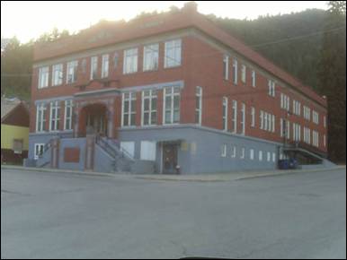
The historic Morning Club building was
built by the Morning Mine in 1921 as a gift to the town. The Club is now owned
by the city and is home to a bowling alley and the library. There is also a
multipurpose room complete with stage. Photo was taken in 2009.
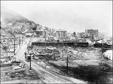
Wallace, Idaho, following the Great Fire
of 1910 Source: U.S. Library of Congress
Source: Shoshone County,
Wikipedia,
Teton County
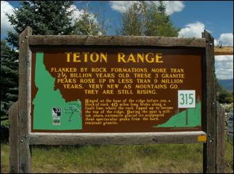
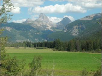
Teton County was named after
the Teton Mountains to the east. The county seat
is Driggs, formerly the county's largest city,
recently overtaken by Victor.
Teton
County is part of the Jackson, WY-ID
Micropolitan Statistical Area. Cities: Driggs, Tetonia, and Victor
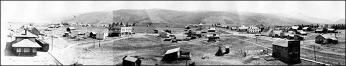
Panoramic
view of early Victor. Photo from Victor City
website.
The Teton Valley
was discovered by John Colter in 1808, a member of
the Lewis and Clark Expedition (1804–06). It became known as Pierre's Hole, and it hosted the
well-attended 1832 Rendezvous, which was followed by the Battle of Pierre's
Hole.

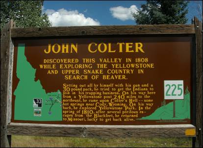
Pierre's Hole, just west of the Teton Range in Wyoming,
which collects the headwaters of the Teton River.
It was a strategic center of the fur trade of the northern Rocky
Mountains. Today, the valley in Teton
County is known as Teton Basin
or Teton Valley, and sits at an elevation of over
6,000 feet. In 1984 it was designated a historic place as the site of the
infamous events in the Battle of Pierre's Hole, following the well-attended
Rendezvous in July 1832.
Explorer and mountain man John Colter, a member of the earlier Lewis & Clark
Expedition, asserted that he passed through the valley in 1808. The Teton River
flows northward though the mountain meadows of Pierre's
Hole and then conjoins Bitch Creek (once known as the North Fork of the Teton)
just before it turns west and into Teton
Canyon. To mountain men,
a large low-lying valley, such as this, with abundant beaver and game was
called a "hole". Mountain men preferred these areas of numerous
beaver rich streams as they provided ample food and comfortable camping in
addition to beaver pelts. Pierre's Hole was
named in honor of "le grand Pierre" Tivanitagon, a Hudson's
Bay Company trader said to be of Iroquois descent, who was killed in a battle
with Blackfoot Indians in 1827.
Pierre's
Hole was the site of the huge Rendezvous of 1832. Hundreds of mountain men,
trappers, Indians and fur company traders met to sell furs or trade for
supplies. At the end of the 1832 rendezvous, an intense battle ensued between a
group of Gros Ventre and
the party of American trappers aided by their Nez Perce and Flathead allies.
After the fur trade subsided in the 1840s, Teton Basin
returned to a quiet summer hunting valley for Native Americans. An Englishman
named Richard ' Beaver Dick ' Leigh came to the Teton region sometime around 1860, and frequently trapped and hunted in Teton Basin
and wintered on the lower Teton River near its
confluence with the Henry's Fork of the Snake some miles below the basin.
Beaver Dick guided F. V. Hayden and his geological survey through the Teton and
Yellowstone region in 1872. He guided the
Stevenson party in exploration of Teton
Basin and the first ascent of the
Grand Teton and guided the entire Hayden Expedition in Yellowstone and in Jackson Hole. In honor of his service, Leigh Lake
in Grand Teton National
Park is named after Richard Leigh and Jenny Lake
is named after his Indian wife. Teton
Basin, was later settled by Mormon farmers, who used the fertile
but elevated valley to graze cattle and raise hay and other feed.
The 1832 'rendezvous at Pierre's
Hole', or 'Rendezvous of 1832' was one of the largest rendezvous held in the Rocky Mountains. The meeting was held at the west foot of
the Three Tetons in Teton County,
Idaho. The basin was accessed
from a trail that reached the Snake River from Green River.
The trail then branched off towards Pierre's
Hole through a gap between the Big Hole Mountains
and the Palisades range.
Indian and mountain man camps extended from
Teton Creek on the south end of present-day Driggs,
north along the west side of the Teton
Mountains to Tetonia. The camps covered an area of seven square miles,
or more. It is estimated there were four hundred mountain men, one hundred and
eight lodges of Nez Perce, eighty lodges of Flatheads, and over three thousand
horses.
A mountain man rendezvous was a yearly event
held in the summer for American fur trappers to gather together, sell their
furs, and resupply themselves for another season of trapping. Representatives
of eastern fur-trading companies would arrive with pack mules loaded with trade
goods to meet the needs of the trappers for the upcoming year. If trappers were
employed by a particular company, they turned their furs, mainly beaver, over
to the company representative and received their pay, less the amount used to
cover what they would need for another trapping season. Profits could purchase
additional goods, including whiskey, tobacco, and other luxury items. Free
trappers, i.e. men not contracted with a company, could negotiate a purchase
price for their accumulated furs.
In general, trappers and merchants settled
into a protected valley for two to three weeks. The larger group provided
protection from hostile Indians and support during harsh weather. Small hunting
groups traveled outward from the valley to obtain meat. The rendezvous would
generally include recreation and entertainment, including contests, games and
gambling. Most participants had a good time, swapping tall tales and drinking.
Driggs was founded
in 1888 by Benjamin Woodbury Driggs, Jr. and Don
Carlos Driggs, whose descendants later moved to Arizona and founded Western Savings and Loan where most
live still, though some remain in Idaho.
John Driggs, a descendant of Don Carlos Driggs, later became the mayor of Phoenix, Arizona
in the 1970s. In 2007, National Geographic magazine listed Driggs
as one of the 10 best outdoor recreation destinations in the U.S.
Victor was established in 1889, and was named
for George Victor Sherwood, a dedicated mail carrier who delivered the mail
despite threats of Indian attacks.
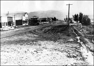
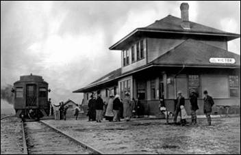
Main
Street in Victor (left) Victor Train Depot
(right). Photos from Victor City
website.
Twin Falls County
Twin Falls
County was established on February 21,
1907 with its county seat at Twin
Falls. It was named for the nearby waterfalls on the Snake River. The Snake River
is the county’s northern boundary. As of the 2010 Census, the county had a
population of 77,230.
Prior to the 1860s, the Twin Falls County
area was an unorganized part of Shoshone lands, then as part of the Oregon
Country. The area was first organized as part of the original Owyhee County
in 1864 as part of Idaho
Territory. In 1879 it was
partitioned away from Owyhee County to form part of Cassia County.
The first permanent settlement in the area
was a stage stop established in 1864 at Rock Creek for the Ben Holladay Stage
Line. In 1865 James Bascom built the Rock Creek
Store. In 1876 Herman Stricker purchased the store
and remained the proprietor until it closed in 1897.
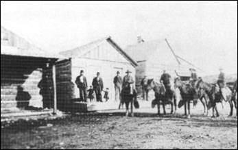
In its day, Rock Creek saw westward migration, freight and passenger
traffic, robberies, gun fights, range wars, mining booms and busts, water
disputes, births, deaths, and marriages-organ music and flowers. Its doors
welcomed Oregon Trail travelers, cowboys,
farmers, miners, Indians, Chinese, Irish, British, Russians, Danes, Swedes,
Germans and more. Some were well known including Ezra Meeker, cattle barons
Jasper and A.J. Harrell and John Sparks, Diamond Jack, Buffalo Horn; many were less known.
Rock
Creek Station was the first trading post on the Oregon
Trail west of Fort Hall. It served as a
saloon, dance hall, post office, polling place, and supply post for emigrants
traveling west. At one time, the Rock Creek Station was the largest stage
station between Fort Hall and Fort
Boise. Today, travelers
can visit the log store, two stone cellars, a cemetery and the 1901 Stricker home.
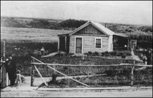
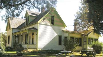
The Stricker
family lived in a six-room log cabin (left) until it burned down. Only Lucy’s
walnut bedroom set, her beloved organ, and pictures were saved. The family
built a new home the same year. The walls are constructed of hand-hewn upright
logs, hauled from Albion. In 1916, the house
was extended, adding a formal dining room, kitchen, bath, service entrance, sun
porch, and storage area. The upper floor was a hotel for cowboys, travelers,
and later for construction workers on the Milner Dam and Twin Falls Canal
System. The photo to the right and those below are of the house as it looks
today. Photos by Ed Walter.
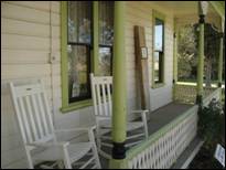
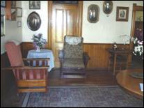

The Carey Act, a federal reclamation and land
claim law, was important to the development of agriculture in the Rock Creek
area. Federal public lands were donated to individual states, which then held
the land until a private reclamation proposal was developed for a given tract.
Individuals could then “prove up” and claim up to 160 acres of land. The men
pictured below were instrumental in funding and promoting irrigation projects
in the region.
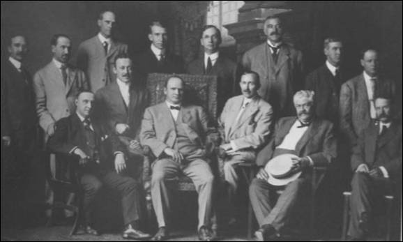
Seated (l-r): J.H. Purdy, A.C. Milner,
F.R. Gooding, George Baird, Frank L. Buhl, I.B.
Perrine. Standing (l-r): D.C. McWaters, H.L.
Hollister, M.J. Sweeley, Fentris
Hill, S.H. Hays, Fred Voigt, C.A.
Tush, R.W. Faris. Photo and info from Idaho State
Historical Society.
Even after Idaho
became a state in 1890, there were only a handful of successful agricultural
operations in the Snake River
Canyon, but the lack of
infrastructure and the canyon’s geography made irrigating the dry surrounding
area improbable at best.
To address this issue, in 1900 I. B. Perrine
founded the Twin Falls Land and Water Company largely to build an irrigation
canal system for the area. After an August 1900 survey of 244,025 acres in the
area, in October 1900 the company was granted the necessary water rights to
begin construction of the irrigation system. Several lots in the surveyed area
were set aside specifically for future townsites.
These lots eventually became the settlements of Twin Falls, Kimberly, Buhl, Filer, Hansen and
Murtaugh. In 1902 the project nearly failed as most
of the original investors pulled out, with only Salt Lake
businessman Stanley Milner maintaining a stake in the company.
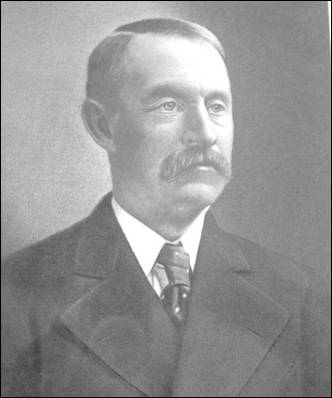
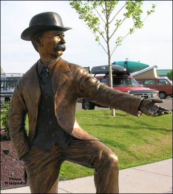
Ira Burton Perrine (May 7, 1861 - October 2, 1943) was an Idaho farmer, rancher
and businessman. Perrine is generally credited as the founder of Twin Falls and other towns in the Magic Valley
region.
Perrine was born in Delaware, Indiana, a son of George and Sarah
Burton Perrine, and a descendant of Daniel Perrin, “The Huguenot”. He
moved to Idaho Territory
in 1884 and established a farm and ranch operation in the Snake River Canyon
near present-day Jerome. Perrine was a successful farmer and rancher who among
other things received a gold medal for his fruit display at the 1904 Louisiana
Purchase Exposition in St. Louis.
The ranch remained in the Perrine family until 1964, when it was sold and
became part of Blue
Lakes Country Club.
Although Perrine’s operation in the
canyon received plenty of water, the surrounding area could not be easily
irrigated and was therefore largely unproductive. Beginning in 1893 Perrine
worked to convince private financiers to build a dam on the Snake
River along with a corresponding canal system to irrigate the
area. This work culminated in the 1900 founding of the Twin Falls Land and
Water Company and the subsequent completion of Milner Dam in 1905.
After Twin Falls was founded in 1904,
Perrine served as a bank president and owned a hotel in the new city.
Perrine is buried near his former ranch in Jerome County.
Perrine Bridge
and I. B. Perrine Elementary School in Twin
Falls are named after him.
By 1903 Perrine, who had been a successful
farmer and rancher in the Snake River Canyon, had obtained private financing
from Milner and others under the provisions of the Carey Act of 1894 to build a
dam on the Snake River near Caldron Linn. Completed in 1905, Milner Dam and its
accompanying canals made commercial irrigation outside the Snake River Canyon
practical for the first time. As a result Perrine is generally credited as the
founder of Twin Falls.
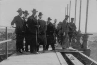
“On March 1, 1905, Frank Buhl gave a
ceremonial pull on the wheel on a winch and the gates of Milner Dam were
closed, and the gates to a thousand miles of canal and laterals were opened,
and the Snake River was diverted, and that night Shoshone Falls went dry as the
water rushed across the desert far above, and Perrine’s vision was realized,
and 262,000 acres of desert were shortly transformed.” Photo (right) and
information is from Milner Dam Interpretative Kiosk. Photo on the left was
taken October 7, 2012.
Most of the county’s other towns were
established during this period as well. In response to local government needs
for these new communities, which were as much as 80 miles away from Cassia County’s
seat at Albion, Twin Falls
County was created by the
Idaho Legislature on February 21, 1907.
Twin Falls city
was founded in 1904 as a planned community, designed by celebrated
Franco-American architect Emmanuel Louis Masqueray,
with proceeds from sales of town site lots going toward construction of
irrigation canals. Twin Falls
was incorporated as a village on 12 April 1905. The city is named for a nearby
waterfall on the Snake River of the same name.
In 1907 Twin Falls became the seat of the
newly-formed Twin Falls
County.
The original town site follows a unique
design. It is laid out on northeast-to-southwest and northwest-to-southeast
roads. The northwest-to-southeast roads were numbered and called avenues, while
the northeast-to-southwest roads were numbered and called streets. Only two
central streets, the northwest-to-southeast
Main Avenue and the northeast-to-southwest Shoshone Street,
were named. It is purported that the reason this was done was to allow sun to
come into every room in the home at some point during the day. This system
created situations where one side of a street may have an entirely different
address than the other, and where the corner of “3rd and 3rd,” for example, was
in more than one location. In 2003 the numbered northeast-to-southwest streets
were renamed to alleviate decades of confusion. Later city roads, such as Blue
Lakes Boulevard, Addison Avenue
and Washington Street,
are laid out in standard north-south and east-west orientations.
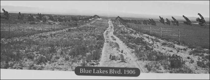
Hard to believe this is what Blue Lakes Boulevard
looked like in 1906.
Photo from Shoshone Falls Interpretative Kiosk.
After Milner Dam was constructed
agricultural production in south-central Idaho
increased substantially. In 1909 the privately-owned Twin Falls Land
and Water Company was reorganized as the shareholder-owned Twin Falls Canal
Company. Twin Falls
became a major regional economic center serving the agriculture industry, a
role which it has sustained to the present day. The city became a processing
center for several agricultural commodities, notably beans and sugar beets. In
later years other food processing operations augmented the local economy. By
1960 Twin Falls had become one of Idaho’s largest cities
even though its origins were still within living memory for many.
Twin Falls
became the center of national attention in September 1974 thanks to an attempt
by Evel Knievel to jump the
Snake River Canyon in a specially-modified rocket
cycle. Watched by millions on television, the attempt ultimately failed due to
high winds and a premature deployment of Knievel’s
parachute. The foundation of the launch ramp, which lies on private land, can
still be seen.
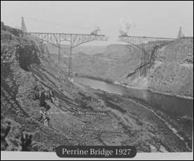
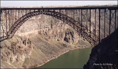
The Perrine Bridge, completed in 1927, crosses the Snake River Canyon
north of Twin Falls.
At the time of its construction it was the highest cantilever bridge in the
world. It was replaced in 1976 with the current span, which is 1,500 foot long
and 486 feet above the Snake River. It is
still the highest bridge in Idaho.
The privately financed $650,000 structure was originally a toll bridge,
but the tolls were eliminated in 1940 after the bridge was purchased by the
state of Idaho.
By the early 1970s, the original bridge was outdated and unable to
handle heavy loads and required replacement. Construction on the current bridge
was completed in July, 1976 at a cost of $9,700,000. The original bridge was
demolished.
The bridge is named for I. B. Perrine, who spearheaded the early 20th
Century irrigation projects in Idaho’s Magic Valley
region and is largely credited as the main founder of Twin Falls. Photo on the left is from Shoshone Falls Interpretative Kiosk.
Buhl was founded on April 17, 1906. It was named for
Frank H. Buhl of Sharon, Pennsylvania,
a major investor in a Carey Act project known as the Twin Falls South Side
project, which introduced large-scale irrigation to the Magic Valley
in the early 20th Century. The history of Buhl began with the vision of men who
could see the potential hidden beneath the sagebrush-covered area. The U.S.
government was interested in developing the west for settlement and provided
financial assistance for early settlers under the Carey act and the Bureau of
Reclamation Act in the early 1900’s. Eager financiers from the east arrived in
the area in the early 1900’s to look at the possibilities. These men had been
interested in a proposed irrigation project for the land in Southern
Idaho called the Twin Falls South Side project.
Frank Buhl came west from Sharon,
Pennsylvania, to Salt Lake City, Utah
in 1901 to examine a mining property that interested him. Discovering that it
had already been sold, he decided to investigate a proposed irrigation
development in southern Idaho
(Twin Falls South side project). Mr. I.B. Perrine met Bulh
at the train depot in Shoshone and introduced him to Peter Kimberly. Buhl and
Kimberly formed the corporation that accomplished the project.
The townsite of
Buhl was platted in 1905, and the Twin Falls Investment Company sold lots at
Broadway and Main Street
for $1,750 each, in April, 1906. Much to the dismay of some early residents,
the town was laid out in the same diagonal design as the city of Twin Falls. Normally a
town is laid out in a north-south, east-west direction for ease of finding places,
but the Buhl town site was arranged to get the most benefit from the sun.
It was decided by members of the Twin Falls Land and Water Company that the town
should be named after Frank H. Buhl because of his decision to donate land for
the initial town site. Mr. Buhl continued to be a major support for the
fledgling town throughout his life. He contributed $25,000 towards the building
of the F.H. Buhl High School
(now the middle school building) and the land for Faris
Field (a game field used for baseball and soccer).
Over 40 historical buildings encompass the
downtown section of Buhl. The tree-lined streets are in the process of being
upgraded with new sewer and electrical lines, new sidewalks and new urban
furniture (street lamps, trash receptacles and benches).
Lush grasses and fertile ground encompass the
land around the rural town of Buhl.
Along with a moderate climate, this land is ideal for raising animals and
crops. Annual rainfall is about 10 inches. At an elevation of 3,660 feet, there
are over 300 days of sunny skies.
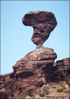
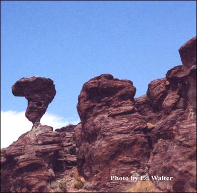
Balanced Rock - South of Buhl, 16 miles off Highway 30 in the Salmon Falls
Creek Canyon,
is the world-famous Balanced Rock. Over 48 feet tall, the rock balances on a
pedestal 3 feet by 17 inches and weighs 40 tons.
Sinking Canyon - Located six miles up the course of Salmon Falls Creek,
is an interesting natural phenomenon called Sinking Canyon.
The creation of the “canyon” created quite a stir in August of 1937. An article
in the August 12, 1937 issue of the Buhl Herald read, “West End people have
been witnessing an unusual geological phenomenon this week as a large area of
farmland has dropped on an average of 150 feet to form a new canyon joining
Salmon Canyon about five miles west of Buhl.”
The 12 acre block of land slid over a three week period.
Castleford
- Castleford was named for an early crossing of Salmon Falls Creek. The ford
was so named because of the odd-shaped obelisks of rhyolite
near the stream. The ford, used by pioneers in 1849, was also used by the Kelton-Dalles stage route.
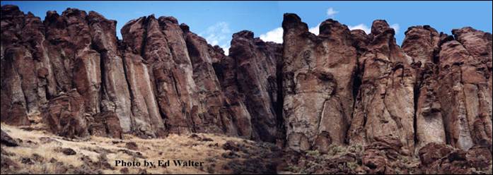
Filer
was named after Walter G. Filer, who served as general manager of the Twin
Falls Water and Land Company. The city was established in 1906 as the terminus
of the Oregon Short Line branch of Twin
Falls. Walter Filer was a mining engineer and surveyor
from Sharon, Pennsylvania,
who supervised the construction of the Milner diversion dam on the Snake River. Since 1916, the City of Filer
has been the home of the Twin Falls County Fair & Magic Valley
Stampede.
Kimberly was founded in 1905. It is named after Peter L.
Kimberly, a major investor in the construction of Milner Dam which made
commercial irrigation practical in the area.
Murtaugh is a small community originally known as Drytown. The town was later named for Mark Murtaugh, the assistant superintendent of the Twin Falls
Canal Co., who was head of construction on the South Side Irrigation Project.
Other towns in Twin Falls County
include Hansen Hollister,
and Rogerson.
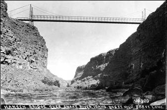
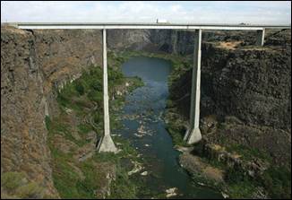
Hansen Bridge - Until 1919, when a high suspension
bridge was completed here, this 16-mile long Snake River
gorge could be crossed only in a rowboat.
With 14 cables, each more than 900 feet long, a $100,000 suspension
bridge was wide enough to accommodate two lanes of farm wagons or early cars
that had begun to gain popularity then. From its deck nearly 400 feet above the
Snake River, travelers had a spectacular view
that still can be seen from the replacement, built in 1966.
Old Photo - The original Hansen Bridge,
built in 1919 as a Suspension Bridge. Located on State Highway 50, 345 Ft. High, 688 Ft.
Long. Photos from Wikipedia
Excavations at Wilson
Butte Cave
near Twin Falls in 1959 revealed evidence of
human activity, including arrowheads that rank among the oldest dated artifacts
in North America. Later Native American tribes
predominant in the area included the Northern Shoshone and Bannock.
The first people of European ancestry to
visit the Twin Falls area are believed to be
members of a group led by Wilson Price Hunt, which attempted to blaze an
all-water trail westward from St. Louis, Missouri, to Astoria,
Oregon, in 1811 and 1812. Hunt’s
expedition met with disaster when much of his expedition was destroyed and one
man was killed in rapids on the Snake River
known as Caldron Linn near present-day Murtaugh. Hunt
and the surviving members of his expedition completed the journey to Astoria by land.
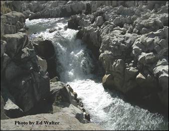
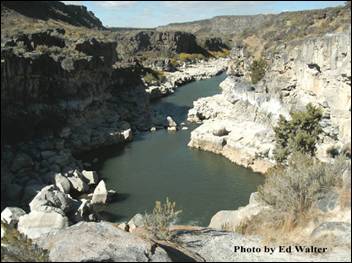
Wilson Price Hunt’s expedition met with
disaster and one man was killed at this 40 foot wide passage on the Snake River
near the Oregon Trail in 1811. During the
spring and early summer the force of the force of the waters is a sight to see.
These photos above were taken in early October when the waters were calm. A
close look at the rocks and you can see the perfectly round holes that had been
drilled into them by the swift churning waters.
In 1812 and 1813, Robert Stuart
successfully led an overland expedition eastward from Astoria
to St. Louis which passed through the Twin Falls area. Stuart’s
route formed the basis of what became the Oregon Trail.
Some 150 years later, Robert Stuart Middle School
in Twin Falls
was named in his honor.
Source: Twin Falls County, Buhl Chamber of
Commerce, Friends of Stricker, Inc., Elmore County
Press, Wikipedia, and web links.
Valley County
Valley County established
in 1917, was named after the Long Valley of the North Fork of the Payette
River, which extends over 30 miles
from Payette Lake
at McCall south to Cascade to Round
Valley. The valley was
formerly a summer pasture for livestock from the Boise Valley.
Since the completion of the Cascade Dam in 1948, much of the northern valley
has been covered by the Cascade Reservoir.
Cities: Cascade, Donnelly, and McCall
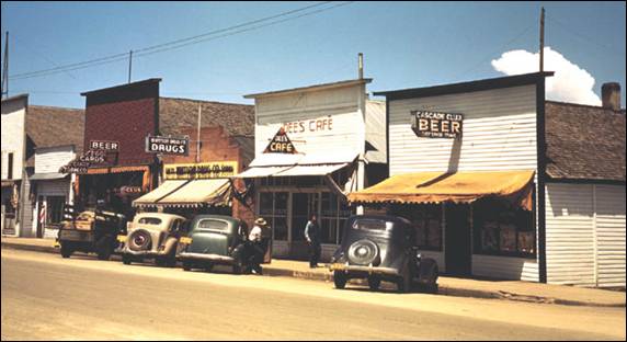
Main
Street Cascade, 1941 (Russell Lee/Library of
Congress)
Cascade is located on the southeast shore of Lake Cascade,
formerly known as "Cascade Reservoir." With the introduction of the
Tamarack Resort in 2004, the name was officially changed to sidestep the
negative marketing connotations of "reservoir." It was formed by the
completion of Cascade Dam, on the north side of the city. Construction by the
Bureau of Reclamation began in 1942, was halted during World War II, and
completed in 1948. Motto: "Play, Stay, Relax, in the beautiful Cascade
area".
Their Cascade Chamber of Commerce
is a vibrant part of this community. A statement made by a local Cascade
businessman years ago best describes the Chamber of Commerce; "I don’t
belong to Chamber because of what it can do for me; I belong for what I can do
for it, and in the process, for my community". Whatever we do as a group benefits the entire
community and therefore every business.
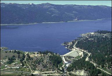
Cascade
Dam, near Cascade, Idaho, on the North
Fork on the Payette
River, is a zoned earthfill structure 785 feet across the crest. The initial
total storage capacity was 703,200 acre-feet (active 653,200 acre-feet). The
spillway is located on the right abutment of the dam. The invert is 45 feet
wide at the crest under the radial gates and about 330 feet long excluding the
open cut channel to the reservoir. The design capacity is 12,500 cubic feet per
second with the water surface at elevation 4828.0 feet. Two 21-foot
wide by 20-foot high radial gates are installed on the crest of the spillway to
provide means for regulating the discharge of water over the spillway and to
provide protection for the dam in the event of a sudden rise in reservoir water
level. A sedimentation survey completed in 1995 at Lake Cascade
estimated the total capacity at 693,200 acre-feet (active 646,500 acre-feet).
Cascade Dam is sited on igneous rock of
granitic type, which generally is of fair quality, but there are numerous
localized areas of poor quality. The rock `is light gray coarse-crystalline porphyritic granite and locally is gneissic. It is
extremely sheared, conspicuously sheeted and jointed and zones of crushed rock
are numerous. Much of the rock is hard, competent and relatively fresh. The dam
embankment cutoff trench extends to bedrock and includes a concrete cutoff wall
with footings in bedrock. A pressure grout curtain was placed to depth not
exceeding 100 feet under the cutoff wall footings. An area of badly broken rock
(by blasting) was consolidated with grout. Soils remaining in the embankment
foundation upstream and downstream of the cutoff trench are mostly
coarse-grained and bouldery, not types considered
subject to liquefaction. The gated spillway structure and chute are in a rock cut
on the right abutment. The outlet works intake structure and tunnel
are on the right side. Foundation rock conditions for the spillway and
outlet works are similar to rock described above. An inferred east-west
trending fault has been mapped a short distance north on the left abutment. The
dam is located within a notch in a bedrock ridge which is interpreted to be a
tilted fault block nor an uplift block (horst) related
to regional block faulting. The abutments upstream and downstream are natural
bedrock slopes, which are stable. The excavated slope of rock adjacent to the
spillway and outlet works is stable. None appear to be subject to landslides or
rock falls. Basement igneous rocks enclose the basin, which makes the water
holding capability of the reservoir satisfactory.
Donnelly early history dates back to when the Nez Perce,
Bannock and Shoshone Indians returned annually to summer lodging sites in the
area. Fur trappers and gold miners were the first white people to venture into Long Valley,
and by the mid 1880s, the valley’s fertile soil attracted farmers and ranchers
who established the first homesteads. Long Valley
was only accessible then by horse-drawn wagons or on foot. Six-horse teams
hauled supplies from Boise,
Idaho, a distance of about 100
miles. Traveling mountain roads was slow, often taking a week, and at times
impassible during winter. Having the need to reliably obtain supplies and food,
the small community of Roseberry was established which was centrally located
between McCall and Cascade, Idaho.
By the early 1900s, Roseberry became the
largest community in Long
Valley. Roseberry held a
promising future as the community anticipated the arrival of the Idaho Northern
Railroad. But, in 1913, the railroad bypassed the town entirely, placing the
tracks one and one-half miles west on its way to McCall.
The Donnelly railroad depot, with regularly
scheduled train service, became a center of activity in Long Valley.
As the commercial district of Roseberry waned, several of Roseberry’s buildings
were relocated west to Donnelly using horses and a steam-powered tractor. The
City of Donnelly,
named after a prominent railroad man, was incorporated in 1914, platted from
the railroad grounds east as a three by two block community. By 1916, Donnelly
had a population of 200; the community’s most populated to date. Over the
years, Donnelly continued as a vibrant community even though the railroad
eventually abandoned the route.*
Donnelly Chamber of Commerce
is dedicated to improving the business climate and quality of life in Donnelly, Idaho
and the surrounding areas.
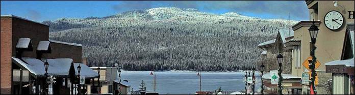
Photo by McCall Chamber of
Commerce
McCall is
a resort town on the western edge of Valley
County. Named after its
founder, Tom McCall, it is situated on the southern shore of Payette Lake,
near the center of the Payette
National Forest.
Originally a logging community whose last
sawmill closed in 1977; McCall is now an all-season tourist destination for
outdoor recreation.
Native Americans were the first inhabitants
of the land in and around McCall. Three tribes, the Tukudika
a sub-band of the Shoshone known as the "Sheepeaters",
the Shoshone, and the Nez Perce inhabited the land primarily in the summer and
migrated during the harsh winter months.
In the early 19th century, the nomadic
French Canadian fur trapper, François Payette, roamed the area alongside other
mountain men including Jim Bridger, Peter Skene
Ogden, and Jedediah Smith.
During the 1860s, miners temporarily named
the settlement "Lake City", but only alluvial gold was discovered, so
the temporary establishment was abandoned as most mining activity moved fifty
miles north to the town of Warren.
The settlement of McCall was established by
Thomas and Louisa McCall circa 1889-91. For a cabin and assumed rights to the
160 acres of land, they traded a team of horses with Sam Dever,
who held the squatter rights. Tom, his wife, four sons and a daughter lived in
the cabin located on the shore of the lake, near present-day Hotel McCall. He
established a school, hotel, saloon, and post office, and named himself postmaster.
McCall purchased a sawmill from the Warren Dredging company and later sold it
to the Hoff & Brown Lumber Company, which would become a major employer
until its closure in 1977.
During this time Anneas
"Jews Harp Jack" Wyatte provided the first recreational
sailboat rides around the lake for tourists and advertised in the Idaho
Statesman a "30-foot sailing yacht for the use of parties who might visit
the lake". The Statesman referred to McCall as a "pleasure
resort".
Tourism continued in the early 20th century.
In June 1902, the Boydstun Hotel in nearby Lardo opened as a "place to stay and camp on Payette Lake". In 1906, Charlie Nelson
opened a tented camping area known as Sylvan Beach Resort along the west side
of Payette Lake. In 1907, Lardo
Inn opened for business. The arrival of the Oregon Short Line Railroad (later
named the Idaho Northern and Pacific Railroad) in 1914 secured McCall as a
viable community and tourist destination. Three years later McCall was
incorporated as a village. In the 1920s, the state land board started leasing
home sites along the lake.
The town's annual winter carnival started in
1923-24. Reports vary between hundreds to thousands of tourists visiting the
festivities.
The beauty of McCall and Payette Lake
drew attention from Hollywood in 1938 when it
was selected as the filming location for the Academy Award-nominated Northwest Passage, starring Spencer Tracy, Robert Young,
and Walter Brennan. The film, released in 1940, was about the French and Indian
War of 1755-63 in eastern North America; the forests of Idaho standing in for
the woods of New England and the Upper Midwest.
In 1943, the U.S. Forest Service opened the
McCall smokejumper base, one of eight smokejumper training bases in the nation.
The site includes a smokejumper training unit, paraloft,
dispatch office, and the McCall air tanker base at the airport.
After World War II, a consortium of
businessmen and doctors from Lewiston,
150 miles to the north, decided that McCall and the lake were
an ideal recreation site and thus the town was transformed from lumber to
tourism. The iconic Shore Lodge opened July 3, 1948, along Shellworth Beach on Payette
Lake. The lodge became
McCall's centerpiece for the next 51 years. Shore Lodge management and shareholders
intentionally created a resort-style lodge that was a cozy and intimate place
for locals and tourists, contrasting with the glamour and glitz of the other
famous Idaho lodge in Sun
Valley. A private club for nearly a decade, it re-opened to the
public in 2008. One of Shore Lodge's first summer employees was a University of
Idaho student, who worked as a bellhop learning the business from the bottom up
and was to go on to found the Nugget hotel, convention center and casino in
Sparks, Nevada, one of the largest and most successful in the Reno area.
McCall Chamber of Commerce
is the concerted voice of local businesses to promote and protect their
interests and the community as a whole.
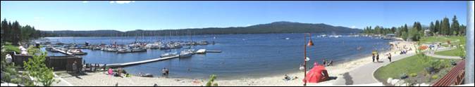
Payatte Lake
in central Idaho. Photo by Karthikc123
Source:
City of Donnelly,
McCall, Cascade, and Wikipedia
*History
of Donnelly from Donnelly City info.
Washington County
Washington County was
officially created by an act of the 9th Territorial Legislature on February 20, 1879 when Idaho
was a territory; it was named after U.S. president George Washington.
According to Washington County
history the county had several
mining encampments. They were: Mineral, Ruthburg (now
called Heath, Seven Devils, Rapid
River, and the Blue Dog.
As of the 2010 Census, the county had a
population of 10,198, up from 9,977 in 2000. The county seat and largest city
is Weiser, with over half of the county's population.
Washington
County is home to the Idaho ground squirrel.
Cities and towns are Cambridge,
Midvale, and Weiser.
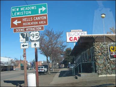
Intersection
of U.S. Route
95 at Cambridge, Idaho. Author Bobjgalindo
Cambridge
is a small farming, ranching, and logging community situated in a sheltered
valley approximately 100 miles northwest of Boise, Idaho
on U.S. Highway 95. The community was founded in 1900 following the
construction of the Pacific and Idaho Northern Railway’s line in route to the
mining and logging fields further to the north. The population of Cambridge is around 360
inside the city limits. Cambridge
is the second largest city in the county, behind the significantly larger
Weiser, the county seat.
The elevation of Cambridge
is 2,650 feet above sea level with the surrounding mountains reaching
elevations around 8000 feet, plummeting to around 1500 feet in Hells Canyon.
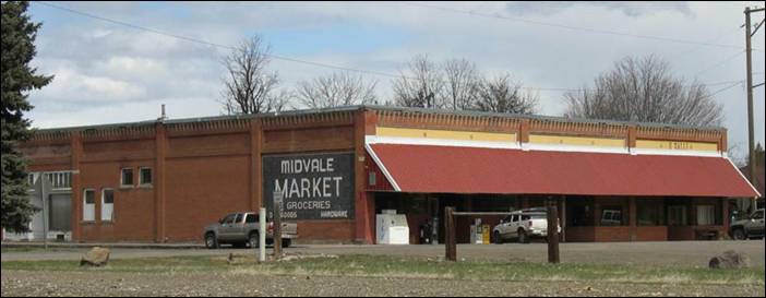
Midvale Market (photo Midvale.com)
Midvale was named when the valley in which it stands was
called Middle Valley. The first settlers came in 1868
and in 1876 a post office and school were begun. In 1884 the Middle Valley
Ditch was undertaken: in 1885 the first store was built, and in 1898 the P&IN Rail Road
came through. From 1870 to 1900 stock raising was the
chief industry, but today Midvale serves a diversified farming area. Midvale is
the hometown of former U.S. Senator, Larry Craig.
Midvale Post Office (photo Midvale.com)
Weiser
is the county seat of Washington
County. With its mild
climate, the city supports farm, orchard, and livestock endeavors in the
vicinity. The city sits at the confluence of the Weiser
River with the great Snake River,
which marks the border with Oregon.
The population was 5,507 at the 2010 census. Locals pronounce the city's name
as "Wee-zer."
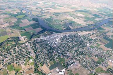
Weiser 31 May 2009 - Photo Sam Beebe
The city was named after the nearby Weiser River,
but exactly who that was named for is not precisely known. In one version it is
for Peter M. Weiser, a soldier and member of the Lewis and Clark Expedition of
1804-1806. Another has it for Jacob Weiser, a trapper-turned-miner who struck
it rich in Baboon Gulch in the Florence Basin of Idaho in 1861. William Logan
and his wife settled in the vicinity of Weiser in 1863 building a roadhouse in
anticipation of the opening of Olds Ferry west of them on the Snake
River across from Farewell Bend. In 1863, Reuben Olds acquired a
franchise from the Territorial Legislature and began operating Olds Ferry. Olds
ferry business did well (as did Logan's) as it
diverted much of the traffic from the old Snake River
crossing point at Old Fort Boise. Increasing settlement on the Weiser River
valley increased Weiser’s population. A post office
was established in 1866 as Weiser Ranch. In 1871, it was renamed Weiser.
Weiser reached its height of prosperity when
a railroad way station was established and it became a transportation hub for
travelers. Its history is well represented by the great number of original
buildings from the 1890s and early 1900s that are on the National Register of
Historic Places.
During the 1890s, the city had pretensions
of becoming a major regional market and transportation center. The Idaho
Northern Railroad was built up the Weiser
River with the intention of reaching Lewiston and river
transportation to the ocean. The dream ended among the lumber mills of central
Idaho almost at the community of Meadows... not needing to actually go past the
stock loading and lumber ponds outside the village, the terminus station was
built there and a new city, New Meadows, came into being. Likewise the Union
Pacific, after taking over the Oregon Short Line chose not to locate its major
section yards in the flats west of Weiser—probably due to inflated prices asked
by land speculators—and built at Huntington, Oregon at the western edge of the
Snake River valley.
Legendary Hall of Fame pitcher Walter
Johnson played semi-pro baseball for the Weiser Senators as a teenager in
1906-1907. After high school in Fullerton,
California, the "Big
Train" was lured to Weiser to play baseball and work for the local
telephone company. While in Weiser, he once pitched 84 consecutive scoreless
innings. His skills attracted a scout from the Washington Nationals (later
Senators) and in July 1907 he departed Idaho
for the major leagues at age nineteen.
Weiser bills itself as the "Fiddling
Capital of the World" and the National Oldtime Fiddlers' Contest has been held each year since 1953. Fiddling
contests have been held in Weiser since 1914, but the present festival was the
idea of Blaine Stubblefield, a fiddler and folk music collector, and the head
of the city's Chamber of Commerce. The
festival is held at the beginning of summer, during the third full week in June,
the only exception occurring during leap years when it is held on the 4th week
of the month. It draws national media coverage and over 7,000 people to the
Weiser area.
The city has been consistently served by the
Weiser Signal-American, a newspaper whose archives include many references for
the history and culture of the city.
For many years Weiser's
location as the last city upriver from Hells
Canyon made it the jump-off
point for wilderness tours by powered rubber raft down the gorge. Enormous
sturgeon and plentiful salmon was a draw for anglers. The salmon runs ended not
long after the float tours with the blocking of the river by three hydro-power
dams built by Idaho Power Company starting in the 50's.
Source: Weiser Chamber of Commerce,
National Fiddle Contest, Washington County, City of Weiser,
City of Midvale, City of Cambridge, Washington
County, and Wikipedia.