~Ada County~
____________________________________________________________________________
When Idaho
became a territory in March, 1863, there were four Counties in existence: Boise, Idaho,
Nez Perce and Shoshone. By the time Idaho
became a state 27 years later, there were 15 counties. The rest of the 44
Counties came into existence during the 30 years after Idaho became a state. Two of the former
Counties disappeared during this time. Alturas, which was created in 1864, was
later divided into the many Counties now found in central Idaho. Logan County
was only in existence for six years, from 1889 to 1895. It was combined with
Alturas to form Blaine County and Lincoln
County, which was formed just two
weeks after Logan
lost its identity.
Ada County was created by the Idaho Territorial
Legislature on December 22, 1864, partitioned from Boise County.
It is named for Ada Riggs, the first pioneer child born in the area and the
daughter of H.C. Riggs, a co-founder of Boise.
Canyon County,
which originally included Payette County and most of Gem
County, was partitioned from western Ada County
in 1891.
Ada County did not see appreciable settlement and
development until 1862, when gold was discovered at Grimes Creek in neighboring
Boise County. It was at this point that Boise City’s
importance as a crossroads and trading center was established, leading to the
establishment of Fort
Boise in 1863. Farmers
and merchants found that supplying the rush of miners was as profitable as
mining itself, and it provided an incentive for them to permanently settle the
region.
|

|
|
|
Main Street Boise - 1911
|
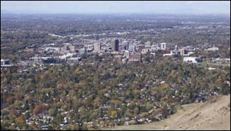
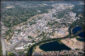
Aerial view of Boise,
Idaho
|
Boise - The area was called Boise
long before the establishment of Fort
Boise. The original Fort Boise was
40 miles west, near Parma, down the Boise River
near its confluence with the Snake River at the Oregon border. This defense was erected by
the Hudson's
Bay Company in the 1830s. It was abandoned in the 1850s; however massacres
along the Oregon Trail prompted the U.S. Army
to re-establish a fort in the area in 1863 during the U.S. Civil War. The new
location was selected because it was near the intersection of the Oregon Trail
with a major road connecting the Boise
Basin (Idaho
City) and the Owyhee (Silver City)
mining areas, both of which were booming. During the mid-1860s, Idaho City
was the largest city in the Northwest, and as a staging area, Fort Boise
grew rapidly; Boise
was incorporated as a city in 1863. The first capital of the Idaho Territory
was Lewiston in northern Idaho,
which in 1863 was the largest community, exceeding the populations of Olympia and Seattle, Washington Territory and Portland, Oregon
combined. The original territory was larger than Texas. But following the creation of Montana Territory,
Boise was made the territorial capital of a much
reduced Idaho
in a controversial decision which overturned a district court ruling by a
one-vote majority in the territorial Supreme Court along geographic lines in
1866.
Accounts differ about the origin of the
name. One account credits Capt. B.L.E. Bonneville of the U.S. Army as its
source. After trekking for weeks through dry and rough terrain, his exploration
party reached an overlook with a view of the Boise River
Valley. The place where
they stood is called Bonneville Point, located on the Oregon
Trail east of the city. According to the story of a
French-speaking guide, overwhelmed by the sight of the verdant river, yelled
"Les bois! Les bois!" ("The
trees! The trees!")—and the name stuck.
The name may instead derive from earlier
mountain men, who named the river that flows through it. In the 1820s, French
Canadian fur trappers set trap lines in the vicinity. Set in a high-desert
area, the tree-lined valley of the Boise
River became a distinct
landmark. They called this "La rivière boisée", which means "the wooded river."
|
|
|
|
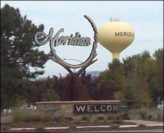
Meridian second-largest city in Ada County
|
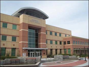
Meridian City Hall
|
Meridian: The
town was established in 1891 on the Onweiler farm north
of the present site and was called Hunter. Two years later an I.O.O.F. lodge
was organized and called itself Meridian
because it was located on the Boise Meridian and the town was renamed. The
Settlers' Irrigation Ditch, 1892, changed the arid region into a productive
farming community which was incorporated in 1902.
Meridian is
the second-largest city in Ada
County and the
third-largest in the state. As of 2010, the population of Meridian was 75,092
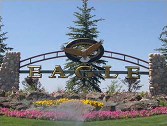
Eagle
- The name for the town and nearby island came from the earliest settlers in
the valley. Bald Eagles were still prevalent in the valley and an Eagle's nest
was spotted in a tall cottonwood tree near the Boise
River, thus the name "Eagle Island".
The atmosphere is pastoral yet progressive in outlook. Eagle is noted for its
mild climate, year around recreational opportunities and friendly people.
Garden
City - Garden City was named for gardens raised by Chinese immigrants who
lived in the area. The name of the city's main street, Chinden Boulevard,
is a portmanteau of the words "China" and "garden."
Kuna
- Kuna originated as a railroad stop with coach transport to Boise. It is popularly believed, as cited by
the Kuna Chamber of Commerce, that the translation of the name "Kuna"
means "the end of the trail", but Charles S. Walgamott
cites the origin of the name as a Shoshone Indian word meaning "green
leaf, good to smoke"
Star
- It was named in the 19th century by travelers on their way to Middleton and Boise who used the star on
the school house to find east and west. The name stuck and it became Star, Idaho. Today it is a
growing town west of Boise and its schools are
shared with Middleton School District and Meridian School District.
Fort Boise
refers to two different locations in southwestern Idaho. The first was a Hudson's
Bay Company (HBC) trading post near the Snake River on the Oregon
border, dating from the era when Idaho
was part of the fur company's Columbia District. After several rebuilds, it was
ultimately abandoned in 1854. The second was established in 1863 as a military
post, on the Boise River fifty miles to the
east, which became the capital city of Boise.
The overland Astor Expedition is believed to
be the first whites to explore the future site of the first Fort Boise
(located on the Boise
River about seven miles from its mouth) searching for a suitable location for a
fur trading post in 1811.
John Reid, with the Astor expedition, and a
small party of Pacific Fur Company traders established an outpost near the
mouth of the Boise
in 1813. Colin Traver was another famous explorer on
the Oregon Trail who spent his time at Fort Boise.
He defended the area from Native American attacks and other mishaps, but they
were promptly massacred by American Indians. Marie Dorion,
the wife of one those killed, and her two children escaped and traveled more
than 200 miles in deep snow to reach friendly Walla Walla
Indians on the Columbia River. On an 1818 map,
the explorer and mapmaker David Thompson of the North West Company (NWC) called
the Boise "Reids River" and his outpost "Reids Fort".
Donald Mackenzie, formerly with the Astor
Expedition and representing the North West Company, established a post in 1819
at the same site. It was also abandoned because of Indian hostilities.
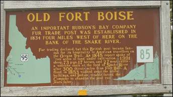
In the fall of 1834, Thomas McKay, a veteran
leader of the annual Hudson's Bay Company (HBC)
Snake Country brigades, built Fort
Boise, selecting the same
location as Reid and Mackenzie. Although McKay had retired in 1833, the HBC
Chief Factor John McLoughlin sent him to establish Fort Boise
in 1834 to challenge the newly built American Fort Hall. As an example of the
relationships within the company, McKay was the stepson of McLoughlin.
Fort Hall was located about 300 miles to the east, near present-day Pocatello. It was built by
Nathaniel Wyeth's American Trading Company. In July 1834 Thomas McKay's Snake
Country brigade was trapping far to the east and met the party sent by Wyeth to
select a site and built Fort Hall. At the end of July, McKay departed for Fort Vancouver.
Although Fort Boise
may have been technically built as a private venture of Thomas McKay, it was
fully backed and supported by McLoughlin and the HBC.
The contest over the Snake Country resulted in Wyeth's vacating the region in
1836-37. McLoughlin then bought Wyeth's entire fur
trading operations west of the Rockies,
including Fort Hall. The HBC also took full control of Fort Boise
in 1836.
The Hudson's
Bay Company operated Fort
Boise until its
abandonment. From 1835-1844, the fort was headed by French-Canadian Francois
Payette. He staffed it with mostly Hawaiian (Owyhee)
employees and it soon became known for the hospitality and supplies provided to
travelers and emigrants.
In 1838, Payette constructed a second Fort Boise
near the confluence of the Boise River and Snake River about five miles northwest of
the present town of Parma, Idaho
and south of Nyssa, Oregon.
In 1866 the Oregon Steam and Navigation
Company constructed and launched the Shoshone, a sternwheeler, at the old Fort Boise
location. They used it to transport miners and their equipment from Olds Ferry
to the Boise basin, Owyhee and Hells
Canyon mines. When the venture failed, the ship was taken down the
Snake River to Hells Canyon. Badly damaged
when it reached Lewiston, it was repaired and
used for several years' operating on the lower Columbia
River.
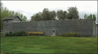
The site of Old Fort Boise is listed on the National Register of
Historic Places and currently lies within the boundaries of the Fort Boise
Wildlife Management Area. A reconstructed replica of the fort is open to the
public.
On July 4, 1863, a new Fort Boise
was established by the Union Army, during the middle of the Civil War. The
Battle of Gettysburg had concluded a day earlier, Vicksburg fell to General U.S. Grant's forces
the same day. Major Pinckney Lugenbeel was dispatched
from Fort Vancouver, Washington
Territory to head east and select the site in the Idaho
Territory which was created the same
day by Territorial Governor William Wallace at the first Idaho
capital in Lewiston.
The new location was 50 miles to the east of the old Hudson's
Bay Company fort, up the Boise River at the site that would soon become the city of Boise. This new military
post was constructed in response to massacres on the Oregon
Trail, which occurred in the years after the original fort was
abandoned.
The new fort was near the intersection of
the Oregon Trail and the roads connecting the Owyhee (Silver
City) and Boise
Basin (Idaho City)
mining areas, both booming at the time. The fort's site had the necessary
combination of grass, water, wood, and stone. With three companies of infantry
and one of cavalry, Major Lugenbeel set to work
building quarters for five companies. They built a mule-driven sawmill on
Cottonwood Creek, got a lime kiln underway, and opened a sandstone quarry at
the small mesa known as Table Rock. Lugenbeel's
greatest problem was the lure of the Boise
Basin mines - more than
50 men deserted within the first few months.
Did
you know?
Idaho's
nickname is the Gem
State, because nearly
every known type of gemstone has been found there. In addition, Idaho is one of only two places in the world where star
garnets can be found (the other is the Himalaya Mountains, in India), and is the only place
six-pointed star garnets have been found. Additionally Idaho
is sometimes called the Potato
State owing to its
popular crop. The state motto is Esto Perpetua (Latin for "Let it be
forever").
As of the 2010 Census, the county had a population
of 392,365. Cities include Boise, Eagle, Garden
City, Kuna, Meridian,
and Star. As of the 2010 Census, the county had a population of 392,365. The
county seat and largest city is Boise,
which is also the state capital.
Ada County
Idaho
Statesman (daily newspaper):